
Vil du gøre sidens indhold bedre? Foreslå en ændring.
I Lyndon B Johnson National Historical Park · side 1 af 5
Lyndon B. Johnson National Historical Park preserves the places and landscapes of the 36th president's life. It covers 1,570 acres, 674 of them federal, in two districts in the Pedernales River valley of the Texas Hill Country: a rugged land of hills on granite or carbonate bedrock with thin soils. The Park Service's Geodiversity Atlas describes the ground beneath it.
The park's Geologic Resources Inventory report. Credit: National Park Service.
The two units
| Unit | What's there | Underfoot |
|---|---|---|
| LBJ Ranch | The Texas White House, other Johnson family sites and a working ranch that recalls Johnson's presidency | Quaternary river alluvium and the Hensel Sand near the Pedernales; the Glen Rose Formation farther from the river |
| Johnson City | Johnson's Boyhood Home and the site where his grandparents first settled in the Hill Country | Largely Quaternary alluvium in the floodplain of Town Creek; Glen Rose Limestone elsewhere |
Hills in the valley are capped by Cretaceous limestone over older Cretaceous sandstones and shales. Differential erosion gives the land a stair-stepped look, with Ashe juniper and oak woodland on the hills.
Between a dome and a plateau
The park lies near the boundary of two regions:
- The Llano Uplift (Central Texas Uplift), just to the north, exposes Precambrian igneous and metamorphic rock — the crystalline core of a Proterozoic Grenville mountain belt formed when proto-North America (Laurentia) collided with landmasses and island arcs to the south. Though structurally a dome, it is not high ground but a basin of rounded granite hills rimmed by Paleozoic sedimentary rock. Near the ranch it includes the Valley Spring Gneiss, Oatman Creek Granite and Town Mountain Granite.
- The Edwards Plateau surrounds the uplift. Capped by hard Cretaceous limestone and cut by deep streams, it is full of caves and sinkholes. The Balcones Escarpment separates it from the younger rocks of the Gulf Coastal Plain to the southeast.
The rock record
| Age | Unit | Notes |
|---|---|---|
| Late Cambrian | Wilberns Formation | Sandstone and limestone from one advance and retreat of the sea; the oldest rock in the ranch unit |
| — | Regional unconformity | A gap separating Paleozoic rocks from the Cretaceous above |
| Early Cretaceous, about 115 million years ago | Hensel Sand | Conglomerate, sandstone, siltstone and dolomitic limestone, up to 130 ft (40 m) thick near the ranch; laid down as the sea advanced from the southeast and coastal plains gave way to tidal flats and lagoons |
| About 113–108 million years ago | Glen Rose Limestone | Dolomite, limestone and clastic beds from a shallow subtropical sea; weathers into stair-step terrain |
| Later Cretaceous | Edwards Limestone and others | On the valley's higher ground; the Edwards holds the Edwards aquifer to the southeast |
The Hensel Sand and Glen Rose are sometimes grouped as members of the Shingle Hills Formation. In the middle Tertiary the Edwards Plateau was uplifted along the Balcones Fault Zone, and rivers then cut down into it, carving the Hill Country's familiar landscape.
The Pedernales and its floods
About 2.5 miles (4 km) of the Pedernales, a spring-fed tributary of the Colorado River, runs through the ranch unit. The river drains 1,302 square miles, about 602 of them upstream of the ranch. Shallow bedrock, a steep gradient of 10.5 feet per mile and intense storms, mostly in spring and fall, make it very prone to flash floods.
| Flood | Discharge |
|---|---|
| 2-year flood (estimated) | 16,400 cubic feet per second |
| 500-year flood (estimated) | 320,000 cubic feet per second |
| Largest on record, 1952, at Johnson City | 441,000 cubic feet per second |
Much of the park and most of its historic buildings lie in the 100- or 500-year floodplain. The Junction School, LBJ Birthplace, Johnson Family Cemetery, Sam E. Johnson Sr. Farmhouse (the grandparents' house) and Cedar Guest House are in the 100-year floodplain; the Texas White House is just outside it but within the 500-year floodplain.
Two historic low-head dams downstream of the Texas White House are kept for their place in the ranch landscape: the Jordan Dam (1940) and the Johnson Dam, built at the president's direction in 1952.
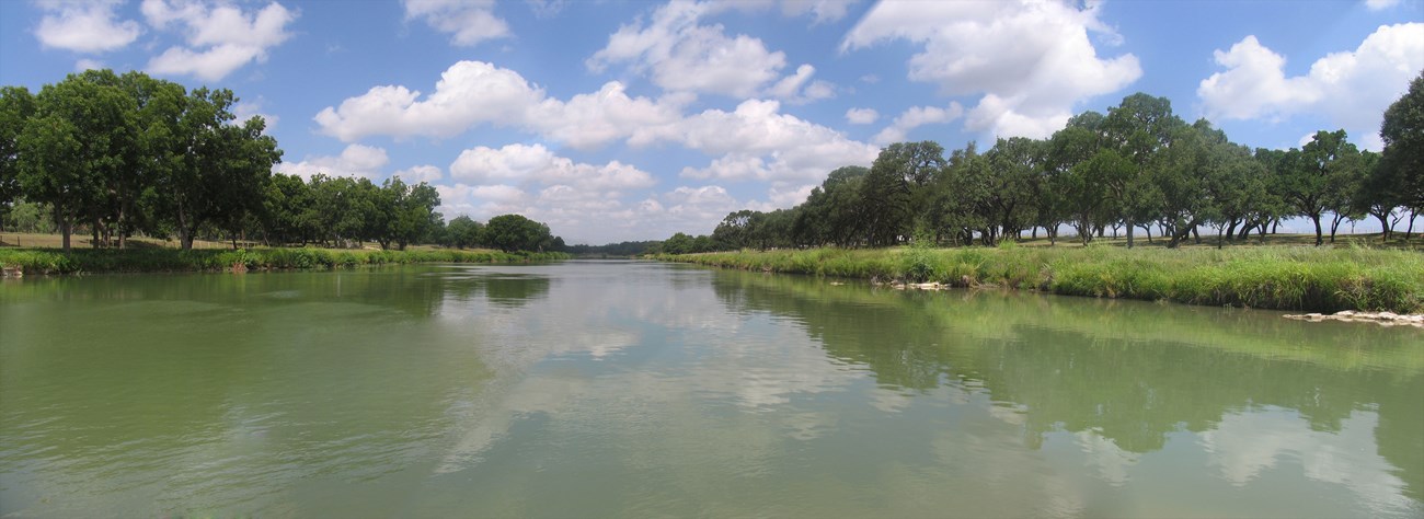
The Pedernales River. Image from the National Park Service's Geodiversity Atlas page for the park.
Water underground
Groundwater supplies much of the river's baseflow. The valley's fairly shallow aquifers lie in thick alluvium and colluvium, loose terrace deposits and fractured Cretaceous rock, whose sand and gravel beds are often productive. Some ranch wells tap the deeper Ellenburger aquifer, in Cambrian and Ordovician cherty limestone and dolomite. At Johnson City, alluvium lies over thick Glen Rose Limestone, which in turn lies over the Ellenburger.
Caves and fossils
Carbonate rock underlies almost the whole park, so karst is possible, but no caves or sinkholes have been documented. Nor have fossils been reported inside the park, though its rocks could yield them. Nearby, the Wilberns holds brachiopods, trilobites and stromatolites; the upper Hensel Sand holds marine fossils — foraminifera, bivalves, gastropods, crabs, ostracodes, echinoids, ophiuroids and burrows; and the Glen Rose is rich in marine invertebrates and microfossils, and elsewhere in the Hill Country even dinosaur tracks, as at Dinosaur Valley State Park. Caves and fossils on park land are protected by federal law.
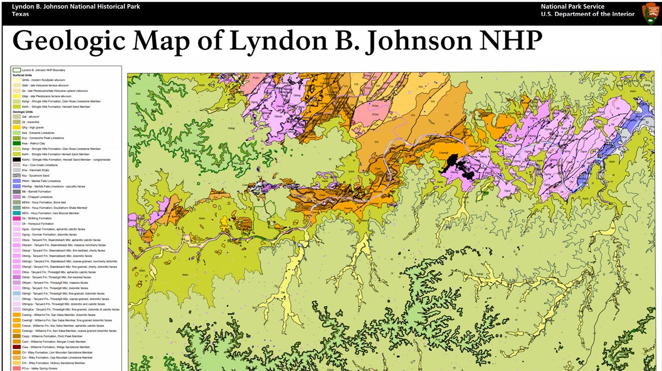
The park's geologic map. Credit: National Park Service.
The park belongs to the Great Plains physiographic province. Its Geologic Resources Inventory maps and report, and a completed Soil Resources Inventory, are on the NPS DataStore.
Sources
Based on "NPS Geodiversity Atlas—Lyndon B. Johnson National Historical Park, Texas," National Park Service; a work of the United States government in the public domain.
I disse samlingerLyndon B Johnson National Historical Park
Licens: CC0 1.0 (offentligt eje) · Bearbejdet efter www.nps.gov
1
0
0
0

Kommentarer
Læs videre


