
উন্নত করার কিছু দেখছেন? একটি পরিবর্তন প্রস্তাব করুন।
Letter From the Regional Director ...............................................................................................................2 Chesapeake Bay Studies ..............................................................................................................................3 Florence Bascom Geoscience Center .......................................................................................................4 Geology, Energy, and Minerals Science Center .......................................................................................5 National Minerals Information Center .......................................................................................................6 Science and Decisions Center ....................................................................................................................7 Maryland-Delaware-D.C. Water Science Center.....................................................................................8 New England Water Science Center..........................................................................................................9 Patuxent Wildlife Research Center ..........................................................................................................10 Leetown Science Center ............................................................................................................................11 New Jersey Water Science Center ..........................................................................................................12 New York Water Science Center ..............................................................................................................13 Ohio-Kentucky-Indiana Water Science Center ......................................................................................14 Pennsylvania Water Science Center........................................................................................................15 Virginia and West Virginia Water Science Center .................................................................................16 Woods Hole Coastal and Marine Science Center..................................................................................17 Climate Adaptation Science Center .........................................................................................................18 Partnerships With Tribal Nations ..............................................................................................................19 Regional Productivity ..................................................................................................................................20
requires well-informed management decisions. The North Atlantic and Appalachian Region (NAAR) of the U.S. Geological Survey (USGS) supports science-based decision making for Federal, State, and local policymakers to meet the challenges of today and into the future. The science centers in the NAAR have well-deserved reputations as world leaders in delivering unbiased science. We help protect the lives and property of our families, friends, neighbors, and the Nation by providing the data and scientific interpretation that decision makers need to make informed choices on a myriad of topics. Many of our jobs include inherent risk. When others are moving themselves and their families to higher ground during storms, NAAR employees can be found heading toward high water to ensure that accurate streamflow and stormtide data continue to be collected and delivered to the public and first responders.
the challenges, the NAAR has had an incredibly productive year. I am not just citing publications (with our labs and field offices closed in the spring, centers increased annual publications by 10 to 40 percent compared with 2019) or partnerships (new CALIFORNIA science initiatives and partnerships are up significantly as well). Leaders at the center level created the right environments for their teams to be safe but still meet and exceed their program goals. Our vast data collection networks were maintained and enhanced. Our laboratories met holding times and quality-control objectives. When folks asked for help, our staff provided. Some solutions were not perfect at first, but we just kept trying. What started as a short-term inconvenience may now have become the new normal, but in quickly adapting, the NAAR staff showed dedication and wisdom, made the region a little safer, and just might change the world.
mission and each other that makes me grateful to be a part of this family. This ALASKA general information product highlights just a few of the many accomplishments of
Meeting the Challenge: U.S. Geological Survey North Atlantic and Appalachian Region Fiscal Year 2020 in Review
The utilization, preservation, and conservation of the Nation’s resources
In March 2020, the world changed, and the NAAR staff adapted to it. Despite
I have been with the USGS less than 5 years, but it is this dedication to our IDAHO
the NAAR staff during these challenging times. I hope it offers you a taste of all the great work being done by the USGS community.
Gratefully, Mike Tupper Director, North Atlantic and Appalachian Region MONTANA
https://www.usgs.gov/unified-interior-regions/region-1
RHODE ISLAND CONNECTICUT PENNSYLVANIA NEW JERSEY DELAWARE MARYLAND
Nutrients in Streams and Rivers
Nutrients and suspended sediment are being monitored to assess restoration efforts. The USGS developed protocols for safe-distance sampling so field work could carry on during the pandemic. This allowed staff and partners to continue monitoring nutrients, sediment, and flow at the majority of the stations in nontidal streams and rivers in the watershed, and allow USGS to assess progress towards reduction of nutrients and suspended sediment.

https://www.usgs.gov/centers/cba
USGS Shares Lessons Learned Across the Nation
The USGS Chesapeake science activities are part of the USGS priority ecosystem sciences (PES) studies, which are place-based, integrated science efforts that address complex, multidimensional ecosystem restoration and management issues across the United States. These programs focus on critical, high-value ecosystems that face multiple threats that have caused long-term degradation of the ecosystem’s quality. The PES programs are focused in the greater Everglades, Chesapeake Bay, Northern Great Plains, the desert Southwest, Washington’s Puget Sound, and California’s Sacramento-San Joaquin Estuary. The study units increased interaction, including a virtual workshop, to share lessons learned during the pandemic.
Emerging Contaminants and Fisheries
The USGS produces information on the distribution of contaminants, exposure of organisms to contaminants, and effects of that exposure on fisheries in the Chesapeake ecosystem. During the novel coronavirus pandemic, USGS scientists analyzed data on pesticides, hormones, and other organic contaminants from rivers in the Chesapeake Bay watershed. The USGS was also able to adjust to the pandemic restrictions by using archived samples of fish plasma to be analyzed for perfluoroalkyl and polyfluoroalkyl substances (PFAS) compounds, which is an emerging concern of the program. The findings were used to assess mercury bioaccumulation in freshwater fishes and develop approaches to inform management about contaminants of concern in agricultural and urban settings.

Meeting the Challenge: U.S. Geological Survey North Atlantic and Appalachian Region Fiscal Year 2020 in Review
Response to the Sparta, North Carolina, Earthquake
At 8:07 a.m. on August 9, 2020, the USGS measured a moderate earthquake with an epicenter near Sparta, North Carolina, the earthquake was felt across the southeastern United States. Geologists were mobilized to map the faults and liquefaction associated with this quake, including an almost 3-kilometer-long surface rupture, rockfalls, and a small area of liquefaction on the Little River, and to measure damage to more than 500 buildings and other infrastructure near the epicenter. In cooperation with State and university partners, we produced aerial photography, light detection and ranging (lidar), kinematic studies of the rupture, and detailed surficial and bedrock studies of the epicenter area.
Mapping Surficial Geology in the Delaware River Basin
The Delaware River Basin covers 13,500 square miles in parts of New York, New Jersey, Pennsylvania, and Delaware and is important to more than the approximately 7.3 million people that live in the watershed. The basin has the largest levels of interbasin withdrawals of water east of the Mississippi River and provides potable water to more than 15 million people. Researchers developed a regional map compilation of the surficial geology of the basin. The map is being used by modelers who are estimating the thickness of unconsolidated materials across the basin and who can use the data from this map as a tool to validate machine-learning estimates of depth to bedrock based on borehole information. This work contributes to the forecasting and resilience assessments of Earth systems.

https://www.usgs.gov/centers/fbgc Drivers of Climate Variability Determined From the Geologic Record
Understanding the extent of sea ice is critical to the $1 billion fishing industry in the Bering Sea as well as to managing infrastructure when loss of sea ice results in coastal erosion. Using pollen, isotopes, and plant macrofossils preserved in the geologic record, researchers determined how climate during the past 5,000 years affected the extent of the ice sheet in the Bering Sea. The data generated support efforts for forecasting change in extent of sea ice in the region. The range of climate variability as revealed by fossil pollen can also be corelated with sea level in other regions. Data on sea level and its influence on coastal resilience and vulnerability to storms are important for thr forecasting needs for habitat preservation and coastal infrastructure maintenance across the United States.

Assessment of Undiscovered, Recoverable Oil and Gas in the Alaska Central North Slope
USGS scientists, in cooperation with researchers from the U.S. Bureau of Land Management, Bureau of Ocean Energy Management (BOEM), and the Alaska Department of Natural Resources, completed an assessment of undiscovered, technically recoverable oil and gas resources on Alaska’s Central North Slope. The results inform decisions about the Trans-Alaska Pipeline and marketing for North Slope natural gas. Exploratory drilling in 2020 confirmed the presence of oil in the Nanushuk Formation on Alaska State lands of the Central North Slope, which corroborated the potential indicated by the 2017 and 2020 USGS assessments of this formation.

https://www.usgs.gov/centers/eersc Effects of Mining and Runoff


Production of iron and steel is foundational to the manufacturing economy of the Nation. Coordinating mine development with environmental protection can be a challenge, especially for the large-scale geologic operation of iron mining. Scientists studied the nature and distribution of amphibole minerals in the Ironwood-Iron Formation in Wisconsin, an area of iron mining activity; the study identified the mineral characteristics of solid wastes and from windblown dusts from those deposits. In addition to the environmental aspects of the study, analysis from the study may help plan mitigation of potential effects of mining and runoff from solid mine wastes on wild rice production, a substantial food source for Tribal Nations and an important resource of the region.
Carbon and Other Energy Gases
Scientists developed a new assessment method to estimate recoverable oil and associated carbon dioxide (CO2) storage, nationwide. The new method forecasts the additional volume of oil produced by injecting CO2 into known oil reservoirs with historical production. In addition, CO2 used for enhanced oil recovery could come directly from human-created sources, thus reducing the amount of CO2 released to the atmosphere; the assessment method also estimates the mass of CO2 remaining in the reservoir after extraction of oil and gas is complete.
https://www.usgs.gov/centers/emersc
Meeting the Challenge: U.S. Geological Survey North Atlantic and Appalachian Region Fiscal Year 2020 in Review
Supply Risk of Minerals
In recent years, mineral commodities including cobalt, niobium, rare earth elements, and tungsten have become important to the Nation’s production of new technologies. Researchers developed an innovative analysis that concentrates on the availability risk of supply of these mineral commodities. Beyond traditional supply and production of these commodities, the analysis examined the effects of trade tensions, resource nationalism, and various other factors that are increasing concerns about the reliability of supplies. For the analysis, supply risk was defined by the likelihood of a foreign supply disruption, the dependency of U.S. manufacturers on foreign supplies, and the ability of U.S. manufacturers to withstand a supply disruption.
Minerals Critical to the Economy and National Security
Scientists collected and analyzed information on the domestic and international supply of and demand for minerals and mineral materials essential to the U.S. economy and national security. More than 90 mineral commodities and more than 150 countries were evaluated. Minerals evaluated ranged from low-unit-value, bulk mineral materials such as cement to highunit-value metals such as rhenium, to minerals critical to manufacturing new technology such as rare earths. The information provided is used for planning to ensure that the Nation has a dependable supply of minerals and materials to meet its defense and economic needs at acceptable costs.
https://www.usgs.gov/centers/nmic Natural Resource Economics
The study of natural resource economics provides critical information on the economic consequences of natural resource and hazard management decisions. Economics bridges biophysical science results with natural resources and hazards management in monetary and nonmonetary terms. Researchers developed a comprehensive study on the economic effects of chronic wasting disease in wild deer and elk to examine the cost of the disease in the United States. In partnership with the U.S. Fish and Wildlife Service (FWS), the USGS developed a bioeconomic model to assess the value of tidal wetland habitat for commercial fishing of salmon. In partnership with the National Oceanic and Atmospheric Administration, the National Aeronautics and Space Administration, the European Space Agency, the Canadian Space Agency, and other agencies, researchers started a collaborative effort to report on the economic value of Earth observations.

Ecosystem Services and Natural Capital
An ecosystem services framework incorporates quantities and values of commodities produced by both nature and people so that decisions consider tradeoffs, result in more efficient natural resources management, and allow for increased return on investment. The USGS developed a model and proof-of-concept study on using Landsat and LANDFIRE to inform wildfire management, in collaboration with the University of New Mexico, Brigham Young University in Idaho, and Sandia National Laboratory. Researchers evaluated the biophysical and economic effects of the 2014 fires at Stanislaus National Forest and Yosemite National Park. Scientists collaborated with international partners to report on natural capital accounting in the United States and European Union.
https://www.usgs.gov/energy-and-minerals/science-and-decisions-center
Citizen Science, Crowdsourcing, and Open Innovation
The USGS Open Innovation Community welcomes anyone interested in using participatory science and innovation methods such as crowdsourcing, citizen science, and prize competitions to obtain ideas, data, services, and solutions. To this end, scientists started development of the first USGS open innovation strategy; organized seven USGS Ignite Open Innovation forums and six Federal Crowdsourcing and Citizen Science Community monthly meetings, in collaboration with Federal partners; and supported efforts within the U.S. Department of the Interior to develop a generic information collection request for crowdsourcing and citizen science projects to advance participatory science efforts.
Meeting the Challenge: U.S. Geological Survey North Atlantic and Appalachian Region Fiscal Year 2020 in Review
Artificial Intelligence and Machine Learning To Forecast Water Quality
Researchers are exploring the use of artificial intelligence and machine learning to identify anomalies in raw data and to produce predictions of water-quality sensor values that can help forecast condition-based maintenance of sensors. Using artificial intelligence should predict near-term sensor readings, detect and identify near-real-time sensor-reading anomalies before data loss, and allow for automation in notifying staff when there are anomalies in the raw data requiring attention or equipment maintenance. In addition to preventing the loss of data from sensor malfunctions, benefits could include reduction of technician staff time to correct data and regular site visits to maintain equipment. This model could be expanded for use nationally, thereby diminishing data loss and accruing significant savings to average data-production costs.
Use and Protection of Natural Resources and Infrastructure
In a search to advance the science and improve the methodologies and tools used in designing transportation-related hydraulic structures, the Federal Highway Administration is working with the USGS to develop its next-generation scour program and methodology. This methodology takes into consideration sitespecific soil conditions and flow data (such as volume, duration, and frequency) to determine scour at bridges. The collaborative program also has considerations for aquatic organism passage and culvert design, stream instability at stream reaches near highways, channel formation, vulnerability of roadways to overtopping during floods, and future hydrologic conditions.

https://www.usgs.gov/centers/md-de-dc-water Resilience and Vulnerability of Earth Systems
Sea-level rise plays an important role in groundwater flow and availability of freshwater. In cooperation with the National Park Service, the USGS developed a three-dimensional groundwaterflow model for Assateague Island in eastern Maryland and Virginia to assess the effects of sea-level rise on the groundwater system. Combined with similar models for the Sandy Hook unit of Gateway National Recreation Area in New Jersey and Fire Island National Seashore in New York, these models improve the regional capabilities for predicting climate-change effects on barrier islands and provide resource managers with a common set of tools for adaptation to and mitigation of the effects of sea-level rise.
Connecticut River Watershed and Long Island Sound
Understanding contaminant concentrations, loads, trends, and sources are vital to restoring and preserving the Connecticut River and the freshwater and marine habitats that it sustains. The Connecticut River flows through forests, rich agricultural lands, and urban centers and provides 70 percent of all the freshwater entering Long Island Sound. The USGS is providing technical guidance to the U.S. Environmental Protection Agency on a systemwide hydrodynamic model, creating real-time data visualization tools to view nitrogen loading data, and developing models for groundwater nitrogen loading to rivers and embayments along the coastline of the river. This interdisciplinary and multiscale research is geared to providing projections of how water moves from the hillslope to the stream, how carbon, nutrients, and pollutants move through ecosystems, and how ecosystems respond to climate stresses.

https://www.usgs.gov/centers/new-england-water PFAS Monitoring and Research
The adverse human health effects of PFAS in the environment have been linked to various exposure pathways, including drinking water, and are an issue of national concern. PFAS on Cape Cod, Massachusetts, have been identified in relation to aqueous firefighting foam, septic systems, landfill leachate, and wastewater. With support from Federal, State, and university collaborators, USGS scientists have developed a multifaceted monitoring and research program to examine PFAS in the hydrologic system and drinking-water supplies of Cape Cod.
Drought in New England
New England experienced a combination of above normal temperatures and below normal precipitation beginning in mid-May that led to a flash drought and rapid drying of soil. Near record warmth and below normal precipitation has persisted through October. Some areas, such as Caribou, Maine, experienced their warmest meteorological summer (June-August) on record. By the end of September, almost all of the about 200 monitoring stations with 30 or more years of record were reporting below normal conditions, with about one-quarter of those at a record low. These factors combined to put most of New England under extreme to moderate drought conditions in September. Working within the constraints of strict travel restrictions, technicians and scientists collected more than 350 additional field measurements to define stagedischarge relationships and ensure accurate data for decision makers; held or attended 26 meetings for drought committees to discuss hydrologic conditions with Federal, State, and local partners; and brought droughtrelated expertise to the public through 15 media encounters.

Meeting the Challenge: U.S. Geological Survey North Atlantic and Appalachian Region Fiscal Year 2020 in Review
North American Bird Conservation and Management
Birds are bellwethers of environmental health; they provide ecosystem functions and societal benefits that range from pollination and pest control to aesthetic enjoyment and hunting. The USGS produces the Nation’s premiere datasets on avian populations. The Breeding Bird Survey published a 10-year strategic plan for 2020–30 to meet evolving needs of the avian conservation community in providing data and analyses to assess relative abundance trends for more than 500 species. The Bird Banding Laboratory, an integrated program for the collection and dissemination of data on marked birds, celebrated its 100-year anniversary; banding data are used by management agencies to assess population trends in gamebirds and to set hunting season regulations.

https://www.usgs.gov/centers/pwrc Science Supporting Smart Energy
Research into anthropogenic stressors, with a focus on conventional and renewable energy development (oil, gas, wind, solar, hydroelectric) that potentially impact the management of fish and wildlife species is critical for our DOI partners (BOEM, FWS). The Patuxent Wildlife Center has numerous studies to inform placement of energy facilities to minimize interaction with fish and wildlife, inform best management practices, and help guide restoration efforts. USGS researchers and collaborators provided a preconstruction baseline of exposure of seabirds to the offshore wind installations, informed risk assessments for each offshore wind area, identified the primary periods when seabirds are more likely to be exposed, and supported prioritizing post-construction monitoring efforts. USGS scientists and colleagues from Towson University are investigating potential effects of exposure to oil, gas, and waste fluids on terrestrial wildlife, specifically amphibians, and their food webs.

Atlantic States Fisheries
Landscape change from human population growth is becoming a significant driver to the conservation and sustainable management of our Nation’s aquatic ecosystems. The Atlantic States Marine Fisheries Commission manages sustainable fisheries along the Atlantic coast for diadromous fish such as shad, striped bass, American eel, and Atlantic sturgeon. These species are vulnerable to human habitat modification in the watersheds of coastal States because they depend on freshwater habitats to complete their life cycle. The USGS is working with the commission to assess the condition of and stressors on fish habitats at fine spatial scales; model fish populations to establish sustainable harvest limits; design innovative fish passageways to improve upstream and downstream migration of diadromous fish; characterize population abundance, movements, and diet of invasive catfish; and evaluate manmade stressors on fish and fish habitat offshore, with the ultimate goal of informing the placement of offshore wind energy facilities to minimize effects on economically important fishery resources.


https://www.usgs.gov/centers/lsc
Leetown Science Center

Species Status Assessments
The FWS uses the framework of species status assessments to guide listing decisions under the Endangered Species Act. USGS scientists and FWS managers are working collaboratively to address data deficiencies and resolve uncertainties to advance the conservation of prelisting and at-risk species, including two new agreements. The USGS developed a Bayesian modeling framework to connect current and future species conditions using scenario analysis and deployed genetic markers to determine the taxonomic status of two similar, rare mussels.
Meeting the Challenge: U.S. Geological Survey North Atlantic and Appalachian Region Fiscal Year 2020 in Review
Coastal Flood Mapping
Hurricanes, tropical storms, and nor’easters provide an increased risk of flooding and flood-related damages for coastal communities. In cooperation with the New Jersey Department of Environmental Protection and the New Jersey Office of Emergency Management, the USGS is developing coastal flooding mapping linked to the existing network of USGS tide gages. Mapping flooding from coastal storms requires the use of simulated storm data, historic documentation of past flooding, and a flexible visualization tool to help users understand the flooding hazards associated with different peak tidal water-surface elevations. This mapping effort uses real-time tide gages to provide resiliency planning capabilities and potential scenario training opportunities for local communities and emergency response agencies and can also be used to develop an enhanced flood warning system.
Domestic Water Use Monitoring at Self-Supplied Households
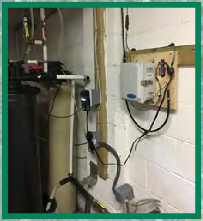
Improving the understanding of water use in households supplied by groundwater from onsite wells in the United States has been an interest of the Water Availability and Use Science Program for many years. A pilot project was developed and implemented to measure water use at five households with onsite wells in New Jersey. The network of monitored domestic wells in New Jersey and adjacent States is being expanded.
https://www.usgs.gov/centers/nj-water Elevated Tide Gages and Upgraded Equipment
Major coastal storms often generate large waves and high winds, resulting in damages to infrastructure and roads. The New Jersey Tide Gage Network was structurally strengthened, and existing equipment was elevated and enhanced with redundant sensors to improve resiliency during future storms.

Harmful Algal Blooms (HABs)
HABs pose a threat to human and aquatic ecosystem health and cause economic damages. From advanced monitoring platforms in the Finger Lakes region of New York and in a partnership with the New York State Department of Environmental Conservation (NYSDEC), we are collecting in real time almost 10,000 data points per day to understand when and how HABs develop. These data are expected to serve as a foundation upon which local and regional forecasts on HABs can be developed.

Soil Monitoring in the Northeast
Calcium is an essential nutrient in the soil for terrestrial and aquatic ecosystems and is critical for neutralizing residual acids from acid rain. Even though tremendous progress has been made since the 1990s in reducing pollutants in the air that form acid rain, ecosystem recovery has been slow. Not only has acid rain stripped much of the calcium out of soils, movement of carbon stored in soils to surface waters has increased because of the lower levels of calcium in soils. To better forecast the rate of calcium recovery needed to improve forest health and water quality, we are repurposing data on the capacity of soils to recover from calcium depletion collected since the 1990s to help with soil modeling. This forecasting can also help address the question if soil carbon sequestration is increasing or decreasing, one of the largest sources of uncertainty in climate models.
https://www.usgs.gov/centers/ny-water
Long Island Groundwater Modeling
Almost all the drinking water for the nearly 3 million people that live on Long Island comes from groundwater pumped from an underground aquifer system. Predicting the effects of groundwater management decisions on water quantity, saltwater intrusion, and effects on ponds, streams, wetlands, and coastal waters is necessary to maintain a balance between meeting the demand for drinking water and protecting the environment. Working with the NYSDEC, we are combining two models to couple recharge with groundwater flow along with predictions of temperature and precipitation from the National Weather Service. This will allow for near real-time forecasts of changes in groundwater levels and streamflows and can will help with planning and regulatory responses to droughts and groundwater flooding.

Meeting the Challenge: U.S. Geological Survey North Atlantic and Appalachian Region Fiscal Year 2020 in Review
Supergage Goes Mobile
Good water quality is crucial for drinking water, industry, farming, recreation, and tourism all along the heavily trafficked navigable river reaches within the Mississippi River, parts of the Ohio River, and the Tennessee River from Red Wing, Minnesota, to New Orleans, Louisiana. Following the success of the first mobile supergage aboard the American Queen, the USGS is installing a second mobile supergage, aboard the American Duchess, to collect water-quality data in real time along the Mississippi River, in partnership with American Queen Steamboat Company. The two supergages aboard the two vessels are unique in that they are mobile, and their sensors collect real-time water temperature, pH, specific conductance, turbidity, dissolved oxygen, and nitrate data. Interactive onboard kiosks display the real-time water-quality data the supergages are collecting to help travelers learn how the data will improve our understanding of nutrient dynamics and other issues affecting water quality along the Mississippi River. The data will also help resource managers working toward a healthier river system.

https://www.usgs.gov/centers/oki-water Real-Time Monitoring System at the Rough River Dam
The 5,100-acre Rough River Lake in south-central Kentucky increases public safety and provides a wide variety of outdoor recreational opportunities. The U.S. Army Corps of Engineers (USACE) manages the lake’s land and water for flood-damage reduction and, as an added benefit, the dam provides diverse habitat for wildlife, fisheries, and opportunities for recreation. To assist the USACE in conducting their mission, the USGS, in partnership with the USACE, installed and operates a stateof-the art monitoring system to detect any potential changes in water-levels (lake, stream, and groundwater); the data provided by this system allows the USACE to make informed decisions and engineer advanced solutions that best serve the public and mitigate flooding in the Ohio River basin.
Estimating Toxins at Recreational Sites and Drinking-Water Treatment Plants
Disease-causing organisms and HABs that produce toxins are widespread human-health and environmental threats to our recreational and drinking waters. Traditional laboratory methods for detecting Escherichia coli (E. coli) or microcystin often take too long to be useful for prompt public health protection. The USGS is collaborating with State and local partners to develop models to provide natural resource managers a tool for real-time swimming advisories or boating advisories for the public and to optimize drinking-water treatment and intake options for current conditions.

PFAS in Surface Water in Pennsylvania
Because PFAS can take a very long time to break down in the environment and may be found in concentrations as low as parts per trillion, the USGS is working with cooperators across the Nation to develop and implement rigorous and innovative techniques to detect PFAS at such low concentrations. In cooperation with the Pennsylvania Department of Environmental Protection, the USGS is evaluating field protocols and collecting data on the occurrence and distribution of PFAS in surface waters in Pennsylvania. This effort has resulted in a first-of-its-kind PFAS dataset to aid Pennsylvania in understanding potential PFAS sources across the landscape. PFAS were detected at 135 of 180 sampling locations; a subset of the 180 sites was sampled to further evaluate seasonal fluctuation and fate and transport of PFAS.
Sustainable Rivers Program Activity on the Allegheny River
As part of the national Sustainable Rivers Program, the USGS is providing field science support to the U.S. Army Corps of Engineers and The Nature Conservancy to characterize ecosystem response to the operation of Kinzua Dam. The dam was constructed on the Allegheny River in 1965 and controls flows from a drainage of approximately 2,180 square miles. Data are being collected to monitor and enhance forecasting the effects of water flow released from the Kinzua Dam on stream ecology and the topography of the area.

https://www.usgs.gov/centers/pa-water
Next-Generation Water Observation System in the Delaware River Basin
The USGS is developing and implementing new technologies for water monitoring. New technologies are expanding and improving on traditional operational networks with real-time and spatially distributed technologies such as long-range wide area networks, aerial drones for high precision topography and remotely sensed water data, three-dimensional integrated water-chemistry data collection using autonomous underwater vehicles, and artificial-intelligence-assisted photographic analysis for noncontact measurements. The USGS is installing a pilot project for the Next-Generation Water Observation System in the Delaware River Basin and is setting up instrumentation to assesses the salt-front, main-stem tidal water, evaluating the development of rapid suspended sediment models, and expanding the capacity of the Groundwater Climate Response Network by monitoring soil moisture and precipitation.
Meeting the Challenge: U.S. Geological Survey North Atlantic and Appalachian Region Fiscal Year 2020 in Review
Groundwater Model for the Eastern Shore of Virginia
Groundwater is the only source of freshwater to the Eastern Shore, and demand for water has been increasing for domestic, industrial, agricultural, and public-supply uses. This increase in demand has led to increased interest in and concern for understanding and managing groundwater resources in the region, including groundwater availability and groundwater quality in the present and the future. A numerical groundwater model can be used to simulate past and current conditions as well as possible future responses of the hydrogeologic system to anticipated future stresses. A groundwater model developed in 2009 by the USGS is being updated with new information related to the hydrogeologic framework underlying the Eastern Shore as well as current and projected amount of groundwater pumped.
https://www.usgs.gov/centers/va-wv-water Subsidence and Sea-Level Rise in Hampton Roads, Virginia
Sea-level rise in Hampton Roads is a welldocumented threat to the future economic viability of the region. Relative sea-level rise in the region is twice the average rate of that in the east coast of the United States and is the result of both sea-level rise and subsidence. A substantial portion of the subsidence is the result of large amounts of the same groundwater pumpage that is critical to the viability of the regional economy. The USGS operates a network of tide gages, survey benchmarks, and extensometers to better characterize the relative sea-level rise, in addition to adding spatial detail in the subsidence. In addition, the USGS has started participating with the Hampton Roads Sanitation District on a large-scale regional wastewater reinjection project. As wastewater is injected, the USGS networks identify those areas that are rebounding as well as the rate of the rebounding. Models using the data collected should allow for more accurate forecasting of regional relative sea-level rise.

Remote-Sensing Coastal Change
Quantifying coastal change can help mitigate hazards and safeguard infrastructure, tourism and recreation, and marine habitats. Remote-sensing technologies, such as aerial photography, satellite imagery, and laser-based lidar surveying, can be used to improve forecasts of changes along the shorelines of the coastal United States. Days after Hurricane Isaias made landfall on the east coast in August 2020, the USGS processed imagery collected at North Core Banks in Cape Lookout

Coupled Ocean-Atmosphere-Wave-Sediment Transport Modeling System
Understanding the processes involved in coastal change is important for managing our natural and economic coastal resources. Storms are one of the primary driving forces causing coastal change from a coupling of wave- and wind-driven flows. The USGS is working to understand the mechanisms that control the salinity distribution in the Delaware Estuary and drive salinity upstream into the Delaware River. Modeling results could help inform hazard guidance, emergency preparedness, and resource management of the Delaware estuary and improve understanding of salinity mixing in other estuarine environments. National Seashore, North Carolina, by the National Oceanic and Atmospheric Administration National Geodetic Survey. We compared the topography of the affected coastline with topography before the storm and provided critical information to the National Park Service before assessment teams could be deployed on the ground.

https://www.usgs.gov/centers/whcmsc
Gas Hydrates
Methane hydrates—a frozen form of gas and water found in marine sediments and in areas of continuous permafrost—account for one-sixth of the world’s methane (also known as natural gas). The USGS examines gas hydrates for their resource potential, the effect gas hydrates can have on the global climate when released, and for the associated risk of submarine landslides when gas hydrates are thawed. In 2020, we compiled and released a fully referenced database of global locations where gas hydrate formations have been confirmed. This database has already been adapted for use by colleagues and collaborators in Japan and elsewhere.

Meeting the Challenge: U.S. Geological Survey North Atlantic and Appalachian Region Fiscal Year 2020 in Review
Climate Change Refugia
Natural resource conservation is complicated by climate change, invasive species, limited resources, and decreasing biodiversity. To focus on a tangible and productive way to deal with these effects, the USGS, in collaboration with the National Park Service (NPS) and the University of Massachusetts, is working to identify climate change refugia, areas that are buffered from climate change that increase persistence of valued resources. A translational ecology approach was used to convene a series of remote workshops that engaged more than 100 participants.


Ecological and Decision Thresholds in a Climate Change Context
On October 7–8, 2020, more than 100 scientists and natural and cultural resource managers from Federal, State, and Tribal agencies and nongovernmental organizations convened virtually for a workshop focused on biological thresholds in the context of climate adaptation. The workshop was designed to share understanding on the mechanisms that drive changes in the distribution and abundance of plant and animal species across the Northeast, including any thresholds that might soon be crossed. Workshop participants identified climate-driven or management thresholds for populations, ecosystems, and landscapes to inform cultural and natural management planning. The workshop continued through October through small-group discussions focused on forests, freshwater, coasts, and invasive species to determine priority areas for research and adaptation strategies to support management decisions.
https://www.usgs.gov/ecosystems/climate-adaptation-science-centers Sea-Level Rise Effects on Intertidal Biodiversity
The northeastern coast of the Nation is experiencing rapid sea-level rise and more intense storms that affect coastal biodiversity, ecosystems, and cultural resources. The USGS, in collaboration with the NPS and the University of Massachusetts under the auspices of the Natural Resources Preservation Program, is compiling existing data on the occurrence and distribution of intertidal species and habitat characteristics and developing monitoring tools for the Boston Harbor Islands Recreation Area. The resulting synthesis and field scoping activities should provide a baseline assessment of current ecological conditions and protocols that can be used to inform site selection and track changes before and after coastal adaptation actions.

Santuit River Streamgage
Providing science to assist Tribal Nations maintain the health and safety of their Tribal lands and the sustainability of Tribal resources is part of the mission of the USGS. How we obtain, distribute, and use that science demands special care to respect the sovereignty of Native American lands and waters. In parts of Cape Cod, polluted groundwater discharging into rivers may transport nitrogen to surface waters, which in turn can affect fish and wildlife ecosystems. In partnership with the Mashpee Wampanoag Nation, the USGS has installed a new streamgage on the Santuit River on Cape Cod to monitor river flow and water pollution entering Tribal lands.

https://www.usgs.gov/about/organization/science-support/office-tribal-relations Onondaga Creek Mudboils
Water plays an important part in the life and rituals of the Onondaga Nation. Mudboils have been documented in the Tully Valley in central New York since the late 1890s and have continuously discharged sediment-laden water into nearby Onondaga Creek since the 1950s. The discharge of sediment causes gradual land-surface subsidence. In partnership with the Onondaga Nation, the USGS developed new cooperative projects relating solution mining and mudboil activity and how best to mitigate the environmental effects of the mudboils.
Partnerships With Tribal Nations

Technical Training and Assistance
To support Tribe objectives in the management of their natural resources and hazards with grants awarded through the Technical Training in Support of Native American Relations (TESNAR) program, the NAAR has provided technical training on specific skills that enhance the Tribes’ scientific independence. In partnership with the Shinnecock Nation, the USGS developed two training courses on geographic information systems (GIS) and geospatial methods for mapping flood vulnerability using existing aerial lidar coverages and on cyanobacteria toxin testing using rapid test strips manufactured by Eurofin Abraxis.
Meeting the Challenge: U.S. Geological Survey North Atlantic and Appalachian Region Fiscal Year 2020 in Review


James F. Reilly II, Director
U.S. Geological Survey, Reston, Virginia: 2020
Meeting the Challenge: U.S. Geological Survey North Atlantic and Appalachian Region Fiscal Year 2020 in Review—

ISSN 2332-3531 (print) ISSN 2332-354x (online) https://doi.org/10.3133/gip207
Where this page came from
This page was imported from U.S. Geological Survey. Published by the U.S. Geological Survey and, as a work of the United States government, in the public domain.
Nobody has written it yet — it is the source material at a new address, which is why search engines are asked to skip it and why no one earns from it. It is up for grabs: take it on, and it is yours to rewrite and to earn from.
লাইসেন্স: CC0 1.0 (পাবলিক ডোমেইন) · গৃহীত হয়েছে pubs.usgs.gov
1
0
0
0

মন্তব্য


