উন্নত করার কিছু দেখছেন? একটি পরিবর্তন প্রস্তাব করুন।

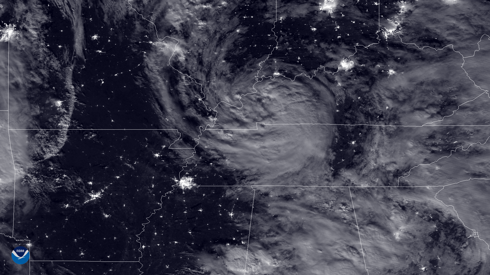
Download Image Download Image of Tropical Storm Alberto
The NOAA-20 satellite's VIIRS day night band captured this nighttime image of the remnants of subtropical storm Alberto moving through the South and Midwestern U.S. in the early morning hours of May 30, 2018. On May 25, the National Hurricane Center named Alberto the first storm of the 2018 Atlantic Hurricane Season, which officially begins June 1. While most tropical storm systems disintegrate upon making landfall, Alberto took on a more symmetrical spiral appearance after tracking inland from the Gulf of Mexico, even though it was downgraded to a subtropical depression. In this image, the center of the storm's circulation can be seen along the border of Kentucky and Tennessee. The storm's remnants have caused torrential rain and flash flooding in western North Carolina, where the National Weather Service reported nearly 7 inches of rain fell in 24 hours near Asheville, N.C.
NOAA-20's VIIRS sensor is sensitive enough to detect the noctural glow produced by Earth's atmosphere, the glow of urban areas as well as detailed cloud imagery, as seen in this imagery.
Where this page came from
This page was imported from NOAA Satellites (NESDIS). Published by NOAA's National Environmental Satellite, Data, and Information Service and, as a work of the United States government, in the public domain; pictures credited elsewhere are left out.
Nobody has written it yet — it is the source material at a new address, which is why search engines are asked to skip it and why no one earns from it. It is up for grabs: take it on, and it is yours to rewrite and to earn from.
লাইসেন্স: CC0 1.0 (পাবলিক ডোমেইন) · গৃহীত হয়েছে www.nesdis.noaa.gov
1
0
0
0

মন্তব্য