উন্নত করার কিছু দেখছেন? একটি পরিবর্তন প্রস্তাব করুন।

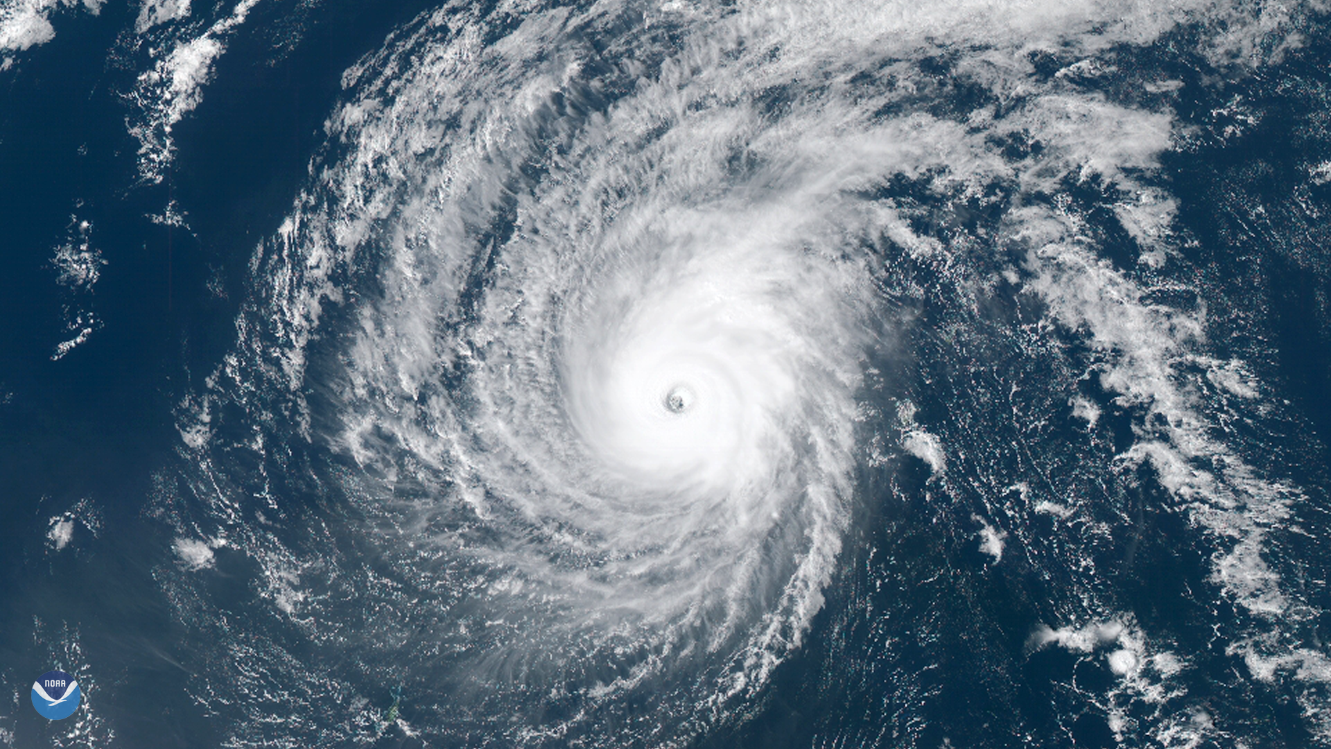
Download Image Download Image of Typhoon Wutip
Typhoon Wutip, the strongest February storm seen in the western Pacific Ocean in 70 years, passed south of Guam and may brush the northern Philippines later this week. This visible imagery, captured by Japan's Himawari-8 geostationary satellite on Feb. 25, 2019 (12:35 a.m. ET), shows Wutip's distinct eye as it churned through the Pacific.
On Feb. 23, Wutip became a rare February super typhoon – just shy of Category 5 strength – with sustained winds of 155 mph. According to NOAA's Historical Hurricane Tracks database , only three other February storms in the Northwest Pacific basin have reached at least Category 4 intensity since records began in the 1940s.
Wutip passed less than 200 miles south of Guam on Feb. 23, battering the U.S. territory with tropical-storm force winds and heavy rain. An update from the Joint Typhoon Warning Center issued Monday morning (Feb. 25) showed Wutip's sustained winds were still near 149 mph as the storm moves west-northwest toward the Philippine Sea.
Where this page came from
This page was imported from NOAA Satellites (NESDIS). Published by NOAA's National Environmental Satellite, Data, and Information Service and, as a work of the United States government, in the public domain; pictures credited elsewhere are left out.
Nobody has written it yet — it is the source material at a new address, which is why search engines are asked to skip it and why no one earns from it. It is up for grabs: take it on, and it is yours to rewrite and to earn from.
লাইসেন্স: CC0 1.0 (পাবলিক ডোমেইন) · গৃহীত হয়েছে www.nesdis.noaa.gov
1
0
0
0

মন্তব্য