Ser du noget at forbedre? Foreslå en ændring.

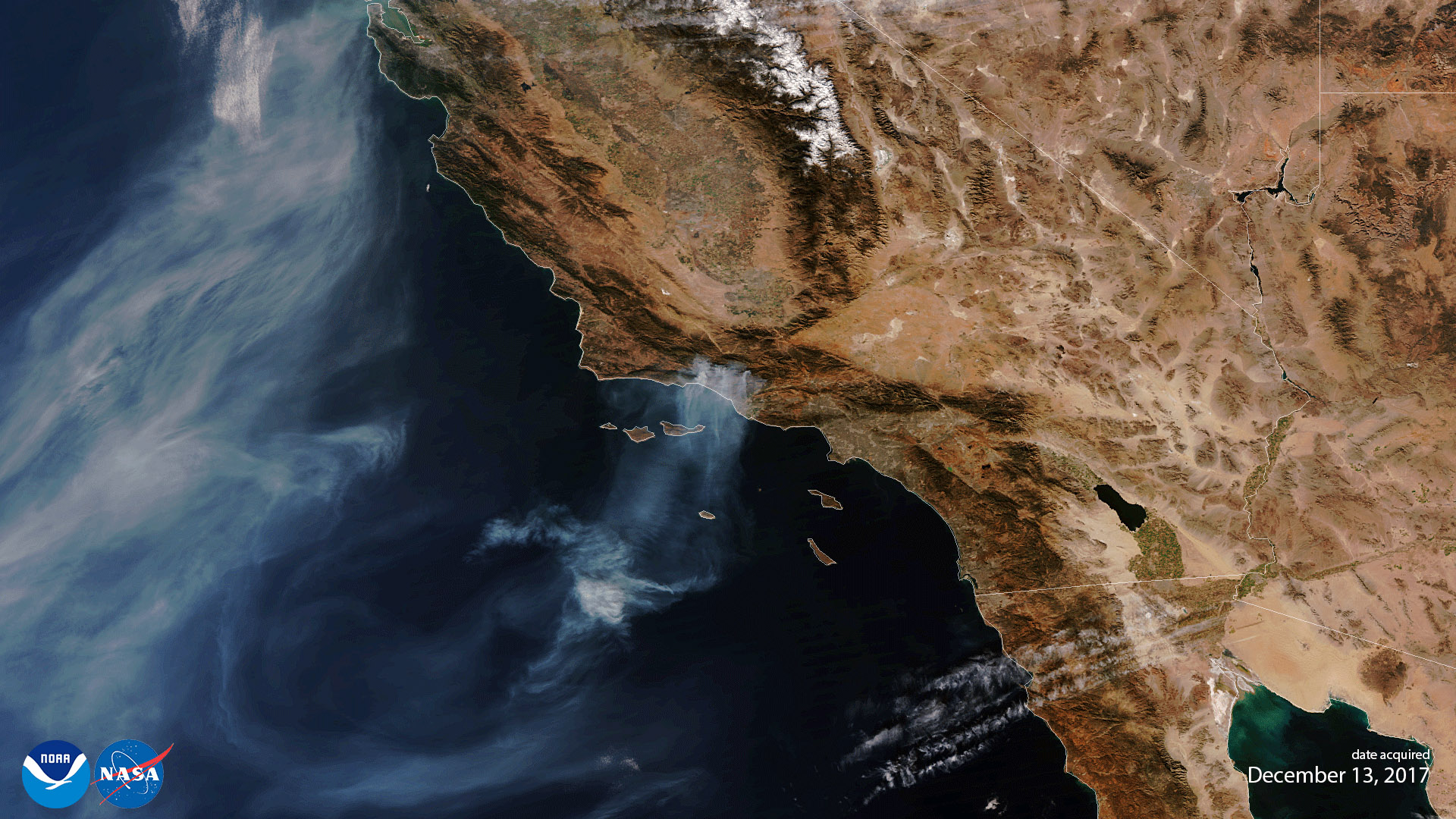
Download Image Download Image of wildfires
Twenty-five days after JPSS-1 (NOAA-20) was launched into Earth orbit, the satellite sent back its first Visible Infrared Imaging Radiometer Suite (VIIRS) science data on December 13, 2017, as part of a series of instrument activations and checkouts taking place before the satellite goes into fully operational mode. This VIIRS true color image captured the aggressive wildfires across Southern California which have forced thousands to flee their homes. As of Wednesday morning, December 13, 2017, the Thomas Fire was the fourth-largest fire in California history, and it continues to generate plumes of smoke as it enters its second week. The fire spanned more than 370 square miles and remains the strongest blaze for firefighters to battle in Ventura and Santa Barbara counties.
VIIRS is one of the five key instruments onboard NOAA-20 that will improve day-to-day weather forecasting and environmental monitoring, while extending the record of many long-term observations of Earth's climate. NOAA-20 VIIRS will help monitor active fires globally for many years to come.
Where this page came from
This page was imported from NOAA Satellites (NESDIS). Published by NOAA's National Environmental Satellite, Data, and Information Service and, as a work of the United States government, in the public domain; pictures credited elsewhere are left out.
Nobody has written it yet — it is the source material at a new address, which is why search engines are asked to skip it and why no one earns from it. It is up for grabs: take it on, and it is yours to rewrite and to earn from.
Licens: CC0 1.0 (offentligt eje) · Bearbejdet efter www.nesdis.noaa.gov
1
0
0
0

Kommentarer