Ser du noget at forbedre? Foreslå en ændring.

Download Image Download Image of the Saharan Dust
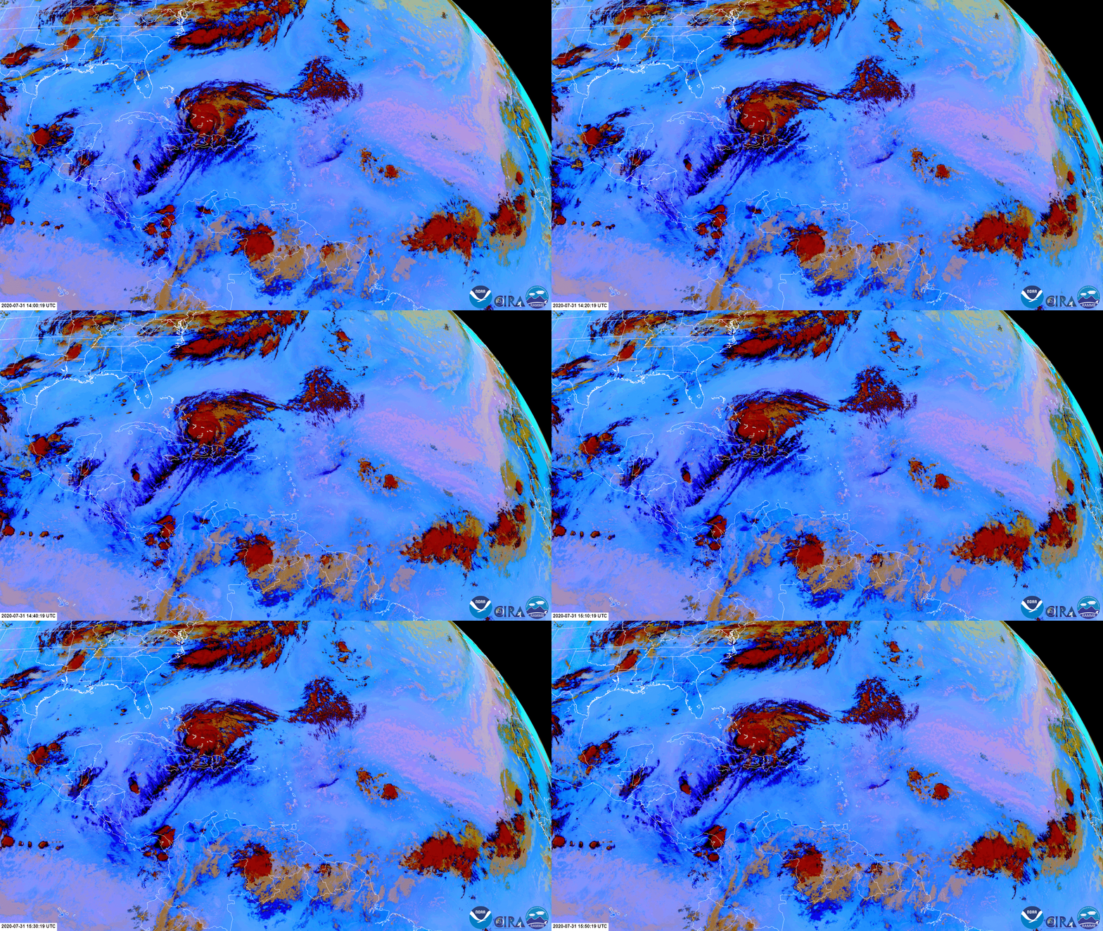
A lot is happening in this dynamic shot of the Atlantic, which was captured by the GOES-East satellite today, July 31, 2020. This imagery utilizes the satellite’s Dust RGB product to show the dust (light pink) that is continuing to blow westward over the Atlantic Ocean from the Sahara Desert. We can also see Hurricane Isaias swirling over the Caribbean Sea.
In both visible and infrared imagery, dust can often be confused with clouds such as cirrus, since they are both considered optically thin. However, by utilizing Dust RGB, we can differentiate the two. Here, dust appears pink or magenta, and is discernible from land surfaces such as deserts due to its thickness and density. Hurricane Isaias appears in Dust RGB as a mass of red, orange, and black clouds. The red and orange colors represent clouds that are cold and thick, while the black areas are high, thin ice clouds. Hurricane Isaias is the earliest ninth (“I”) storm during the Atlantic hurricane season on record.
Isaias, which strengthened to a Category-1 hurricane on the Saffir-Simpson Hurricane Wind Scale just before midnight last night, is expected to produce heavy rains and potentially life-threatening flash flooding and mudslides across the Dominican Republic, northern Haiti, Turks and Caicos, and the Bahamas, according to the National Hurricane Center.
GeoColor sunrise view of Hurricane Isaias via the GOES-East satellite on July 31, 2020.
The GOES-East geostationary satellite, also known as GOES-16, keeps watch over most of North America, including the continental United States and Mexico, as well as Central and South America, the Caribbean, and the Atlantic Ocean to the west coast of Africa. The satellite's high-resolution imagery provides optimal viewing of severe weather events, including thunderstorms, tropical storms, and hurricanes.
Where this page came from
This page was imported from NOAA Satellites (NESDIS). Published by NOAA's National Environmental Satellite, Data, and Information Service and, as a work of the United States government, in the public domain; pictures credited elsewhere are left out.
Nobody has written it yet — it is the source material at a new address, which is why search engines are asked to skip it and why no one earns from it. It is up for grabs: take it on, and it is yours to rewrite and to earn from.
Licens: CC0 1.0 (offentligt eje) · Bearbejdet efter www.nesdis.noaa.gov
1
0
0
0

Kommentarer