Etwas zu verbessern? Schlag eine Änderung vor.

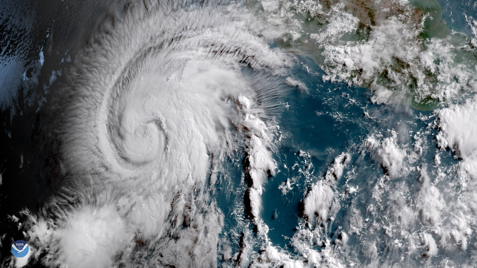
Download Image Download Image of Hurricane Aletta
The GOES East satellite captured this image of Tropical Storm Aletta in the eastern Pacific Ocean on June 7, 2018. Aletta developed about 350 miles off the southern coast of Mexico on June 6 and is the first named storm of the 2018 Eastern Pacific hurricane season. While the storm is not a threat to land, National Hurricane Center expects Aletta to strengthen to a Category 1 hurricane as it tracks west-northwest over the coming days. This satellite image shows the storm intensifying, with tall cloud tops appearing near the center of the storm's circulation as it becomes better organized.
This geocolor enhanced imagery was created by NOAA's partners at the Cooperative Institute for Research in the Atmosphere. The GOES East geostationary satellite, also known as GOES-16, provides coverage of the Western Hemisphere, including the United States, the Atlantic Ocean and the eastern Pacific. The satellite's high-resolution imagery provides optimal viewing of high-impact and severe weather events, including thunderstorms, tropical storms, and hurricanes.
Where this page came from
This page was imported from NOAA Satellites (NESDIS). Published by NOAA's National Environmental Satellite, Data, and Information Service and, as a work of the United States government, in the public domain; pictures credited elsewhere are left out.
Nobody has written it yet — it is the source material at a new address, which is why search engines are asked to skip it and why no one earns from it. It is up for grabs: take it on, and it is yours to rewrite and to earn from.
Lizenz: CC0 1.0 (gemeinfrei) · Bearbeitet nach www.nesdis.noaa.gov
1
0
0
0

Kommentare