Etwas zu verbessern? Schlag eine Änderung vor.

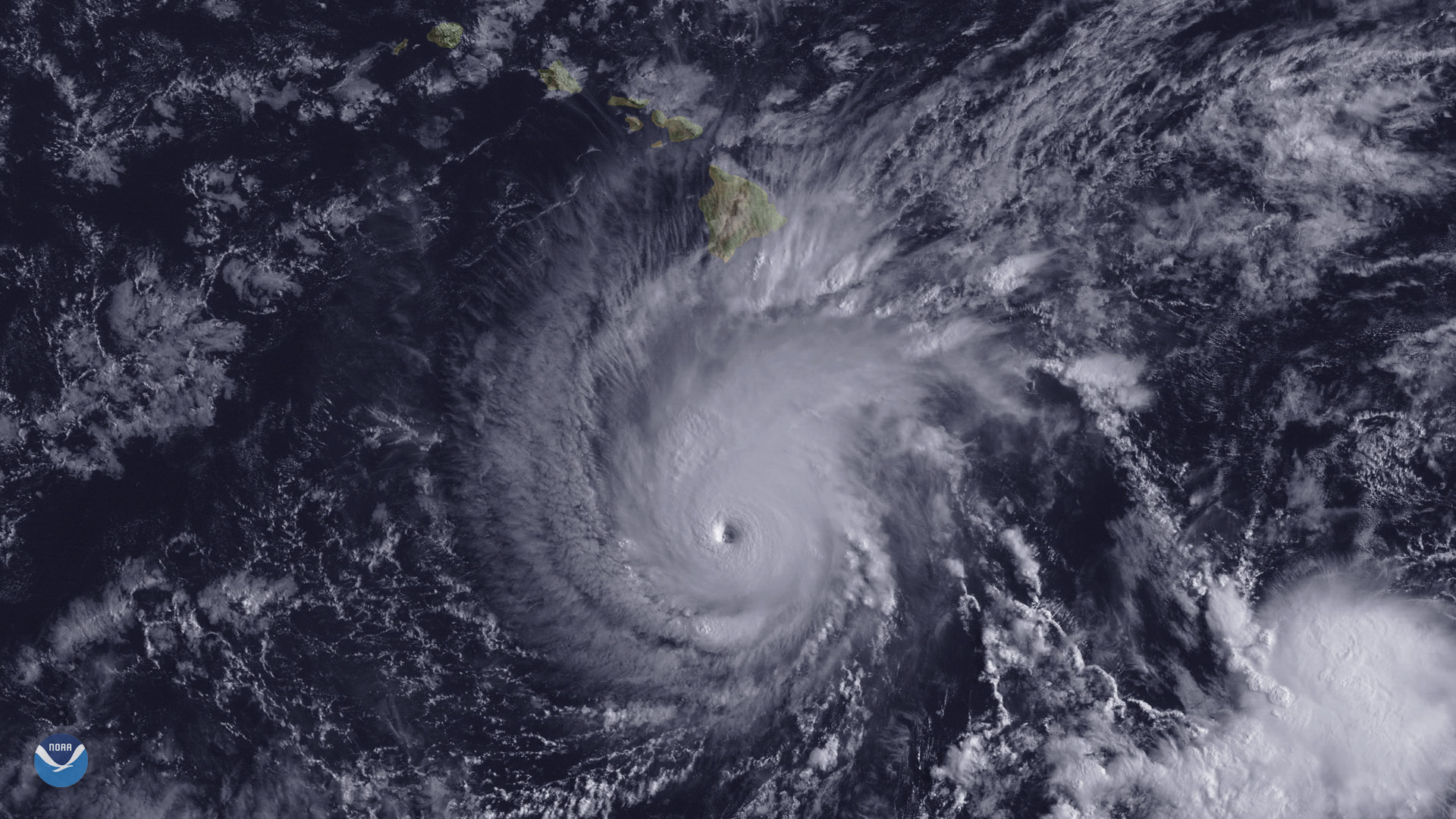
Download Image Download Image of Hurricane Lane
The state of Hawaii faces a significant threat from powerful Hurricane Lane, which is expected to track northward toward the islands by the end of this week. This image from the GOES-15 satellite shows Hurricane Lane, with a well-defined eye, positioned about 300 miles south of Hawaii's Big Island at 2 p.m. ET on August 22, 2018.
Lane briefly reached Category 5 intensity early Wednesday, with sustained winds of 160 mph, before weakening slightly to a high-end Category 4 storm. The latest National Hurricane Center forecast shows the storm beginning a northward turn, putting Hawaii at risk of significant impacts, including damaging winds, heavy rainfall, flash flooding, and storm surge. On Wednesday, the National Weather Service issued a hurricane warning for Hawaii's Big Island and Maui, while hurricane watches are in effect across the rest of the state.
Despite Hawaii's location in the middle of the Pacific Ocean, very few hurricanes have made landfall in the Aloha State. NOAA's historical hurricane tracks database shows only a handful of hurricanes passing within a few hundred miles of the islands. A hurricane has not made landfall since Iniki battered the island of Kauai in 1992, while the Big Island has never been struck by a hurricane since modern weather records began. Forecasters are warning residents that even if Hawaii avoids a direct hit from Hurricane Lane, southern parts of the state may still face damaging impacts from the storm.
The GOES-15 satellite is currently NOAA's operational GOES West satellite, which provides geostationary coverage of the United States, western South America and much of the Pacific Ocean, from 22,000 miles above Earth.
Where this page came from
This page was imported from NOAA Satellites (NESDIS). Published by NOAA's National Environmental Satellite, Data, and Information Service and, as a work of the United States government, in the public domain; pictures credited elsewhere are left out.
Nobody has written it yet — it is the source material at a new address, which is why search engines are asked to skip it and why no one earns from it. It is up for grabs: take it on, and it is yours to rewrite and to earn from.
Lizenz: CC0 1.0 (gemeinfrei) · Bearbeitet nach www.nesdis.noaa.gov
1
0
0
0

Kommentare