
Want to improve the page's content? Try to propose a change.
The Rocky Mountains and the Colorado River Basin are complex, interconnected systems that sustain a great variety of species — including tens of millions of people. They face drought, wildfire, invasive plants and animals, and shrinking habitat. In April 2024, the U.S. Geological Survey's Rocky Mountain Region (Region 7) held a three-day Science Exchange workshop on how science can help managers understand these risks and adapt to them.
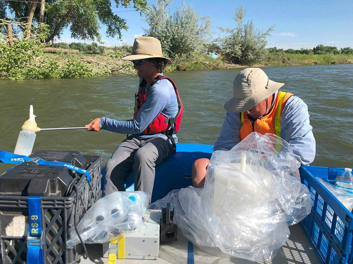
Sampling water to trace the sources and fate of nutrients in the Animas River watershed, New Mexico, June 9, 2022. Credit: Benjamin S. Linhoff, U.S. Geological Survey.
Day 1: Cutting-edge tools
People and natural systems interact in complicated ways — development, wildfires, mining, invasive species, changes that worsen flooding or drought, and waste discharges — with effects that can be local or global. Wildfires can affect air quality and climate on national and global scales; droughts and floods in farm regions can shrink food supplies far away. USGS scientists presented new methods to inform decisions:
- combining elements, isotopes and microbes in water to find the sources of contaminants in western watersheds;
- modeling how salt loads move through hydrologic systems;
- cutting the cost of water and sediment sampling;
- using high-resolution remote sensing to build terrain models and coordinate systems;
- improving geologic maps of the intermountain West.
Day 2: A risk-ready region
Risks in the Rocky Mountain Region can reach well beyond it, and evaluating chains of related hazards draws on many fields — planetary science, geology, meteorology, wildlife ecology, and civil defense and emergency response. Talks covered:
| Theme | Topics |
|---|---|
| Water | Sharper topographic maps for better flood estimates; how evaporation affects drought; the scope of multidecadal drought; water insecurity in the region |
| Cascading hazards | Downwind and downstream hazards from asteroid impacts; dating minerals and layers to estimate how often earthquakes have struck recently |
| Food and health | Remote sensing to assess global food security; risks from emerging pathogens in the environment |
| Contamination | Tools to describe risks from hazardous wastes and to optimize cleanup of contaminated land |
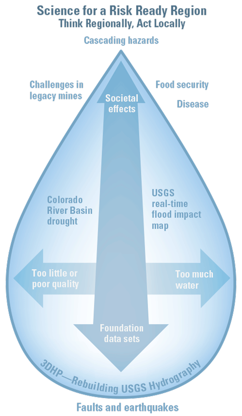
How the workshop's topics connect. Credit: U.S. Geological Survey.
Day 3: Making science with its users
The final day focused on stakeholder engagement and coproduction — producing science together with the managers and communities who will use it, which improves the quality and usefulness of data and decision tools. Engagement ranges from one-way communication in independent research to full coproduction, an equal partnership with shared responsibility for success.
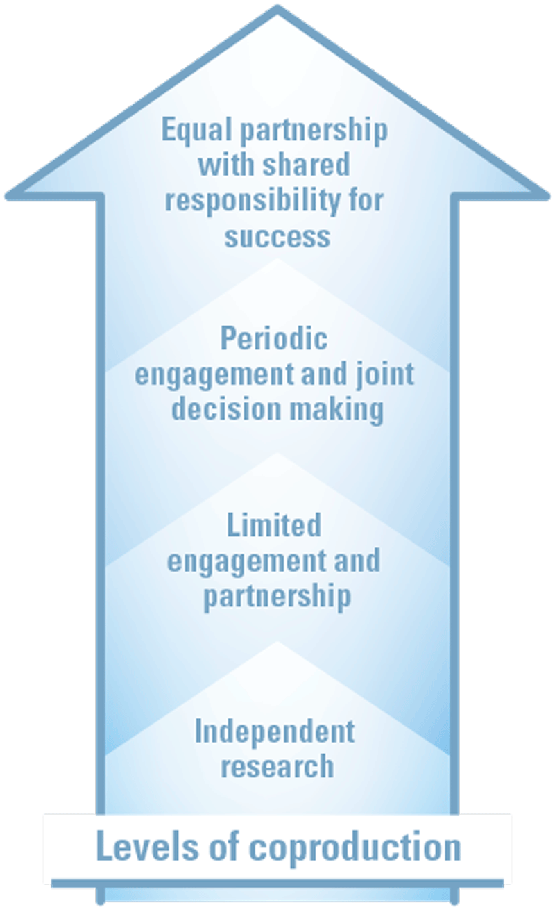
Levels of engagement, from independent research to full coproduction. Credit: U.S. Geological Survey.
Presentations described coproduced projects to improve resource management, predict environmental problems and sharpen water-hazard science and incident response; work with management agencies and partners on natural resource issues; an interactive science collaboration portal; science codesign workshops; a team science curriculum; and a coproduction toolkit of best practices for meeting stakeholder needs with multidisciplinary science.
What came out of it
The workshop brought together three threads that reinforce each other:
- New tools that give a fuller picture of natural systems and how to manage them adaptively;
- Hazard analyses that show how risks cascade, to make cities and rural areas more resilient;
- Deeper engagement with other agencies and stakeholders, so data collection and analysis produce tools people can actually use to adapt to hazards and restore ecosystems.
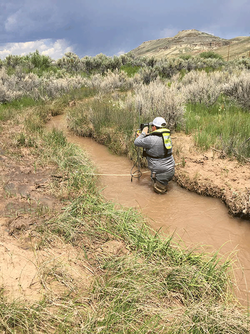
A USGS hydrologic technician measures streamflow on Fogarty Creek near Big Piney, Wyoming, July 17, 2017. Credit: Cheryl Eddy-Miller, U.S. Geological Survey.
Sources
Based on "U.S. Geological Survey 2024 Rocky Mountain Region Science Exchange—Showcasing Cutting-Edge Science to Adapt to Extreme Weather Events," USGS Fact Sheet 2025–3008, U.S. Geological Survey; a work of the United States government in the public domain. Full text.
Licence: CC0 1.0 (public domain) · Adapted from pubs.usgs.gov
1
0
0
0

Comments
Read next


