¿Ves algo que mejorar? Propón un cambio.

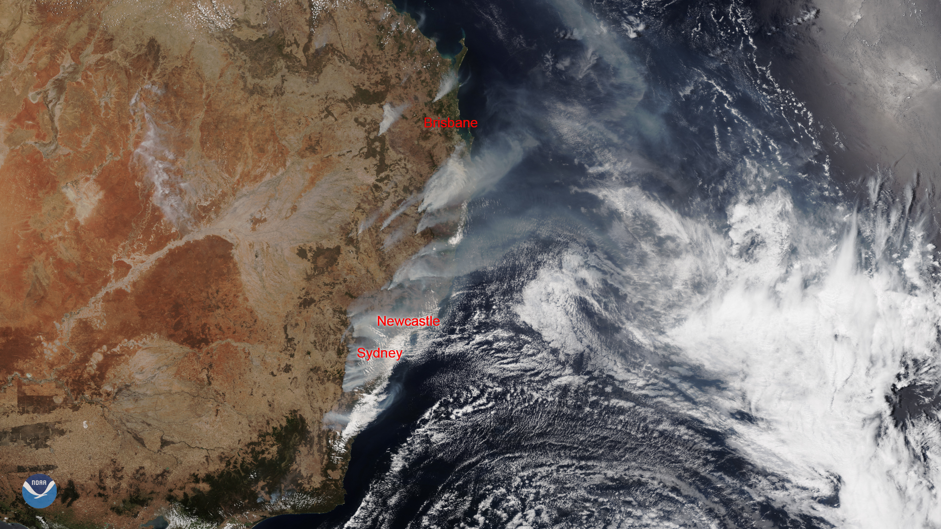
Download Image Download Image of the Australian Wildfires
As massive wildfires continue to rage in the southeastern states of Australia, a dangerous heat wave is also moving across the country from west to east. All-time and daily records may be surpassed in parts of South Australia, New South Wales, and Victoria this week and temperatures may potentially soar to nearly 122 degrees Fahrenheit in some inland areas to the south. Australia’s Bureau of Meteorology (BoM), however, doesn’t expect that the record high will be matched, which was 123.3 degrees Fahrenheit at Oodnadatta, South Australia, on Jan. 2, 1960.
High temperatures can cause heatstroke and heat exhaustion, especially for children and the elderly who are at the highest risk. Thus, officials are recommending that anyone outdoors should drink plenty of fluids and take frequent breaks from strenuous activity and that those at high-risk for heat-related illnesses should stay in air-conditioned locations when possible.
These temperatures also make hazardous fire conditions even worse. Australian authorities are particularly concerned about a “ mega blaze ” that formed when three major fires merged near Sydney, Australia on Dec. 6, 2019, that has now spread beyond its containment lines and destroyed roughly 20 homes in the area. The resulting air quality in Sydney is so bad that it has been labeled a “ public health emergency ” that requires urgent government action.
Although bushfires are common in Australia, this year’s fire season is unusually intense and has begun earlier than expected. The smoke and dust, carried by westerly winds over the Tasman Sea in the South Pacific Ocean, is even reaching New Zealand and discoloring the glaciers there. Australia’s BoM suggests that climate change has led to an increase in extreme heat events and raised the likelihood of other natural disasters, such as drought.
This image was captured by the NOAA-20 satellite's VIIRS instrument , which scans the entire Earth twice per day at a 750-meter resolution. Multiple visible and infrared channels allow it to detect atmospheric aerosols, such as dust, smoke and haze associated with industrial pollution and fires. The polar-orbiting satellite circles the globe 14 times daily and captures a complete daytime view of our planet once every 24 hours.
Where this page came from
This page was imported from NOAA Satellites (NESDIS). Published by NOAA's National Environmental Satellite, Data, and Information Service and, as a work of the United States government, in the public domain; pictures credited elsewhere are left out.
Nobody has written it yet — it is the source material at a new address, which is why search engines are asked to skip it and why no one earns from it. It is up for grabs: take it on, and it is yours to rewrite and to earn from.
Licencia: CC0 1.0 (dominio público) · Adaptado de www.nesdis.noaa.gov
1
0
0
0

Comentarios