¿Ves algo que mejorar? Propón un cambio.

Download Animation Download Animation of Death Valley
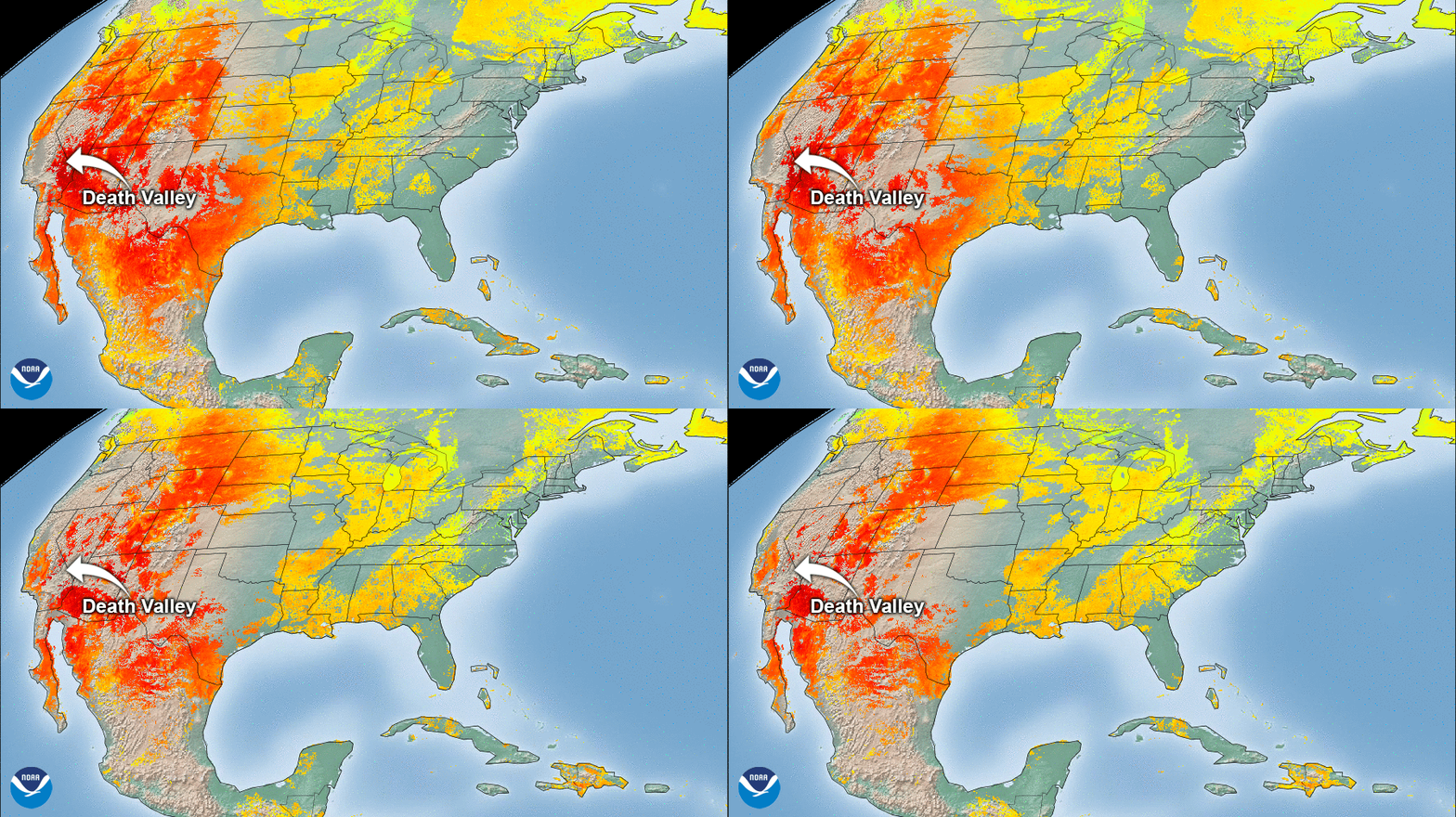
On Sunday, August 16, 2020 at 3:41 p.m. local time, the National Weather Service recorded a blistering temperature of 130 degrees Fahrenheit at Furnace Creek, Calif., near the Visitor’s Center in Death Valley, amid a heatwave affecting most of the southwestern U.S. If officially verified, this would be the hottest temperature recorded there since 1913 and among the top three highest temperatures ever measured in Death Valley. It would also be the highest temperature recorded during the month of August.


Land Surface Temperature (LST) data from both the GOES-East and GOES-West satellites. (Due to cloud cover, sometimes LST data is limited)
Death Valley, in the northern region of the Mojave Desert, is known as one of the hottest places on Earth. On July 10, 1913, a world record temperature of 134 degrees Fahrenheit was recorded at Greenland Ranch at Furnace Creek within the valley. However, this reading has been disputed. More recently, temperatures in the region reached 129 degrees Fahrenheit in July of 2013.

The approximate area of Death Valley is circled.
The imagery above shows land surface temperature (LST) information gathered via the Advanced Baseline Imager onboard the GOES-East and GOES-West satellites. According to Dr. Daniel Lindsey, a program scientist for the NOAA/NESDIS GOES-R Program, LST is not the same as air surface temperature, which is measured by land-based thermometers. However, the temperatures are typically correlated.
The GOES-East geostationary satellite, also known as GOES-16, keeps watch over most of North America, including the continental United States and Mexico, as well as Central and South America, the Caribbean, and the Atlantic Ocean to the west coast of Africa. The satellite's high-resolution imagery provides optimal viewing of severe weather events, including thunderstorms, tropical storms, and hurricanes.
The GOES-West satellite, also known as GOES-17, provides geostationary satellite coverage of the Western Hemisphere, including the United States, the Pacific Ocean, Alaska and Hawaii. First launched in March 2018, the satellite became fully operational in February 2019.
Where this page came from
This page was imported from NOAA Satellites (NESDIS). Published by NOAA's National Environmental Satellite, Data, and Information Service and, as a work of the United States government, in the public domain; pictures credited elsewhere are left out.
Nobody has written it yet — it is the source material at a new address, which is why search engines are asked to skip it and why no one earns from it. It is up for grabs: take it on, and it is yours to rewrite and to earn from.
Licencia: CC0 1.0 (dominio público) · Adaptado de www.nesdis.noaa.gov
1
0
0
0

Comentarios