¿Ves algo que mejorar? Propón un cambio.

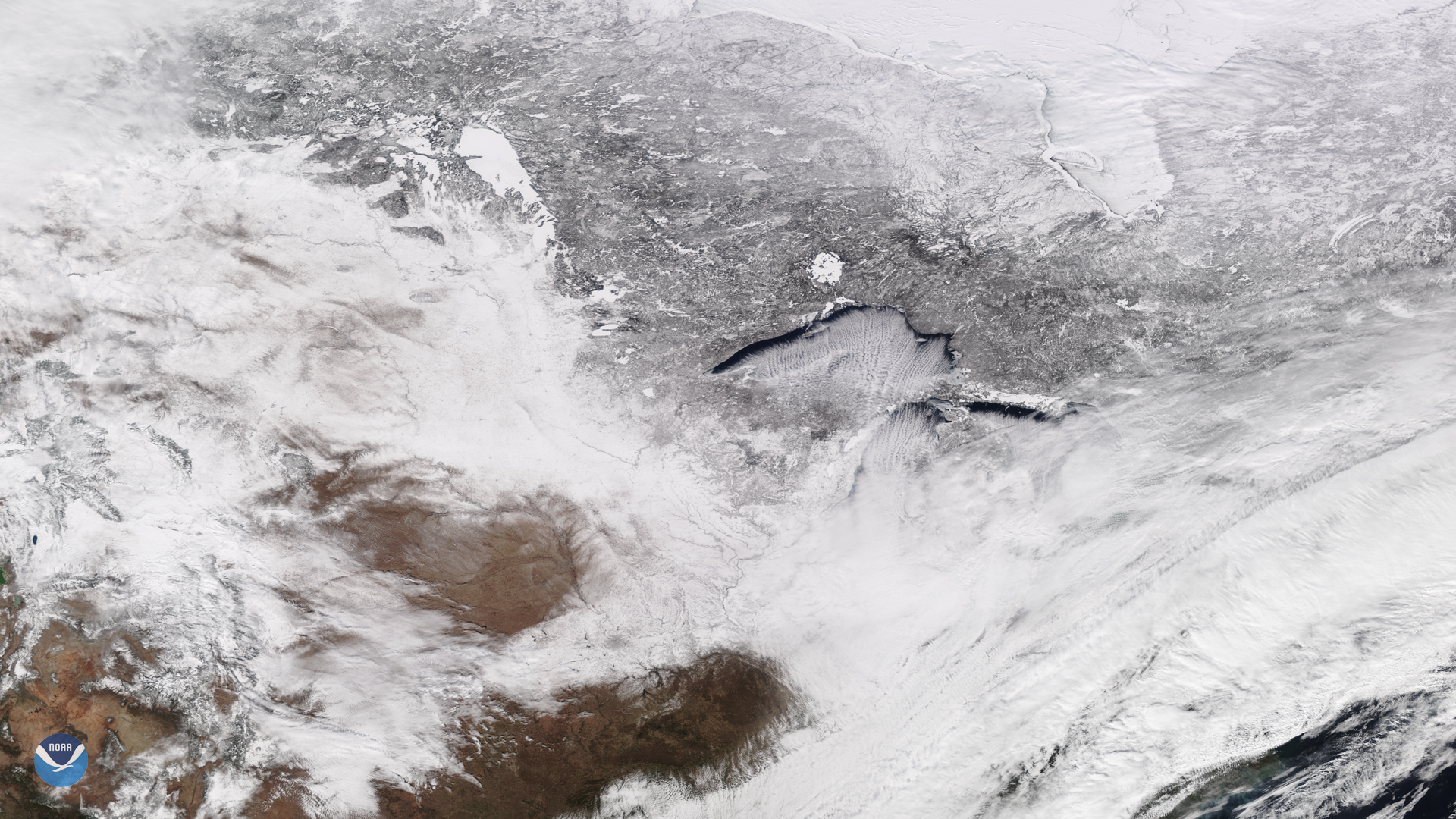
Download Image Download Image of the Northern U.S.
On Feb. 13, 2020, the NOAA-20 satellite viewed cloud streets over Lake Superior, signifying a cold air mass on the move. In fact, wind chill advisories were in effect on Thursday for a portions of the Great Lakes region and Northern New England, according to the National Weather Service.
The Lake Effect phenomenon is well-known and studied in meteorological circles; according to this previous Image of the Day post , the rows of clouds over the Great Lakes [occur] when frigid Arctic air from Canada crosses the relatively warm lake water. Over time, northern or westerly winds blow over the lakes surface, picking up heat and water vapor that produce warm columns of air known as thermals. Those columns then cool down and condense into cumulus clouds, aligning in the direction of the prevailing wind over the lakes surface. When there is a large enough temperature contrast, the cloud structures can dump heavy lake effect snow on the downwind shores of the lakes, in areas such as Grand Rapids, Mich. and the Upper Peninsula of Michigan.
According to the NOAA Weather Prediction Center, light snow is expected to move across the Northern Plains to Midwest through Friday night, across the Great Lakes region Saturday, and into the interior Northeast on Sunday.Â
This image was captured by the NOAA-20 satellite's VIIRS instrument , which scans the entire Earth twice per day at a 750-meter resolution. Multiple visible and infrared channels allow it to detect atmospheric aerosols, such as dust, smoke, and haze associated with industrial pollution and fires. The polar-orbiting satellite circles the globe 14 times daily and captures a complete daytime view of our planet once every 24 hours. Images taken by the VIIRS sensor during each orbit are then merged together to create image mosaics of larger regions, like the one used here.
Where this page came from
This page was imported from NOAA Satellites (NESDIS). Published by NOAA's National Environmental Satellite, Data, and Information Service and, as a work of the United States government, in the public domain; pictures credited elsewhere are left out.
Nobody has written it yet — it is the source material at a new address, which is why search engines are asked to skip it and why no one earns from it. It is up for grabs: take it on, and it is yours to rewrite and to earn from.
Licencia: CC0 1.0 (dominio público) · Adaptado de www.nesdis.noaa.gov
1
0
0
0

Comentarios