¿Ves algo que mejorar? Propón un cambio.

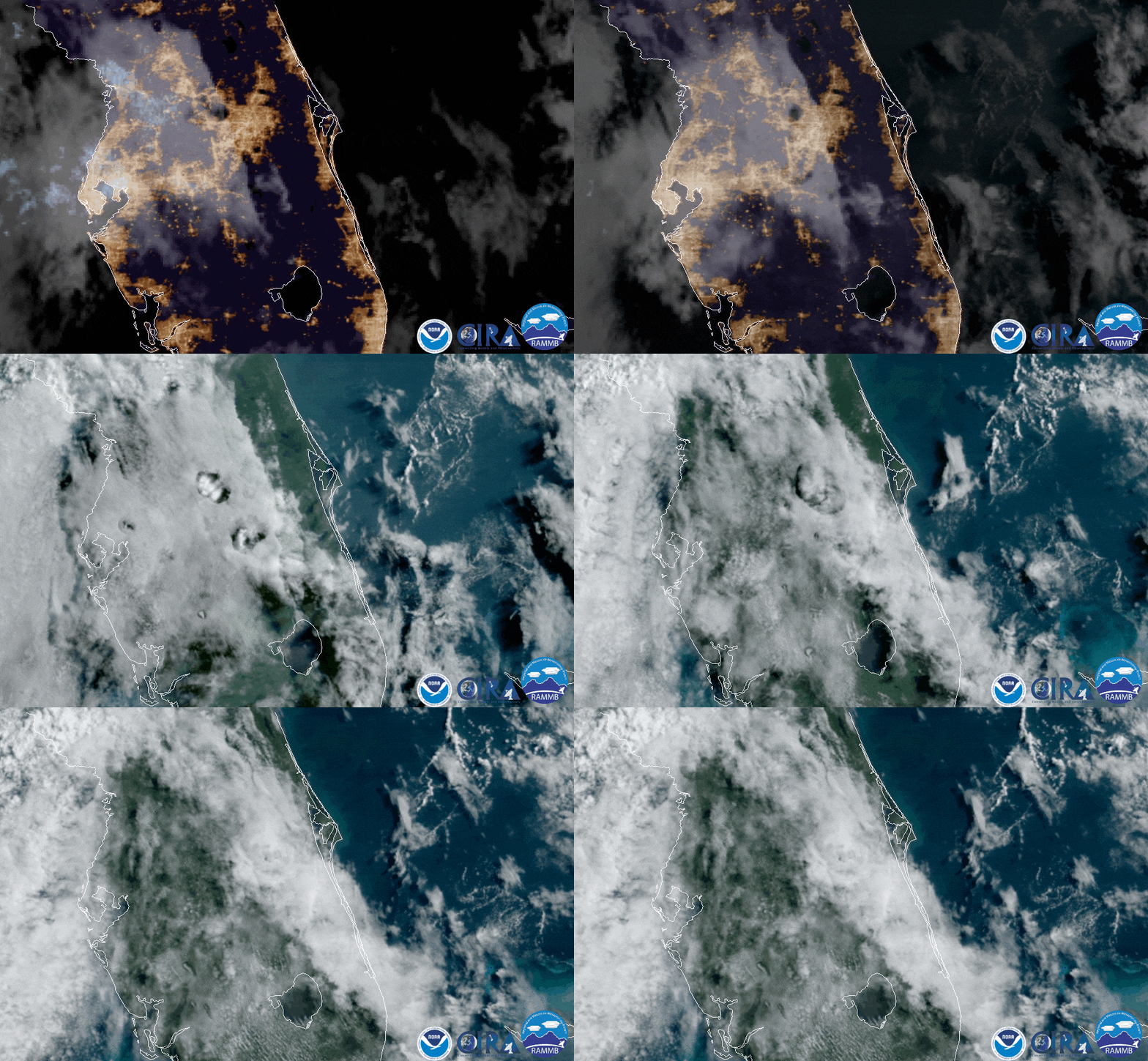
Download Animation Download Animation of the Cloud Phenomenon Over Florida
If you watch the clouds in the image loop above closely, you will notice a phenomenon that meteorologists call fallstreak holes (also known as “hole punch clouds”). They appear right above and slightly south of Orlando, near the middle of the frame. Fallstreak holes look exactly like one would expect: large [circular or elliptical gaps](https://www.weather.gov/arx/why_fallstreaks#:~:text=A%20fallstreak%20hole%20(also%20known,but%20have%20yet%20to%20freeze.) that appear in mid- to high-level cirrocumulus or altocumulus clouds.
These types of clouds are made up of supercooled water droplets, which means that the droplets are composed of water that is below the freezing point (32 degrees F), but are still in liquid form. This can only be achieved in water droplets at high altitudes that have very few impurities or “seeds,” such as dust or pollution particles, fungal spores, or bacteria that may trigger crystallization. Supercooled water is very unstable and will flash-freeze when disturbed.
Note to screen-readers: This page is using an IFrame for the content-area, and you screen reader may not be abel to see it on this website.
For screen-reading purposes, please go directly to the IFrame's target page by going to
https://www.nesdis.noaa.gov/s3/migrated/FallstreakClouds_NorthCarolina_20200217.mp4.
Another example of fallstreak clouds, captured by GOES East on Feb 17, 2020 above North Carolina.
When an aircraft passes through these types of clouds, the airflow around its wings and body triggers the droplets to turn into tiny ice crystals. As they quickly grow, they begin to fall, leaving a hole behind, which will start to expand outward as surrounding droplets start to freeze as well, similar to a domino effect.
The imagery above was viewed via the GOES East geostationary satellite (also known as GOES-16) on June 9, 2020. This satellite keeps watch over most of North America, including the continental United States and Mexico, as well as Central and South America, the Caribbean, and the Atlantic Ocean to the west coast of Africa. The satellite's high-resolution imagery provides optimal viewing of severe weather events, including thunderstorms, tropical storms, and hurricanes.
Where this page came from
This page was imported from NOAA Satellites (NESDIS). Published by NOAA's National Environmental Satellite, Data, and Information Service and, as a work of the United States government, in the public domain; pictures credited elsewhere are left out.
Nobody has written it yet — it is the source material at a new address, which is why search engines are asked to skip it and why no one earns from it. It is up for grabs: take it on, and it is yours to rewrite and to earn from.
Licencia: CC0 1.0 (dominio público) · Adaptado de www.nesdis.noaa.gov
1
0
0
0

Comentarios