¿Ves algo que mejorar? Propón un cambio.

Download Image Download meteorological image
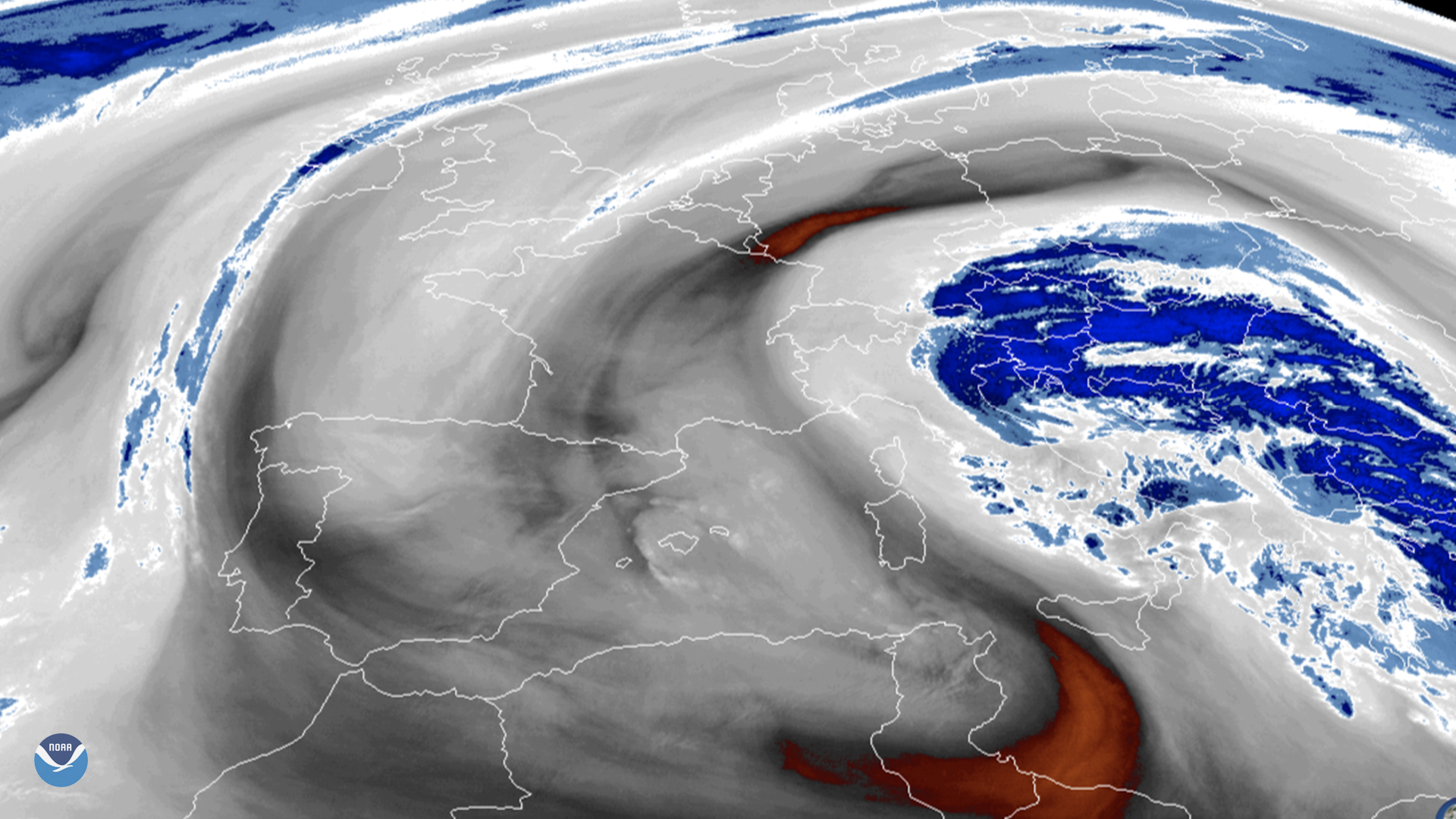
On March 26, 2020, the Meteosat-11 satellite viewed Italy and the surrounding Mediterranean Sea, where a low pressure system is making its way along the length of the peninsula. According to Meteo Aeronatica (in Italian), Italy’s meteorological authority, “precipitation will spread over the Tyrrhenic region [west], and be abundant in the Adriatic region [east] with possible thunderstorms in the evening.”
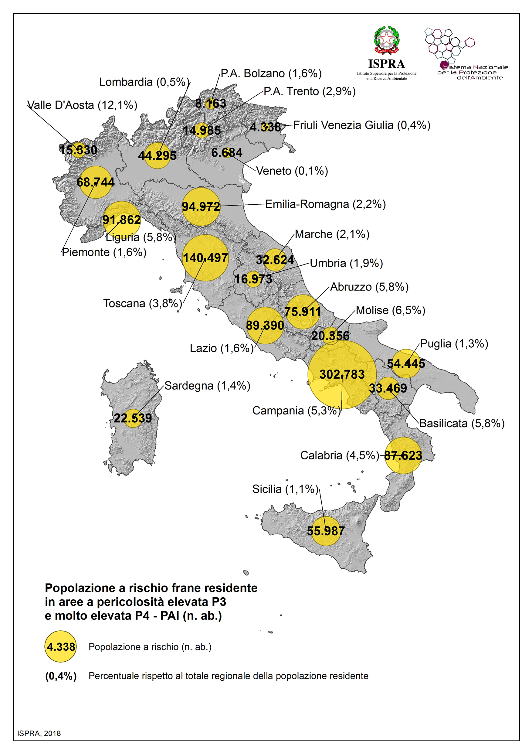
Italy stretches 930 miles from the Alps in the north, southward to the Mediterranean Sea. It comprises all of the Apennine Peninsula and has an average elevation of 1,765 feet. However, since a great deal of its arable land is along its 4,500-mile long coastline, the country is under significant risk of flooding and landslides whenever storms threaten the surrounding waters. Italy’s Higher Institute for Environmental Protection and Research (ISPRA) added that“the expected storm...on the eastern coastline of Sicily, Puglia, and Ionian Calabria could produce significantly larger waves than previously recorded maximum annual values.”
The coming weather will most directly impact the southeastern side of Italy, one of the many areas that ISPRA has identified as especially vulnerable to flooding and landslides. Moreover, the flooding issue has been getting worse in recent years; in Nov. 2019, the archipelago of Venice suffered historic flooding that disrupted its tourism and commerce industries.
In geostationary orbit at approximately 22,300 miles above the equator, the Meteosat-11 satellite operates over Europe, Africa, and the Indian Ocean. Meteosat-11 (launched from the Guiana Space Centre in Kourou in 2015) is positioned at 0.0 degrees and provides full disc imagery every 15 minutes. Meteosat-11 is equipped with the Spinning Enhanced Visible and InfraRed Imager (SEVIRI), which observes the Earth in 12 spectral channels and the Geostationary Earth Radiation Budget (GERB) instrument, a visible-infrared radiometer for monitoring the amount of radiation on Earth. Meteosat-11 is one of the four geostationary satellites operated by EUMETSAT (European Organisation for the Exploitation of Meteorological Satellites).
Where this page came from
This page was imported from NOAA Satellites (NESDIS). Published by NOAA's National Environmental Satellite, Data, and Information Service and, as a work of the United States government, in the public domain; pictures credited elsewhere are left out.
Nobody has written it yet — it is the source material at a new address, which is why search engines are asked to skip it and why no one earns from it. It is up for grabs: take it on, and it is yours to rewrite and to earn from.
Licencia: CC0 1.0 (dominio público) · Adaptado de www.nesdis.noaa.gov
1
0
0
0

Comentarios