
¿Quieres mejorar el contenido de la página? Propón un cambio.
On This Page Navigation
Geodiversity refers to the full variety of natural geologic (rocks, minerals, sediments, fossils, landforms, and physical processes) and soil resources and processes that occur in the park. A product of the Geologic Resources Inventory, the NPS Geodiversity Atlas delivers information in support of education, Geoconservation, and integrated management of living (biotic) and non-living (abiotic) components of the ecosystem.
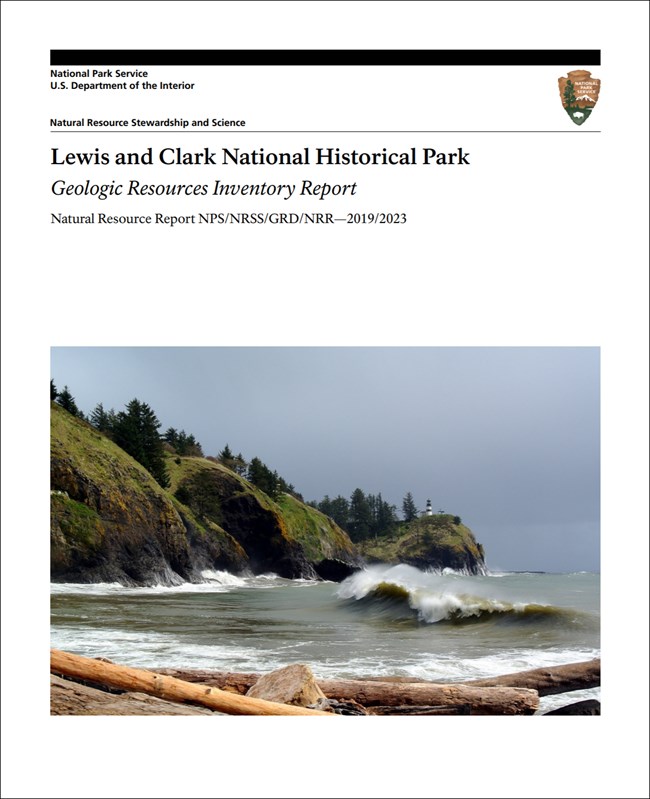
In-depth geologic information is contained in the baseline inventory products of the Geologic Resources Inventory, see table below.
Introduction
Lewis and Clark National Historical Park consists of seven units that encircle the mouth of the Columbia River, extending some 64 km (40 mi) along the Pacific coast from Cannon Beach, Oregon (Clatsop County) to Long Beach, Washington (Pacific County). Established as Fort Clatsop National Memorial on May 29, 1958, the park unit was re-designated a national historical park on October 30, 2004. Lewis and Clark National Historical Park contains about 1,376 hectares (3,400 acres) and preserves, restores, and interprets key historical, cultural, scenic, and natural resources throughout the lower Columbia River area associated with the Lewis and Clark Expedition’s arrival and exploration of the Pacific coast. The historical park also commemorates the 1805–1806 winter encampment at Fort Clatsop following the successful crossing of the continent, where Meriwether Lewis, William Clark, and the Corps of Discovery provisioned, planned for the return journey, and compiled important scientific, cultural, and geographic information collected along their journey, including interactions with American Indian tribes. The area of Lewis and Clark National Historical Park encompasses ancestral homelands of the Chinook and Clatsop tribes, sites of the lower Columbia River where the expedition interacted with American Indian communities, and a reconstruction of the Corps’ winter quarters at Fort Clatsop.
Geologic Setting
The geologic setting of the Lewis and Clark National Historical Park region records three major geologic events: (1) the formation of the Cascadia Subduction Zone, (2) the extensive outpouring of Columbia River basalt, and (3) the Pleistocene ice ages and the colossal Glacial Lake Missoula floods. An oblique collision between the North American and Juan de Fuca tectonic plates during the Eocene formed the Cascadia Subduction Zone off the Pacific Northwest coast. Geologic features in Lewis and Clark National Historical Park such as folds, faults, and inverted topography reflect tectonic processes associated with the Cascadia Subduction Zone that have been occurring for millions of years. During the Miocene (~16 Ma), extensive volcanism associated with the Columbia River Basalt Group covered roughly 164,000 km2 (63,000 mi2 ) of the Pacific Northwest. Towering 1,000-m (3,000-ft) cliffs consisting of lava flows of the Columbia River Basalt Group were encountered by the Lewis and Clark Expedition as they traversed the Columbia River Gorge and explored the lower Columbia River. The failure of ice dams during the Pleistocene (~12 ka) produced the cataclysmic Missoula floods that scoured the landscape and shaped the Columbia River Gorge. Mapped units within the boundaries of Lewis and Clark National Historical Park include (from oldest to youngest): the Eocene Crescent Formation, basalt lapilli breccia and flows at Fort Columbia, sandstone at Megler, and siltstone at Shoalwater Bay; Eocene–Oligocene Lincoln Creek Formation and Smuggler Cove Formation; Pleistocene– Holocene terrace deposits; and Holocene fluvial, estuarine, and beach sand deposits.
Regional Geology
Lewis and Clark National Historical Park, including popular visitor sites like Fort Clatsop, are part of the Pacific Border Physiographic Province and share their geologic history and some characteristic geologic formations with a region that extends well beyond park boundaries.
The Lewis and Clark National Historic Trail route traverses from the plains of the Midwest to the shores of the Pacific Ocean crossing several additional physiographic provinces (in ID, IL, IA, KS, MO, MT, NE, ND, OR, SD, and WA).
Maps and Reports

.
Geologic Resources Inventory
The Geologic Resources Inventory produces digital geologic maps and reports for more than 270 natural resource parks. The products listed below are currently available for this park, check back often for updates as many maps, reports, and posters are still in progress.
Scoping summaries are records of scoping meetings where NPS staff and local geologists determined the park’s geologic mapping plan and what content should be included in the report.
- Digital geologic maps include files for viewing in GIS software, a guide to using the data, and a document with ancillary map information. Newer products also include data viewable in Google Earth and online map services.
- Reports use the maps to discuss the park’s setting and significance, notable geologic features and processes, geologic resource management issues, and geologic history.
- Posters are a static view of the GIS data in PDF format. Newer posters include aerial imagery or shaded relief and other park information. They are also included with the reports.
- Projects list basic information about the program and all products available for a park.
Source: NPS DataStore Saved Search 3004. To search for additional information, visit the NPS DataStore.
Soil Resources inventory
A NPS Soil Resources Inventory project has been completed for Lewis And Clark National and State Historical Parks and can be found on the NPS Data Store.
Source: NPS DataStore Saved Search 3051. To search for additional information, visit the NPS DataStore.
GRI Geology Image Gallery

Lewis and Clark River.
Related Links
Lewis and Clark—Natural Features and Ecosystems
Oregon Department of Geology and Mineral Industries
Related Articles
Lewis And Clark National and State Historical Parks
Narrow By Location
Narrow By Office
Show
10
40
Sort by
Relevance
Recently Updated
Date Released
Title
Loading results...
Tags:
geodiversity
,
geologic
,
[geologic forces](/media/article-search.htm?q=geologic forces)
,
[geologic resources](/media/article-search.htm?q=geologic resources)
,
[geologic feature](/media/article-search.htm?q=geologic feature)
,
[geologic time](/media/article-search.htm?q=geologic time)
,
[geologic layers](/media/article-search.htm?q=geologic layers)
,
[geologic history](/media/article-search.htm?q=geologic history)
,
[geologic formations](/media/article-search.htm?q=geologic formations)
,
geology
,
geological
,
[geological maps](/media/article-search.htm?q=geological maps)
,
geologist
,
[geology talk](/media/article-search.htm?q=geology talk)
,
[geology hike](/media/article-search.htm?q=geology hike)
,
[geology science and learning](/media/article-search.htm?q=geology science and learning)
,
geologists
,
[geology close up](/media/article-search.htm?q=geology close up)
,
[geologic resources inventory](/media/article-search.htm?q=geologic resources inventory)
,
geoheritage
,
geohazards
,
geomorphology
,
[geoscientists in parks](/media/article-search.htm?q=Geoscientists in Parks)
,
geoscientists-in-the-parks
,
[geological survey](/media/article-search.htm?q=Geological Survey)
,
geothermal
,
[geothermal activity](/media/article-search.htm?q=geothermal activity)
,
geotour
,
geotourism
,
[geothermal processes & features](/media/article-search.htm?q=geothermal processes & features)
,
fossils
,
paleontology
,
caves
,
karst
,
glaciers
,
[geoheritage sites](/media/article-search.htm?q=geoheritage sites)
,
earthquakes
,
landslides
,
mining
National Park Service Geodiversity Atlas
The servicewide Geodiversity Atlas provides information on geoheritage and geodiversity resources and values within the National Park System. This information supports science-based geoconservation and interpretation in the NPS, as well as STEM education in schools, museums, and field camps. The NPS Geologic Resources Division and many parks work with National and International geoconservation communities to ensure that NPS abiotic resources are managed using the highest standards and best practices available.
Where this belongs
- Lewis and Clark National Historical Park
Where this page came from
This page was imported from National Park Service. Produced by the U.S. National Park Service and, as a work of the United States government, in the public domain.
Nobody has written it yet — it is the source material at a new address, which is why search engines are asked to skip it and why no one earns from it. It is up for grabs: take it on, and it is yours to rewrite and to earn from.
En estas coleccionesLewis and Clark National Historical Park
Licencia: CC0 1.0 (dominio público) · Adaptado de www.nps.gov
1
0
0
0

Comentarios
Sigue leyendo


