¿Ves algo que mejorar? Propón un cambio.

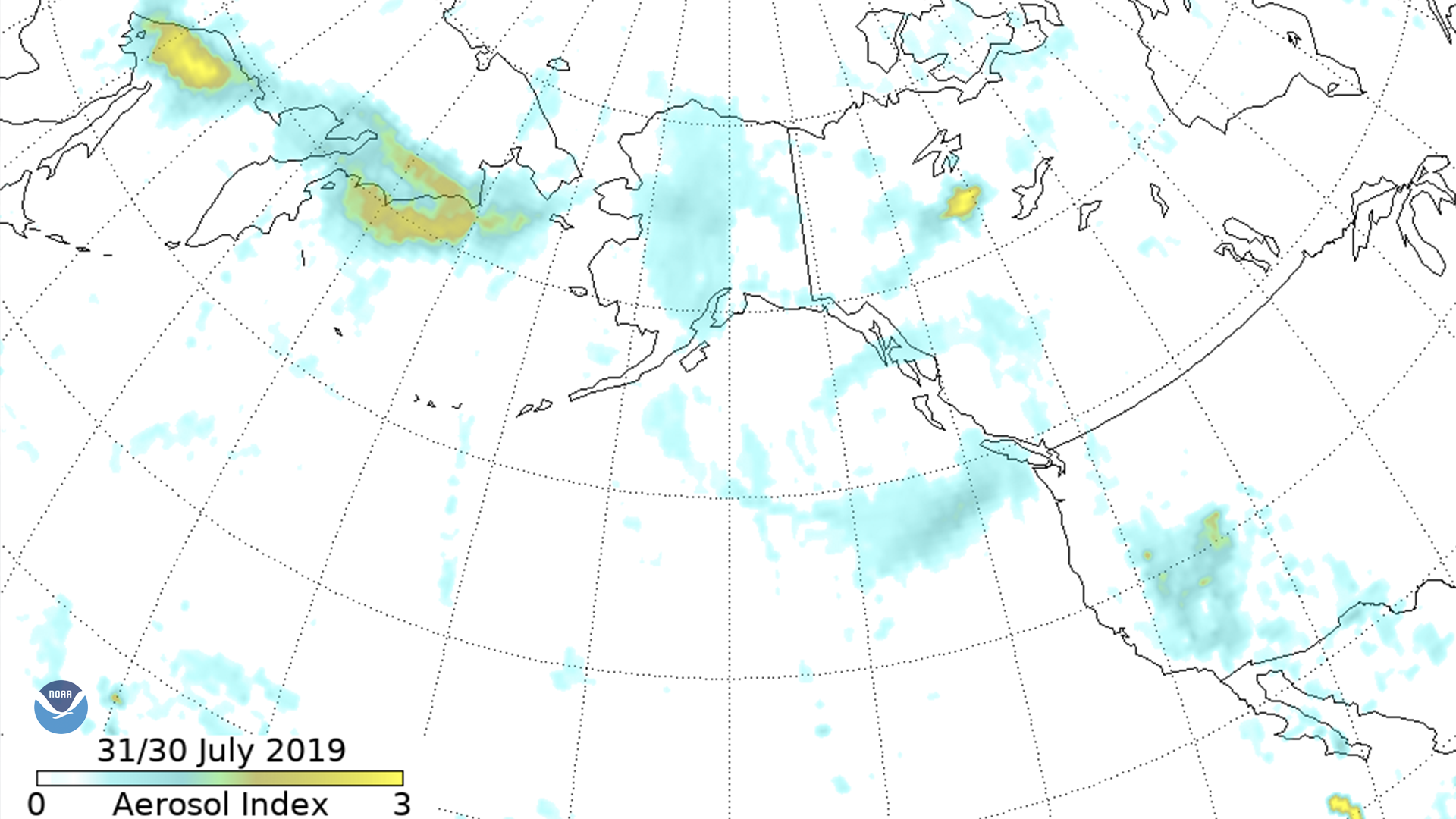
Download Image Download Image of the Siberian wildfires
The Suomi-NPP Ozone Mapping and Profiler Suite (OMPS) aerosol index shows smoke moving across eastern Russia into Alaska, down the west coast of Canada and over Vancouver and Seattle. The first date refers to the UTC west of date line, the second date to the east.
Wildfire smoke traveling east from Siberia had reached Alaska, the west coast of Canada, and Seattle by July 31, 2019 according to an aerosol index from the Suomi-NPP satellite’s Ozone Mapping and Profiler Suite (OMPS) instrument.
The smoke comes from massive forest fires burning across six Russian regions. The country's Federal Forestry Agency on July 29 said more than 10,000 square miles had burned, “an area roughly equal to the size of Crimea,” according to The Moscow Times.
“The smoke travels at such high altitudes that it’s unlikely to significantly impact air quality in the U.S., unless wind currents reach the surface,” said Colin Seftor, atmospheric scientist at NASA's Goddard Space Flight Center in Greenbelt, Maryland, who has been tracking the smoke as it moves across the Pacific.
However, it does illuminate “how interconnected we are due to such atmospheric events,” Seftor said. Smoke from fires can travel vast distances “affecting air quality and creating pretty sunrises and sunsets in places thousands of kilometers away. Equivalently, Saharan dust can be transported across the Atlantic, affecting air quality in cities such as Miami and even Houston.”
Seftor explained how the aerosol index detects the presence of UV-absorbing aerosols, such as dust and soot, and it measures the density of these aerosols over a given area. The index can detect smoke and dust over bright surfaces like clouds and ice, which means it’s good at tracking the movement of aerosol clouds, though is limited in its ability to measure aerosol amount.
Where this page came from
This page was imported from NOAA Satellites (NESDIS). Published by NOAA's National Environmental Satellite, Data, and Information Service and, as a work of the United States government, in the public domain; pictures credited elsewhere are left out.
Nobody has written it yet — it is the source material at a new address, which is why search engines are asked to skip it and why no one earns from it. It is up for grabs: take it on, and it is yours to rewrite and to earn from.
Licencia: CC0 1.0 (dominio público) · Adaptado de www.nesdis.noaa.gov
1
0
0
0

Comentarios