¿Ves algo que mejorar? Propón un cambio.

Download Image Download Image of California
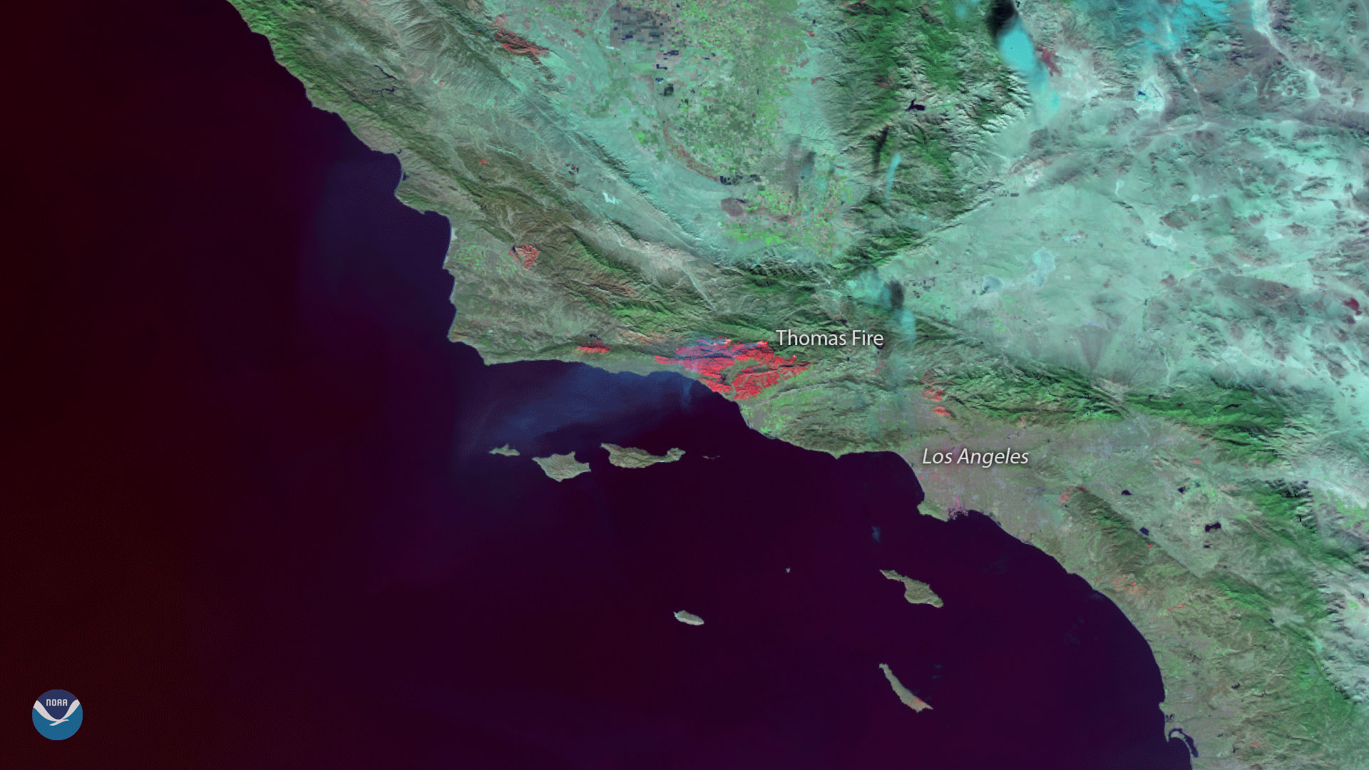
The Suomi NPP satellite's VIIRS instrument captured this image of burn scars from the massive Thomas Fire that has been raging in southern California for the past two weeks. Since it began on December 4, 2017, the wildfire has charred more than 270,000 acres and has become the third-largest wildfire in California history. With little rain forecast over the coming week, the Thomas Fire may soon become the state's largest on record, according to media reports.
This image was created by combining three of the NOAA/NASA Suomi NPP satellite's high resolution thermal and visible channels from the VIIRS sensor (SVI 4,2,1). These different channels allow us to distinguish different land types based on their visual and thermal differences. Areas of land that are hotter in temperature due to an active fire or a burn scar appear red in the imagery.
Where this page came from
This page was imported from NOAA Satellites (NESDIS). Published by NOAA's National Environmental Satellite, Data, and Information Service and, as a work of the United States government, in the public domain; pictures credited elsewhere are left out.
Nobody has written it yet — it is the source material at a new address, which is why search engines are asked to skip it and why no one earns from it. It is up for grabs: take it on, and it is yours to rewrite and to earn from.
Licencia: CC0 1.0 (dominio público) · Adaptado de www.nesdis.noaa.gov
1
0
0
0

Comentarios