
¿Quieres mejorar el contenido de la página? Propón un cambio.
Geodiversity is the full range of a park's geologic resources — rocks, minerals, sediments, fossils, landforms and the processes that shape them — together with its soils. The National Park Service's Geodiversity Atlas, produced by the Geologic Resources Inventory, gathers that information for education, geoconservation and the joint management of the living and non-living parts of each park's ecosystem.
The farm and its landscape
- In 1967, two years before his death, General Dwight D. Eisenhower gave his 76-hectare (189-acre) home to the National Park Service to become a national historic site.
- An act of Congress authorized the site on December 2, 1969, honoring Eisenhower as the 34th president and a commander in World War II.
- The farm now lies within 280 hectares (690 acres) of federally protected pastures, meadows, streamside land and oak-hickory forest on the southwestern side of the Gettysburg battlefield.
The countryside is quiet and rural: flat open fields and pastures cut by rolling hills, woods, meadows, wetlands, streamside zones, vernal pools and small stream valleys such as Marsh Creek and Willoughby Run. Underneath lie flat, undeformed layers of red shale, sandstone and thin limestone; the surface varies mainly where erosion and downcutting streams have carved into those nearly horizontal beds. Looking west from the farm, you can see Culp Ridge, Green Ridge, South Mountain, Jacks Mountain and Piney Mountain.
Geologic setting
Around Gettysburg National Military Park and Eisenhower National Historic Site, the eastern United States is divided into five physiographic provinces, from east to west:
- Atlantic Coastal Plain
- Piedmont — where both park units lie
- Blue Ridge
- Valley and Ridge
- Appalachian Plateaus
The Piedmont
The Piedmont stretches from the Fall Line west to the Blue Ridge Mountains. The Fall Line — the boundary between the Coastal Plain and the Piedmont — is easy to spot where rivers and streams crossing it break into rapids and waterfalls.
- The eastward-sloping Piedmont Plateau was shaped by folding, faulting, uplift and erosion.
- The result is gently rolling hills that begin at about 60 meters (200 feet) above sea level and grow steeper and higher toward the province's western edge, around 300 meters (980 feet).
- The plateau is made of hard crystalline, igneous and metamorphic rock: schist, phyllite, slate, gneiss and gabbro.
The Gettysburg basin
More precisely, Gettysburg sits in a Triassic rift basin laid over the Piedmont — the Triassic Lowland, also called the Gettysburg-Newark Lowland section.
| Feature | Detail |
|---|---|
| Part of | A chain of basins scattered along the Blue Ridge–Piedmont boundary, the length of the Appalachians from Nova Scotia to South Carolina — 2,000 km (1,200 mi) |
| Origin | Formed in the Mesozoic Era as a basin between mountains, when the crust was being pulled apart |
| Trend | Northeast–southwest |
| Size | About 225 km (140 mi) long, 6–50 km (4–30 mi) wide and 5 km (3 mi) deep |
| Rocks | Mostly gently tilted sandstone, siltstone and shale, with intrusions of diabase (sills, dikes and irregular bodies) and basalt flows |
| Eastern edge | A depositional contact where the Piedmont's rolling hills give way to flatter ground in the basin |
| Western edge | A sharp normal fault system, beyond which lies the Blue Ridge; the basin's layers tilt toward that border fault |
Eisenhower National Historic Site shares its geologic history, and some of its typical rock formations, with the wider Piedmont Physiographic Province, which extends far beyond the park.
Maps and reports
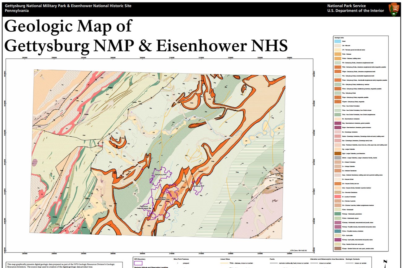
Part of the Geologic Resources Inventory's digital geologic map for the site. Image from the National Park Service's page.
The Geologic Resources Inventory produces digital geologic maps and reports for more than 270 natural resource parks. For this park its products include:
- Scoping summaries — records of meetings where park staff and local geologists planned the geologic mapping and the report's contents
- Digital geologic maps — GIS files, a user guide and supporting map information; newer products add Google Earth and online map services
- Reports — using the maps to cover the park's setting and significance, notable features and processes, resource management issues and geologic history (a combined report covers Gettysburg National Military Park and Eisenhower National Historic Site)
- Posters — static PDF views of the map data, the newer ones with aerial imagery or shaded relief
- Projects — an overview of the program and every product for the park
A Soil Resources Inventory has also been completed for the site. All of these are available through the NPS DataStore.
Sources
Based on "NPS Geodiversity Atlas—Eisenhower National Historic Site, Pennsylvania," National Park Service; a work of the United States government in the public domain.
En estas coleccionesEisenhower National Historic Site
Licencia: CC0 1.0 (dominio público) · Adaptado de www.nps.gov
1
0
0
0

Comentarios
Sigue leyendo


