Quelque chose à améliorer ? Proposez une modification.

Download Image Download Image of Hurricane Douglas
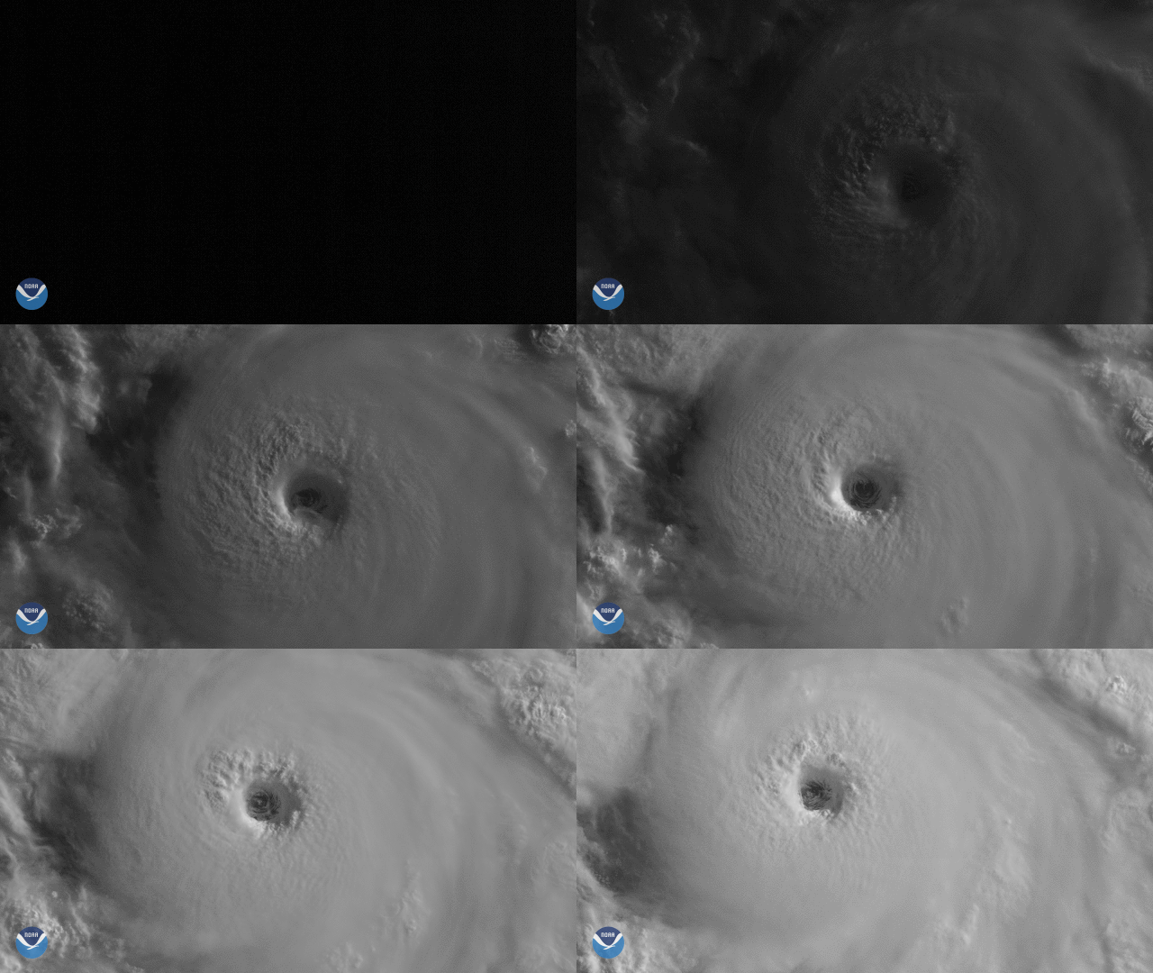
On July 23, 2020, NOAA’s GOES-West satellite captured this impressive view of the eye of Hurricane Douglas as it spun over the Pacific Ocean. The first hurricane of the 2020 eastern Pacific season, the storm rapidly intensified on Thursday and had a maximum sustained wind speed of 120 mph at the last report, making it a major Category-3 storm on the Saffir-Simpson Hurricane Wind Scale. “During the period of reliable records, this is the 4th latest date in which the first hurricane of the season has formed in the region],” said the [National Hurricane Center.
As of 5 a.m. HST today, the hurricane was roughly 1000 miles from Hawaii, and was moving west-northwest at 18 mph toward the island chain. The NWS Central Pacific Hurricane Center in Honolulu, Hawaii predicts it will move near or over portions of the islands this weekend, bringing strong winds, heavy rainfall, and dangerous surf by Sunday. However, it may be downgraded to a tropical storm by the time it gets there.
Another view of the storm via the NOAA-20 satellite's VIIRS sensor.
Since Hawaii is a relatively small plot of land within the expansive Pacific Ocean, a hurricane making landfall isn’t a common occurrence. Factors such as wind shear and dry air often help to either weaken storms or push them away from the islands. The North Pacific High pressure system is another particularly influential atmospheric process which tends to force oncoming tropical systems away from the islands.
The GOES-West satellite, also known as GOES-17, provides geostationary satellite coverage of the Western Hemisphere, including the United States, the Pacific Ocean, Alaska and Hawaii. First launched in March 2018, the satellite became fully operational in February 2019.
Where this page came from
This page was imported from NOAA Satellites (NESDIS). Published by NOAA's National Environmental Satellite, Data, and Information Service and, as a work of the United States government, in the public domain; pictures credited elsewhere are left out.
Nobody has written it yet — it is the source material at a new address, which is why search engines are asked to skip it and why no one earns from it. It is up for grabs: take it on, and it is yours to rewrite and to earn from.
Licence : CC0 1.0 (domaine public) · Adapté de www.nesdis.noaa.gov
1
0
0
0

commentaires