Vedi qualcosa da migliorare? Proponi una modifica.

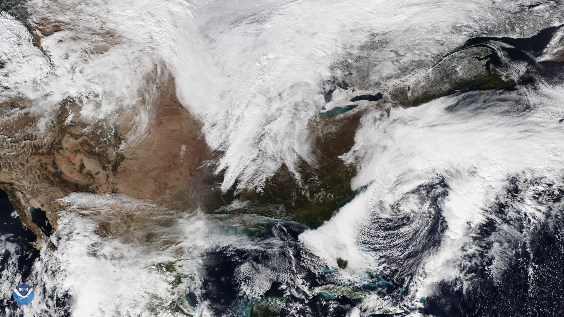
Download Image Download Image of a nor’easter off the mid-Atlantic coast
The NOAA-20 satellite captured this imagery of a nor’easter off the mid-Atlantic coast and a low-pressure system off of Florida’s shores on Nov. 17, 2019, resulting in lower-than-average temperatures for the eastern seaboard and rains in the southeast.
A general gale warning has been issued for mid-Atlantic waters and the nor’easter will continue up the eastern seaboard through Wednesday. However, it is expected to cause intermittent freezing rain and sleet inland, with the heaviest precipitation happening offshore.
The low-pressure system in Florida will have a similar limited scope. While there appears to be the beginnings of cyclonic action off of the coast of Florida and the Carolinas, the Tropical Weather Bulletin from the National Hurricane Center stated that “upper-level winds are expected to become less conducive and ... additional development is not expected.”
In the south, local authorities have issued a small craft advisory. Forecasters predict winds of over 10 mph and seas at 7 to 8 feet each day on average until the latter half of the week, with conditions showing significant improvement by Wednesday. The low-pressure system will continue to travel northwest, causing scattered thunderstorms and winds reaching over 30 mph, but not further impacting areas inland.
This image was captured by the NOAA-20 satellite's VIIRS instrument , which scans the entire Earth twice per day at a 750-meter resolution. Multiple visible and infrared channels allow it to detect atmospheric aerosols, such as dust, smoke and haze associated with industrial pollution and fires.
Where this page came from
This page was imported from NOAA Satellites (NESDIS). Published by NOAA's National Environmental Satellite, Data, and Information Service and, as a work of the United States government, in the public domain; pictures credited elsewhere are left out.
Nobody has written it yet — it is the source material at a new address, which is why search engines are asked to skip it and why no one earns from it. It is up for grabs: take it on, and it is yours to rewrite and to earn from.
Licenza: CC0 1.0 (pubblico dominio) · Tratto da www.nesdis.noaa.gov
1
0
0
0

Commenti