Vedi qualcosa da migliorare? Proponi una modifica.

Download Image Download Image of British Columbia
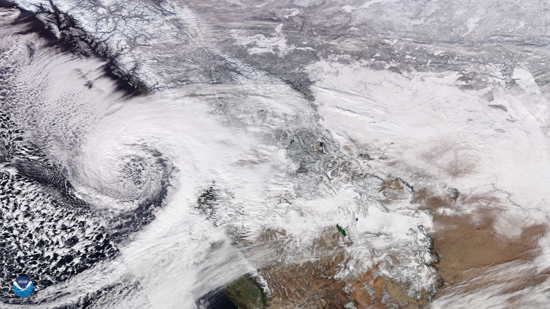
On Jan. 15, NOAA-20 viewed a low pressure system that has been bringing snowfall into British Columbia, Canada since Jan. 10. Authorities predict heavy snow and high winds for Thursday, and a winter storm warning issued at 3:36 a.m. PST on Jan. 16 added that “snow will continue for the next few hours over inland sections of East Vancouver Island” as well as in the north. Winds as high as 68 mph in locations have created blizzard conditions , resulting in Environment Canada--the nation’s weather service--declaring a blizzard warning for the area immediately northwest of Vancouver.
According to weather service in British Columbia, the storm broke several records for temperature, with Quesnel, in particular, dropping to -43 degrees Fahrenheit. The previous record of -41 F occurred in 1916. For the city of Vancouver, eight inches of snow caused some commuter delays, with municipal crews working to clear 932 miles of roads by the start of the weekend.
For the past week , continuous snow has impacted flights, driving, and services for residents. Additionally, several highways in and around British Columbia are experiencing major delays , with drivers contending with limited visibility and snow accumulation. Government authorities advise citizens to use their best judgment while navigating through the snowfall, such as planning alternate work arrangements, using snow tires, and shoveling sidewalks and steps outside of their homes. For the upcoming weekend, however, weather forecasts are offering some respite with warmer conditions and rain.
This image was captured by the NOAA-20 satellite's VIIRS instrument , which scans the entire Earth twice per day at a 750-meter resolution. Multiple visible and infrared channels allow it to detect atmospheric aerosols, such as dust, smoke and haze associated with industrial pollution and fires. The polar-orbiting satellite circles the globe 14 times daily and captures a complete daytime view of our planet once every 24 hours. Images taken by the VIIRS sensor during each orbit are then merged together to create image mosaics of larger regions, like the one used here.
Where this page came from
This page was imported from NOAA Satellites (NESDIS). Published by NOAA's National Environmental Satellite, Data, and Information Service and, as a work of the United States government, in the public domain; pictures credited elsewhere are left out.
Nobody has written it yet — it is the source material at a new address, which is why search engines are asked to skip it and why no one earns from it. It is up for grabs: take it on, and it is yours to rewrite and to earn from.
Licenza: CC0 1.0 (pubblico dominio) · Tratto da www.nesdis.noaa.gov
1
0
0
0

Commenti