
Vuoi migliorare il contenuto della pagina? Prova a proporre una modifica.
Geodiversity is the full range of a park's geologic resources — rocks, minerals, sediments, fossils, landforms and the processes that shape them — together with its soils. The National Park Service's Geodiversity Atlas, produced by the Geologic Resources Inventory, collects that information for education, geoconservation and the joint management of each park's living and non-living resources.
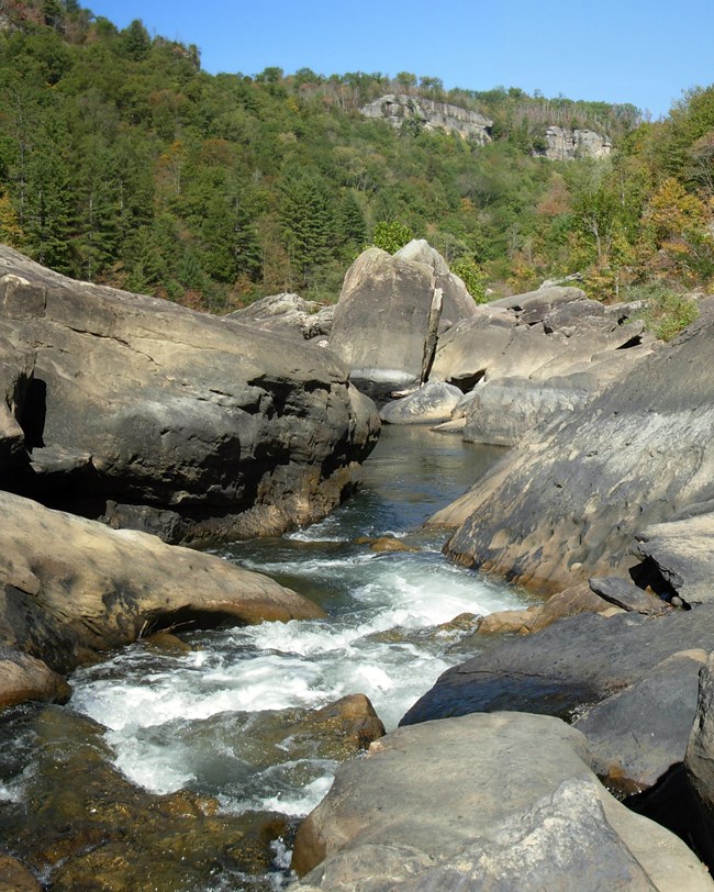
Boulders and river at Angel Falls rapids. Image from the National Park Service's page.
The park
- Big South Fork National River and Recreation Area lies on the Cumberland Plateau in southeastern Kentucky (McCreary County) and north-central Tennessee (Fentress, Morgan, Pickett and Scott counties).
- It covers about 50,051 hectares (123,679 acres) and protects the free-flowing Big South Fork of the Cumberland River and its tributaries.
- Authorized on May 7, 1974, it is both a national river and a national recreation area, protecting the land while offering recreation.
- It is known for scenic gorges, sandstone bluffs, arches, mesas and many natural and historic features.
Geologic setting
The park's bedrock is mostly sedimentary rock from the Pennsylvanian and Mississippian periods, about 360–300 million years ago.
| Rock | Character |
|---|---|
| Pennsylvanian (upper) | Mostly sandstone and shale, with siltstone, conglomerate and coal; weathered into arches, chimneys, cliffs, coves, cracks and mesas |
| Mississippian (below) | Mostly limestone, holding oil and gas inside and outside the park |
The landscape has a branching (dendritic) drainage pattern and narrow, V-shaped gorges, their valleys scattered with huge boulders fallen from the cliffs. The rivers alternate between rugged whitewater and quiet pools. The centerpiece is the Big South Fork River gorge, with sheer cliffs above forested talus slopes.

The view down to the river from the Angel Falls overlook. Image from the National Park Service's page.
Big South Fork is part of the Appalachian Plateaus province and shares its geologic history with a region far beyond the park.
Maps and reports
The Geologic Resources Inventory produces digital geologic maps and reports for more than 270 natural resource parks — scoping summaries, GIS maps, reports, posters and project overviews, available through the NPS DataStore.
Sources
Based on "NPS Geodiversity Atlas—Big South Fork National River & Recreation Area, Kentucky and Tennessee," National Park Service; a work of the United States government in the public domain.
In queste pubblicazioniBig South Fork National River & Recreation Area
Licenza: CC0 1.0 (pubblico dominio) · Tratto da www.nps.gov
1
0
0
0

Commenti


