Vedi qualcosa da migliorare? Proponi una modifica.

Download Image Download Image of Super Typhoon Hagibis
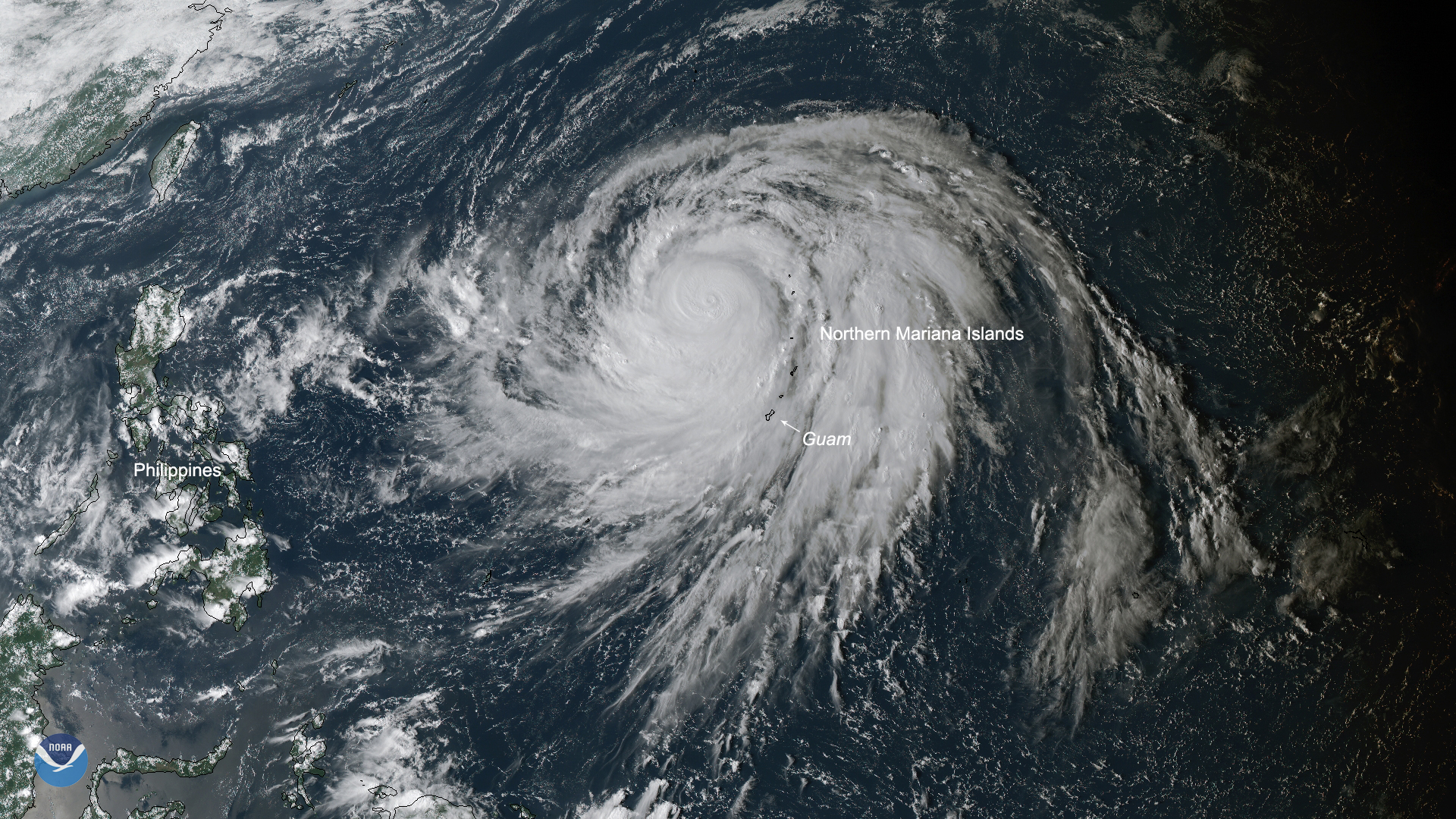
Super Typhoon Hagibis is currently the strongest storm on the planet, with the potential to become the strongest of the year. The storm gathered strength at an incredibly fast rate, intensifying from a tropical storm to a super typhoon in a mere 18 hours, with wind speeds measured at more than 155 mph and gusts up to 195 mph according to the Joint Typhoon Warning Center (JTWC).
Philip Klotzbach, a hurricane researcher at Colorado State University, tweeted that this was the most intensification by a tropical cyclone in the western North Pacific in 18 hours since Typhoon Yates in 1996. This is also nearly three-and-a-half times the rate a storm would need to strengthen to constitute “rapid intensification,” based on the meteorological definition of that term.
The storm is currently bringing heavy rain, strong winds, and thunderstorms over the Northern Mariana Islands, while the more southerly islands of Rota and Guam are experiencing similar conditions, though slightly less severe due to distance from the eye.
The eye wall made direct contact with the small uninhabited island of Anatahan and is currently moving away from Micronesia. Hagibis is predicted to slowly weaken as it turns north, but is predicted to impact Japan by this weekend as possibly a Category 1 or 2-equivalent storm.
A super typhoon is a term utilized by the JTWC to describe typhoons that reach maximum sustained 1-minute surface winds of at least 150 mph, which is equivalent to a strong category 4 or higher on the Saffir-Simpson scale in the Atlantic basin.
This True Color image was captured by the Advanced Himawari Imager (AHI) on Japan’s Himawari-8 satellite. This satellite, the first unit of the Japan Meteorological Agency's (JMA) third-generation of geostationary satellites, provides visible light and infrared images of the Asia-Pacific region. Himawari's data are vital for global geostationary coverage, which is why NOAA and JMA have agreed to mutual back-up arrangements for their geostationary systems.
Where this page came from
This page was imported from NOAA Satellites (NESDIS). Published by NOAA's National Environmental Satellite, Data, and Information Service and, as a work of the United States government, in the public domain; pictures credited elsewhere are left out.
Nobody has written it yet — it is the source material at a new address, which is why search engines are asked to skip it and why no one earns from it. It is up for grabs: take it on, and it is yours to rewrite and to earn from.
Licenza: CC0 1.0 (pubblico dominio) · Tratto da www.nesdis.noaa.gov
1
0
0
0

Commenti