Download Image Download TrueColor Imagery of Australia
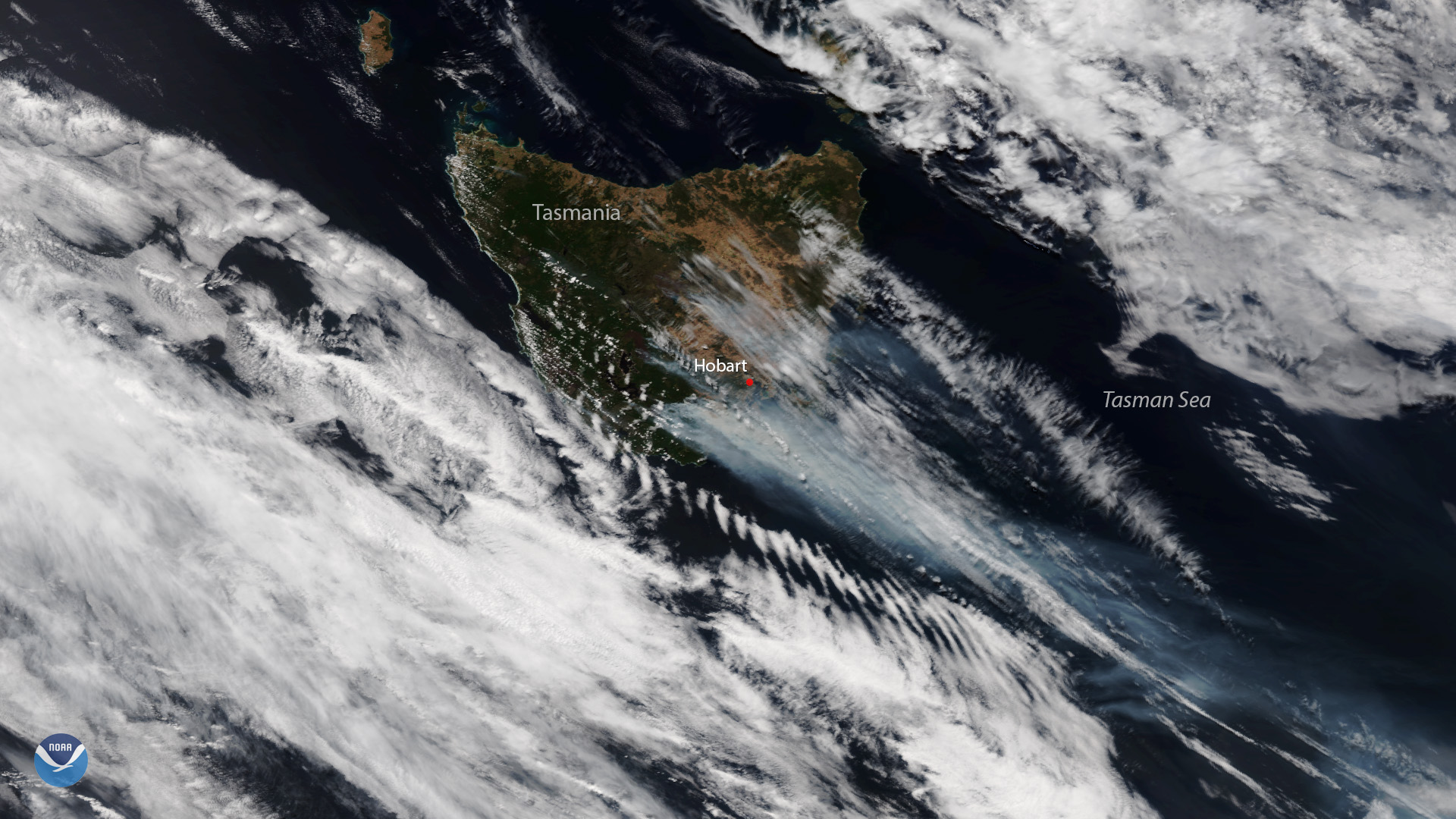
Plumes of smoke are seen over the bushfire-ravaged Australian island state of Tasmania in this Jan. 28, 2019 image from the NOAA-20 satellite. Tasmania experienced its warmest and driest January on record this year, with about 20 percent below average rainfall, according to Australia’s Bureau of Meteorology. Dry vegetation coupled with thunderstorms sparked many of Tasmania’s recent bushfires.
A total of 24 fires are burning across the region, including the “Riveaux Road” and “Great Pine Tier” fires, which are two of the largest, according to the Tasmania Fire Service. A number of these fires threatened the Tasmanian Wilderness World Heritage Area, which “is one of the three largest temperate wilderness areas remaining in the Southern Hemisphere,” Australia’s Department of Environment and Energy notes. The region is also home to some of the oldest living trees on Earth, the Huon pines.
More than 700 firefighters from Tasmania and New Zealand are still working to contain the various fires. As of Feb. 5, 2019 the blazes had burned through nearly 482,000 acres of land.
Much of Australia has been sweltering through a prolonged heat wave in recent weeks. The Bureau of Meteorology reports that January 2019 was Australia's warmest month since national records began in 1910.
Cooler weather and rain are expected in Tasmania and much of the Australian mainland this week, providing welcome relief against the ongoing bushfires. However, Tasmania Fire Service regional controller Greg Butters told the Australian Associated Press that the improving weather pattern is unlikely to put out all of the blazes.
This true color image was captured by the VIIRS sensor on-board NOAA-20, which provides daily, high-resolution visible and infrared images of Earth's atmosphere from across the globe.
Where this page came from
This page was imported from NOAA Satellites (NESDIS). Published by NOAA's National Environmental Satellite, Data, and Information Service and, as a work of the United States government, in the public domain; pictures credited elsewhere are left out.
Nobody has written it yet — it is the source material at a new address, which is why search engines are asked to skip it and why no one earns from it. It is up for grabs: take it on, and it is yours to rewrite and to earn from.
ライセンス: CC0 1.0(パブリックドメイン) · 出典 www.nesdis.noaa.gov
1
0
0
0

コメント