
Geodiversity is the full variety of a park's natural geologic and soil resources and processes — rocks, minerals, sediments, fossils, landforms and the processes that shape them. The NPS Geodiversity Atlas, a product of the Geologic Resources Inventory, supports education, geoconservation, and management of a park's living and non-living parts together. This is its page for Chickasaw National Recreation Area (NRA), Oklahoma.
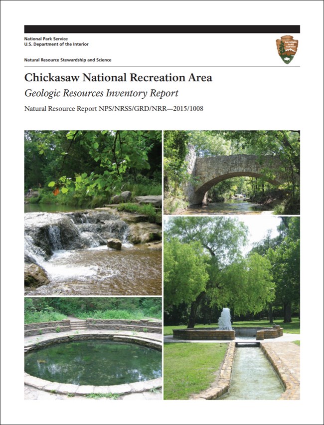
The Geologic Resources Inventory report for the park.
The park
Chickasaw NRA protects historic freshwater and mineral springs among gently rolling hills and stream-cut ravines — the worn-down remains of the Arbuckle Mountains — in Oklahoma's central lowlands. It also includes Veterans Lake and the Lake of the Arbuckles, made by Arbuckle Dam, which the U.S. Bureau of Reclamation completed in 1966.
| Year | |
|---|---|
| 1902 | the springs along Travertine and Rock creeks come under federal protection as the Sulphur Springs Reservation |
| 1906 | the area becomes Platt National Park |
| 1933–1940 | the CCC builds spring pavilions, creek dams, swimming holes and stone picnic tables and benches from local limestone — now, with the springs, the heart of the Platt Historic District |
| 1976 | Platt National Park and Arbuckle National Recreation Area are combined as Chickasaw NRA, named to honor the Chickasaw Nation |
How the land formed
The park lies on the Arbuckle Uplift, one of five major basement-cored uplifts in Oklahoma. The region's history has four great chapters:
- Rifting, in the Cambrian, along the southern edge of ancestral North America.
- Shallow seas: from the Late Cambrian to the Middle Mississippian, mostly marine sediments piled up, with some laid down on land.
- Uplift and deformation: the Wichita and Arbuckle orogenies faulted and folded those layers as the Arbuckle Mountains rose — mostly in the Pennsylvanian.
- Erosion: the Late Pennsylvanian Vanoss Formation, at the surface over most of the park, was laid down in alluvial fans and plains as the mountains wore away. It rests on a major unconformity, and millions of years of erosion since have left rolling hills where mountains stood.
The Vanoss Formation has two parts:
- a lower limestone conglomerate of boulders, cobbles and pebbles, averaging 30 ft (9 m) thick, which caps Bromide Hill — the park's main landmark, about 140 ft (43 m) above Rock Creek;
- an upper unit of shale and red sandstone, exposed mainly around Guy Sandy and west of Rock Creek.
Folds and faults run northwest–southeast. The Reagan Fault is the most significant through the park, with the deep-seated Mill Creek Fault Zone nearby; the folds, from northeast to southwest, are the Hunton anticline, Sulphur syncline, Belton anticline, Mill Creek syncline, Tishomingo anticline and Dougherty anticline, mapped mostly in the Paleozoic rocks east and south of the park.
The springs
In the early twentieth century, mineral water was prized for its supposed medicinal value, and many thousands of people a year came to drink it — above all from Bromide Springs.
- In 1906, Charles Gould of the University of Oklahoma and the Oklahoma Geological Survey made the first full study, recording 33 springs in eight groups.
- In 1987, an NPS survey found 21 of them again, some flowing only seasonally. Many had been altered for looks or easier access; only Antelope Spring is still natural.
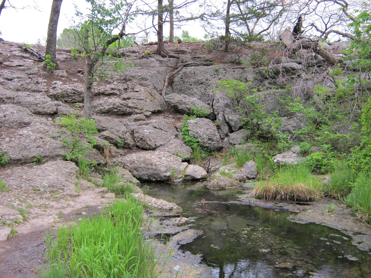
Antelope Springs, Platt Historic District. NPS photo.
Today the Platt District has five named springs and spring groups:
| Spring | Water |
|---|---|
| Antelope, Buffalo | fresh — the main freshwater springs, and most of Travertine Creek's flow |
| Black Sulphur, Hillside, Pavilion | mineralized |
| Bromide | once the most mineralized and perhaps the most popular — dry since 1974 |
Vendome Well, an artesian well with an artificial creek, wading pools, waterfalls and footbridges, is a favorite stop, where visitors fill jugs of sulphur water from a spigot.
Travertine Creek rises just east of the district and runs about two miles through it — intermittently until Antelope and Buffalo springs feed it. Their water is rich in dissolved calcium carbonate, which settles out as travertine terraces and built Travertine Island. Travertine marks present and past springs; deposits away from today's streams may show springs that have dried up. The creek joins Rock Creek, the park's largest stream, near Lincoln Bridge, a stone bridge of 1909 linking the town of Sulphur to the springs; Rock Creek, fed by the mineral springs, runs into the Lake of the Arbuckles.
Where the water comes from: the Arbuckle-Simpson aquifer, held in the Timbered Hills, Arbuckle and Simpson Groups, which crop out over more than 520 mi² (1,300 km²) of south-central Oklahoma and run underground beneath the park, capped by the Vanoss Formation.
- Rain falling on the outcrop recharges it, and water there is fresh; beyond the outcrop it quickly turns saline.
- Across the district, dissolved solids rise more than tenfold from east to west in less than 3 miles — probably fresh water mixing with a little brine.
- The mineral springs carry sodium chloride, which tastes salty, and hydrogen sulfide, which smells of rotten eggs.
Fossils
The park's rocks span about 470 million years (Middle Ordovician) to 300 million years (Late Pennsylvanian), from a time when Oklahoma lay under a wide inland sea. Fossils have been found in ten rock units — though not in the Vanoss Formation:
- marine invertebrates, the most common: brachiopods, echinoderms, trilobites, pelecypods, bryozoans, graptolites and ostracods, which reveal water depths and shorelines;
- vertebrates: conodonts, and an acanthodian fish collected in the 1970s;
- plant microfossils, pollen and spores, and burrows.
In 2016 the park hosted the first official NPS PaleoBlitz — an intensive fossil survey — with paleontologists from the NPS, the Sam Noble Museum of Natural History and Goddard Youth Camp, followed by a public fossil festival. NPS fossils are protected by the Paleontological Resources Preservation Act of 2009.
Caves and karst
There are no significant caves or sinkholes, but small dissolution caves have formed in the travertine, and small caves follow fractures in the Vanoss conglomerate at Bromide Hill. About 9% of the park is known or potential karst. The Arbuckle-Simpson aquifer itself is a massive karst feature more than 50 mi (80 km) across, riddled with dissolution cavities, collapse breccias and widened fractures.
Hazards
- Rockfall, especially at Bromide Hill.
- Flash floods and debris flows along Rock Creek and Guy Sandy Creek; heavy rain can also raise the Lake of the Arbuckles. Climate change may bring more severe storms and flooding.
- Earthquakes: southern Oklahoma's hazard is slightly higher than most of the central and eastern U.S. because of the Southern Oklahoma Aulacogen, a failed rift from the break-up of the supercontinent Rodinia, where the Meers Fault has moved in the late Quaternary. In the last decade or so, Oklahoma's earthquakes have risen sharply, thought to be caused by injecting oil and gas wastewater into deep wells. None has been centered in the park, but there have been quakes in the region, and injection wells lie to its west.
- Abandoned mines: two sites were mined for gilsonite, an asphalt-like rock. Stay out and stay alive.
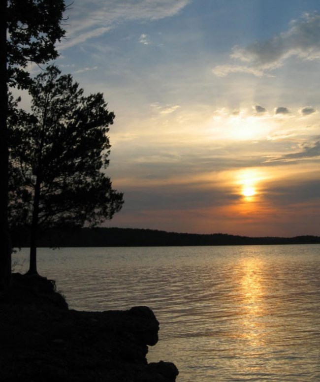
A lake at Chickasaw National Recreation Area. Image from the Park Service's page.
Maps and reports
The park lies in the Central Lowland province. Its geologic maps, reports and posters are in the NPS DataStore, with its completed Soil Resources Inventory; the paleontological inventory is there too.
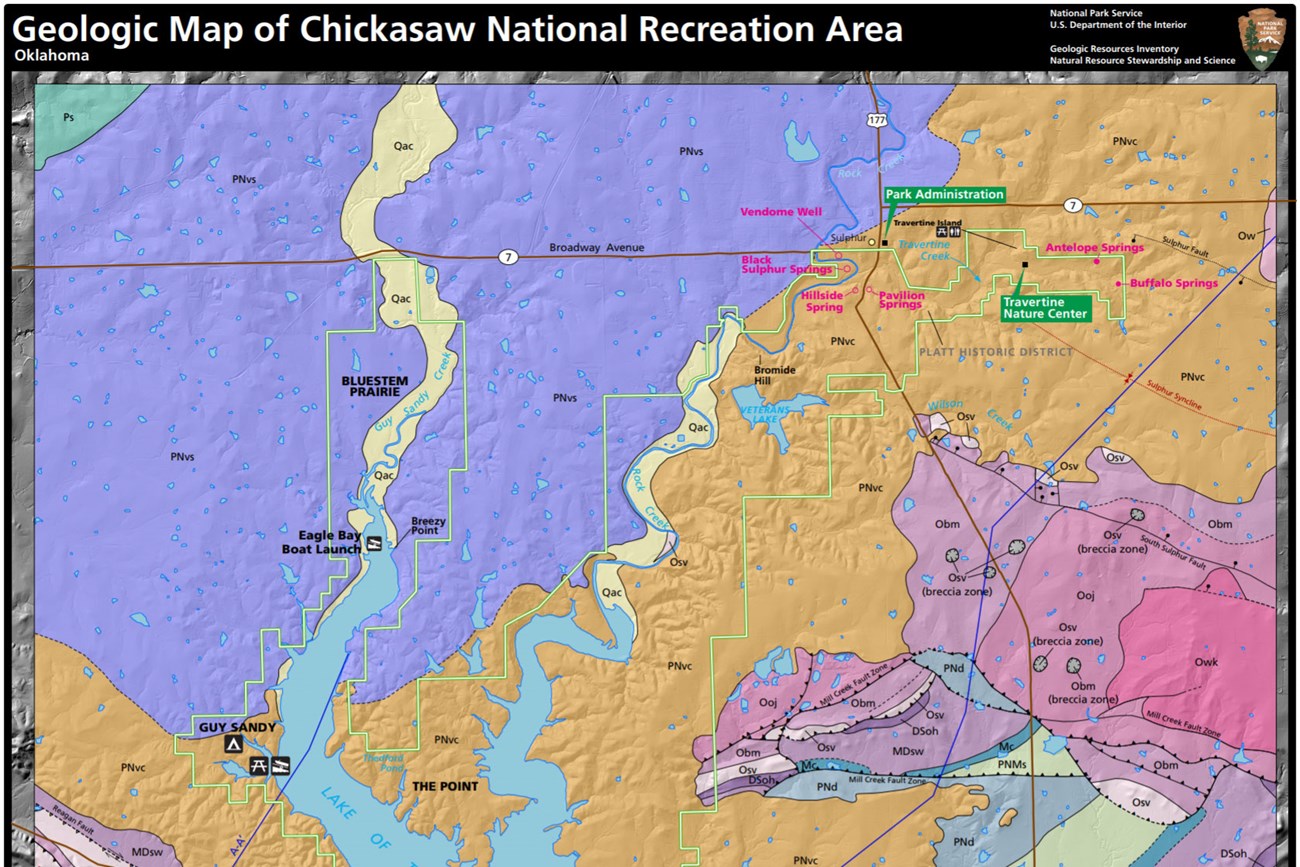
The park's geologic map from the Geologic Resources Inventory.
Sources
Based on "NPS Geodiversity Atlas—Chickasaw National Recreation Area, Oklahoma," National Park Service, drawing on Blome et al. (2013), Armstrong and others (2016) and Korn and others (2016); a work of the United States government in the public domain. The source's "Arkbuckle", "orogonies", "Pennsyvanian", "Venedome" and "soluable" are corrected to Arbuckle, orogenies, Pennsylvanian, Vendome and soluble. It says both that the park has no documented caves and that small caves have formed there; the small caves are kept.
ライセンス: CC0 1.0(パブリックドメイン) · 出典 www.nps.gov
1
0
0
0

コメント


