Download Image Download Image of the earth
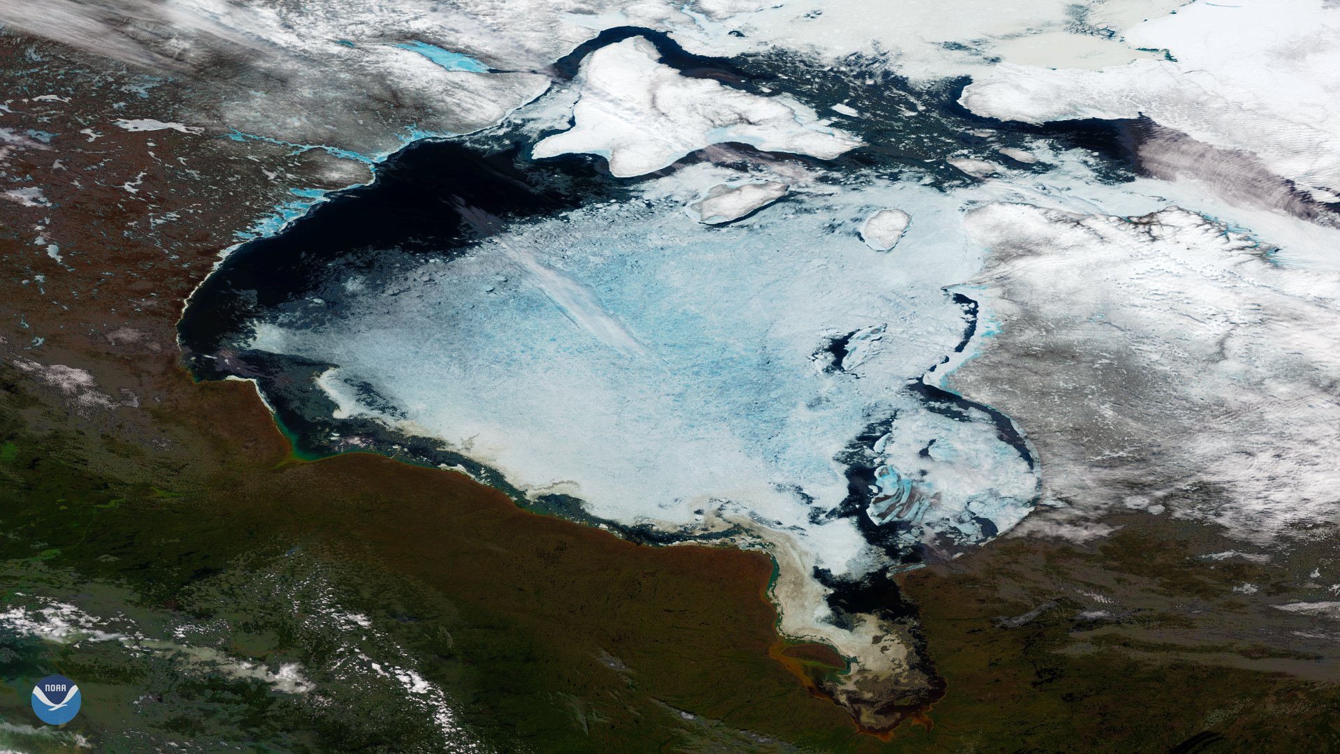
Clear skies over northeastern Canada this week offer a spectacular view of the seasonal summer ice melt that occurs on the Hudson Bay each year. This image, acquired by the NOAA-20 satellite on June 14, 2018, shows ice retreating from the shoreline and areas of dark open water in the northwest portion of the bay. Shallow and surrounded by land, the Hudson Bay freezes over completely during Canada's long, harsh winters. However, by late spring and early summer, warmer temperatures and long daylight hours allow the ice to thaw and break apart.
According to the Canadian Ice Service , about 59 percent of the bay was ice covered this week – slightly below the normal average of 62 percent for mid-June. In a typical year, the Hudson Bay becomes ice-free by August and begins to freeze over again in October or November.
This enhanced true-color satellite imagery is not a simple photograph of Earth, but rather a composite image. It was created by combining data from the three color channels on the NOAA-20 satellite's VIIRS sensor, sensitive to the red, green and blue (or RGB) wavelengths of light. In addition, data from several other channels are often also included to cancel out or correct atmospheric interference that may blur parts of the image.
Where this page came from
This page was imported from NOAA Satellites (NESDIS). Published by NOAA's National Environmental Satellite, Data, and Information Service and, as a work of the United States government, in the public domain; pictures credited elsewhere are left out.
Nobody has written it yet — it is the source material at a new address, which is why search engines are asked to skip it and why no one earns from it. It is up for grabs: take it on, and it is yours to rewrite and to earn from.
ライセンス: CC0 1.0(パブリックドメイン) · 出典 www.nesdis.noaa.gov
1
0
0
0

コメント