
On This Page Navigation
Geodiversity refers to the full variety of natural geologic (rocks, minerals, sediments, fossils, landforms, and physical processes) and soil resources and processes that occur in the park. A product of the Geologic Resources Inventory, the NPS Geodiversity Atlas delivers information in support of education, Geoconservation, and integrated management of living (biotic) and non-living (abiotic) components of the ecosystem.
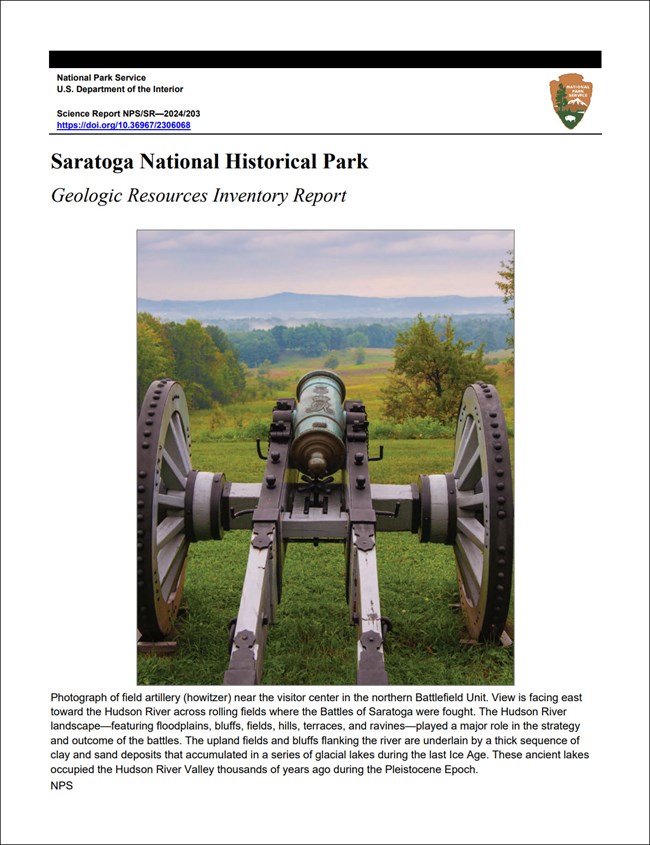
In-depth geologic information is contained in the baseline inventory products of the Geologic Resources Inventory, see table below.
Introduction
Saratoga National Historical Park (SARA) is located along the Hudson River Valley about 60 km (40 mi) north of Albany in Saratoga County, eastern New York. Authorized on June 1, 1938, SARA encompasses about 1,380 hectares (3,410 acres) and commemorates the First and Second Battles of Saratoga (September 19 and October 7, 1777), two American Revolutionary War battles that resulted in a decisive American victory over the British. The British defeat at Saratoga was the first time in history that a British regiment ever surrendered and marked a turning point in the American Revolution. The national historical park is comprised of four park units (the main battlefield, Saratoga Monument, Victory Woods, and the Schuyler House) that feature the battlefield sites, the 47 m (155 ft)-tall Saratoga Battle Monument, historical structures and farms, and American Major General Philip Schuyler’s country home (National Park Service 2016a).

Rolling terrain on ranger-led bike tour.
Geologic Setting
Situated along the Hudson River Valley north of Rockefeller-Vanderbilt Headquarters, Saratoga National Historical Park occupies the northern Valley and Ridge physiographic province of New York in a region predominantly underlain by Paleozoic-age sedimentary and metamorphic rocks. The bedrock of SARA consists of Ordovician-age units that have been incised by the meandering Hudson River to form a broad, flat floodplain with steep cutbanks and bluffs (Figure 56). Underlying a major portion of the historical park is the Ordovician Mohawk River Zone, a mélange (a jumbled assemblage of various lithologies) of shale (mudstone) and greywacke that forms the foundation of the main battlefield site and the low hills that stand above the surrounding landscape. The easternmost portion of SARA contains rocks of the Ordovician Stillwater Shale Zone, a shale-rich flysch unit (sedimentary rocks deposited in deep marine settings) that also contains some greywacke. Similarly aged greywacke-rich flysch deposits of the Rocky Tucks Zone occur in a small area of the northwestern battlefield unit. Quaternary surficial deposits in SARA include Pleistocene glacial till, lacustrine clay-silt and sand deposits, as well as Holocene fluvial terraces and alluvium (DeSimone 2015).
Regional Geology
Saratoga National Historical Park is a part of the Valley and Ridge Physiographic Province and shares its geologic history and some characteristic geologic formations with a region that extends well beyond park boundaries.
Maps and Reports

Geologic Resources Inventory
The Geologic Resources Inventory produces digital geologic maps and reports for more than 270 natural resource parks. The products listed below are currently available for this park, check back often for updates as many maps, reports, and posters are still in progress.
Scoping summaries are records of scoping meetings where NPS staff and local geologists determined the park’s geologic mapping plan and what content should be included in the report.
- Digital geologic maps include files for viewing in GIS software, a guide to using the data, and a document with ancillary map information. Newer products also include data viewable in Google Earth and online map services.
- Reports use the maps to discuss the park’s setting and significance, notable geologic features and processes, geologic resource management issues, and geologic history.
- Posters are a static view of the GIS data in PDF format. Newer posters include aerial imagery or shaded relief and other park information. They are also included with the reports.
- Projects list basic information about the program and all products available for a park.
Source: NPS DataStore Saved Search 3168. To search for additional information, visit the NPS DataStore.
Soil Resources inventory
A NPS Soil Resources Inventory project has been completed for Saratoga National Historical Park and can be found on the NPS Data Store.
Source: NPS DataStore Saved Search 3119. To search for additional information, visit the NPS DataStore.

View of Hudson River Valley.
Related Links
New York State Geological Survey
Saratoga National Historical Park
Narrow By Location
Narrow By Office
Show
10
40
Sort by
Relevance
Recently Updated
Date Released
Title
Loading results...
Tags:
geodiversity
,
geologic
,
[geologic forces](/media/article-search.htm?q=geologic forces)
,
[geologic resources](/media/article-search.htm?q=geologic resources)
,
[geologic feature](/media/article-search.htm?q=geologic feature)
,
[geologic time](/media/article-search.htm?q=geologic time)
,
[geologic layers](/media/article-search.htm?q=geologic layers)
,
[geologic history](/media/article-search.htm?q=geologic history)
,
[geologic formations](/media/article-search.htm?q=geologic formations)
,
geology
,
geological
,
[geological maps](/media/article-search.htm?q=geological maps)
,
geologist
,
[geology talk](/media/article-search.htm?q=geology talk)
,
[geology hike](/media/article-search.htm?q=geology hike)
,
[geology science and learning](/media/article-search.htm?q=geology science and learning)
,
geologists
,
[geology close up](/media/article-search.htm?q=geology close up)
,
[geologic resources inventory](/media/article-search.htm?q=geologic resources inventory)
,
geoheritage
,
geohazards
,
geomorphology
,
[geoscientists in parks](/media/article-search.htm?q=Geoscientists in Parks)
,
geoscientists-in-the-parks
,
[geological survey](/media/article-search.htm?q=Geological Survey)
,
geothermal
,
[geothermal activity](/media/article-search.htm?q=geothermal activity)
,
geotour
,
geotourism
,
[geothermal processes & features](/media/article-search.htm?q=geothermal processes & features)
,
fossils
,
paleontology
,
caves
,
karst
,
glaciers
,
[geoheritage sites](/media/article-search.htm?q=geoheritage sites)
,
earthquakes
,
landslides
,
mining
National Park Service Geodiversity Atlas
The servicewide Geodiversity Atlas provides information on geoheritage and geodiversity resources and values within the National Park System. This information supports science-based geoconservation and interpretation in the NPS, as well as STEM education in schools, museums, and field camps. The NPS Geologic Resources Division and many parks work with National and International geoconservation communities to ensure that NPS abiotic resources are managed using the highest standards and best practices available.
Where this belongs
- Saratoga National Historical Park
Where this page came from
This page was imported from National Park Service. Produced by the U.S. National Park Service and, as a work of the United States government, in the public domain.
Nobody has written it yet — it is the source material at a new address, which is why search engines are asked to skip it and why no one earns from it. It is up for grabs: take it on, and it is yours to rewrite and to earn from.
このページを含むコレクションSaratoga National Historical Park
ライセンス: CC0 1.0(パブリックドメイン) · 出典 www.nps.gov
1
0
0
0

コメント
次に読む


