Download Image Image of a winter storm
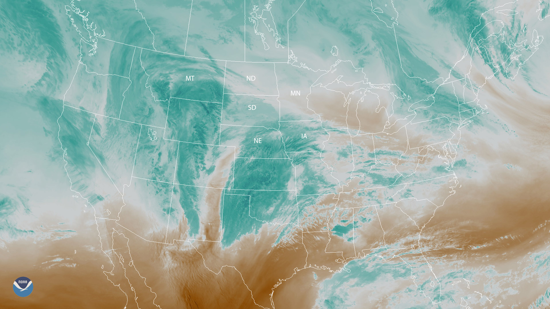
A powerful winter storm is expected to bring a mix of snow and freezing rain to parts of the Plains and the upper Midwest beginning Friday evening (Nov. 30) and lasting well into weekend. In this water vapor imagery from GOES East, you can see the wintry weather approaching the region.
The National Weather Service (NWS) has issued winter storm watches and warnings from central Montana to northern Iowa. Parts of southern South Dakota and northern Nebraska could see snow totals of 8 inches or more, while portions of northern Nebraska may see snow accumulations exceed 12 inches. The NWS warns that travel conditions could become hazardous Saturday morning as the wintry mix changes over to heavy snow and blowing snow across western and central Nebraska and southern South Dakota.
In addition, parts of southern Minnesota and northern Iowa are expected to see a mix of freezing rain and snow Saturday morning with the wintry mix transitioning to all snow by the afternoon.
Water vapor imagery is created using a wavelength sensitive to the moisture content in the atmosphere. In this imagery, bright blue and white areas indicate the presence of high water vapor or moisture content, whereas dark orange and brown areas indicate little or no moisture present.
Where this page came from
This page was imported from NOAA Satellites (NESDIS). Published by NOAA's National Environmental Satellite, Data, and Information Service and, as a work of the United States government, in the public domain; pictures credited elsewhere are left out.
Nobody has written it yet — it is the source material at a new address, which is why search engines are asked to skip it and why no one earns from it. It is up for grabs: take it on, and it is yours to rewrite and to earn from.
ライセンス: CC0 1.0(パブリックドメイン) · 出典 www.nesdis.noaa.gov
1
0
0
0

コメント