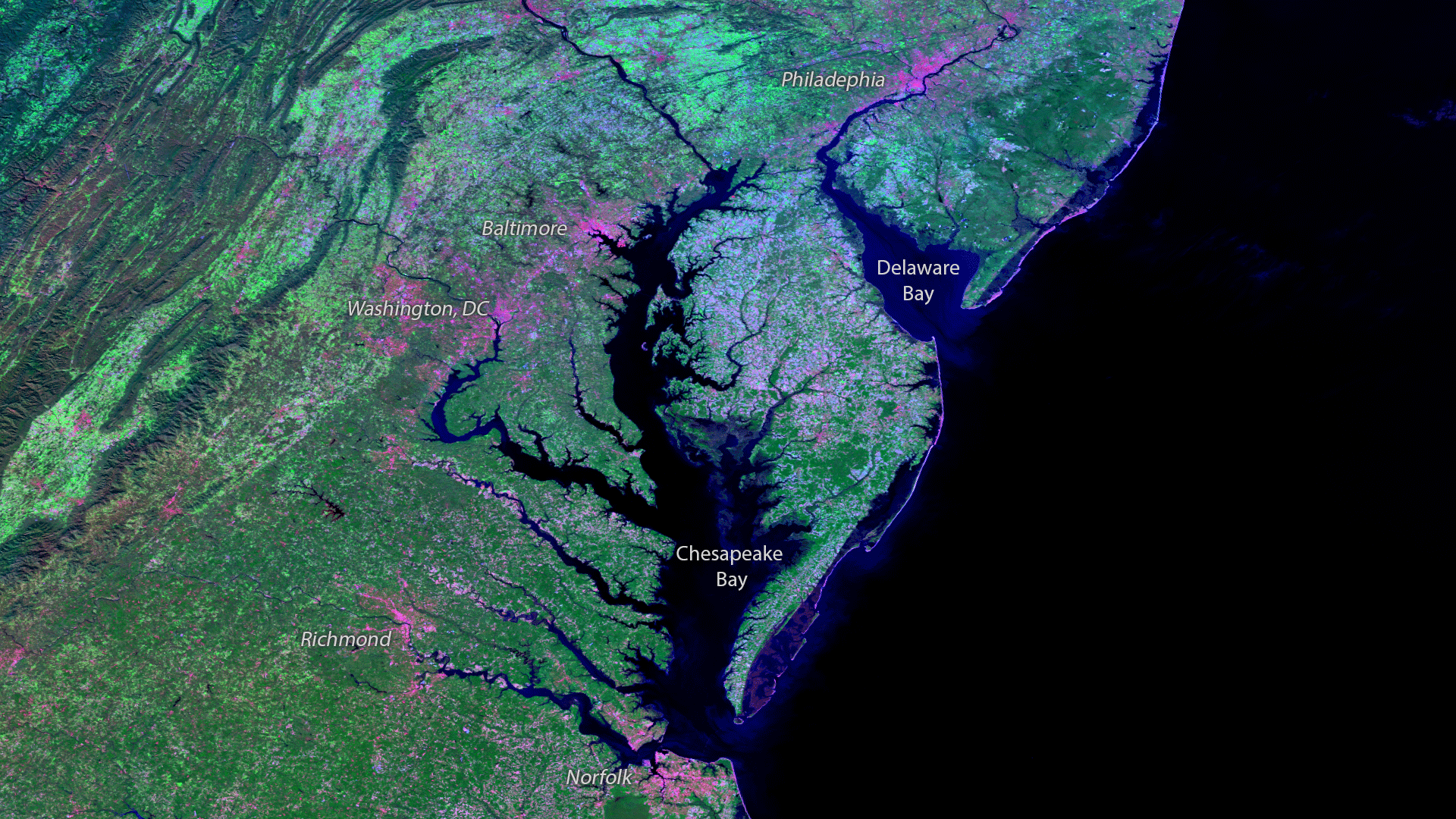
Download Image Download Image of The Chesapeake Bay
The Chesapeake Bay, North America’s largest estuary, provides a vital habitat for local marine life which supports the ecology and economy of Maryland, Virginia, Delaware and the District of Columbia. NOAA plays a significant role in the Bay -- not only do "smart buoys" collect and transmit real-time weather, water conditions, and water quality data, but NOAA and its partners help to restore conditions in the watersheds of the Bay by monitoring nutrients, and working with communities to ensure the long-term ecological function of the Bay. Captured November 13, 2016, this Suomi NPP VIIRS image using three of the sensor’s high resolution imagery channels to differentiate the land types in the areas, based on their visual and thermal differences. Bright pink areas are more barren, due to rock or urbanization, while green areas are vegetated.
Where this page came from
This page was imported from NOAA Satellites (NESDIS). Published by NOAA's National Environmental Satellite, Data, and Information Service and, as a work of the United States government, in the public domain; pictures credited elsewhere are left out.
Nobody has written it yet — it is the source material at a new address, which is why search engines are asked to skip it and why no one earns from it. It is up for grabs: take it on, and it is yours to rewrite and to earn from.
ライセンス: CC0 1.0(パブリックドメイン) · 出典 www.nesdis.noaa.gov
1
0
0
0

コメント