
Three things Montana needs to know cannot be measured from the ground at the
scale they happen: how far cheatgrass has spread across 68 million acres of
rangeland, how much of Glacier National Park is still glacier, and how much
water a field is actually using. Landsat measures all three, and has been
doing it long enough to show change rather than a snapshot.
Rangeland, and what is taking it over
Rangelands cover more than 70% of Montana — 68 million acres — and the beef
industry that grazes them is worth $2.2 billion to the state. For decades
Bromus tectorum, cheatgrass, has been moving in on the sagebrush, and it
brings fire with it.
In the late 2010s the Western Governors' Association and the University of
Montana built a Landsat-based tool that breaks rangeland into its components:
sagebrush, annual herbaceous cover, bare ground. That is what makes the
problem addressable — managers can aim restoration at the invaded ground,
protect what is not invaded yet, and rank wildfire risk.
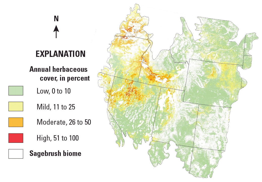
*Annual herbaceous cover — largely cheatgrass — across the western United
States, from the weighted average of USGS Back in Time fractional components,
USGS Harmonized Landsat-Sentinel data and the University of Montana Rangeland
Analysis Platform, 2016–2018.*
The glaciers in Glacier National Park
The USGS Northern Rocky Mountain Science Center has tracked every glacial area
in the park's 1,583 square miles since 1966. **Average area lost: 39%. Worst:
Boulder Glacier, at 85%.**
This is not only a matter of what visitors see. Glacial meltwater is a real
source of moisture and streamflow in Montana. Landsat's value here is its
length — the same instrument family over the same ground for decades. One
team used it to build an automated map of persistent snow and ice cover across
the United States in 2015, and found the decline steeper than previous
estimates had it.
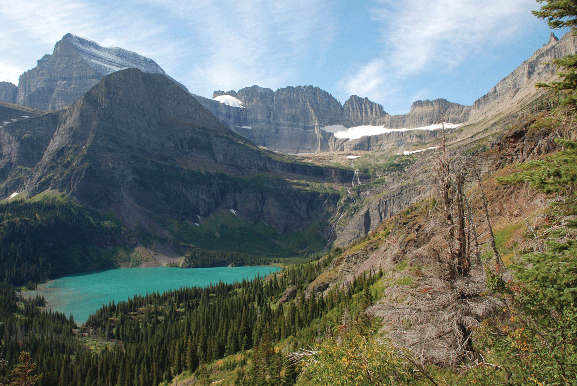
Grinnell Glacier, Glacier National Park.
Water, counted from orbit
Nearly 2 million acres of Montana cropland was irrigated in 2019, inside a
$4.4 billion agriculture industry, and there is not enough water to go
round.
What Landsat's thermal sensors give is evapotranspiration — evaporation
from the surface plus transpiration through leaves, which together is how much
water a field is really using. On the ground that needs a flux tower. From
orbit it can be mapped field by field.
USGS researchers have used evapotranspiration models developed at the EROS
Center to track field-scale water use across the St. Mary–Milk River basin for
the US–Canada International Joint Commission, which manages the lakes and
rivers along the border.
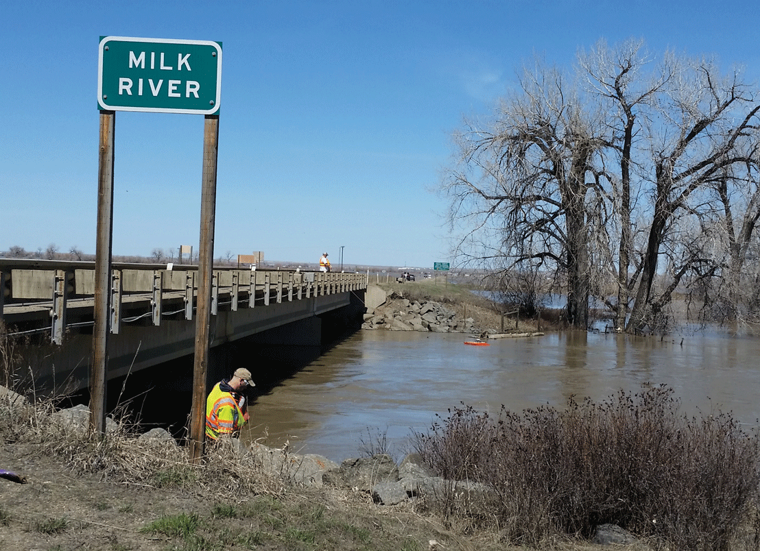
Streamflow measurement on the Milk River near Harlem, Montana.
Sources
Written from the U.S. Geological Survey Fact Sheet Montana and Landsat, a
work of the United States government in the public domain. Glacier figures
from Florentine (2019); snow and ice mapping from Selkowitz and Forster
(2016).
ライセンス: CC0 1.0(パブリックドメイン) · 出典 pubs.usgs.gov
1
0
0
0

コメント


