Download Image Download Image of New South Wales
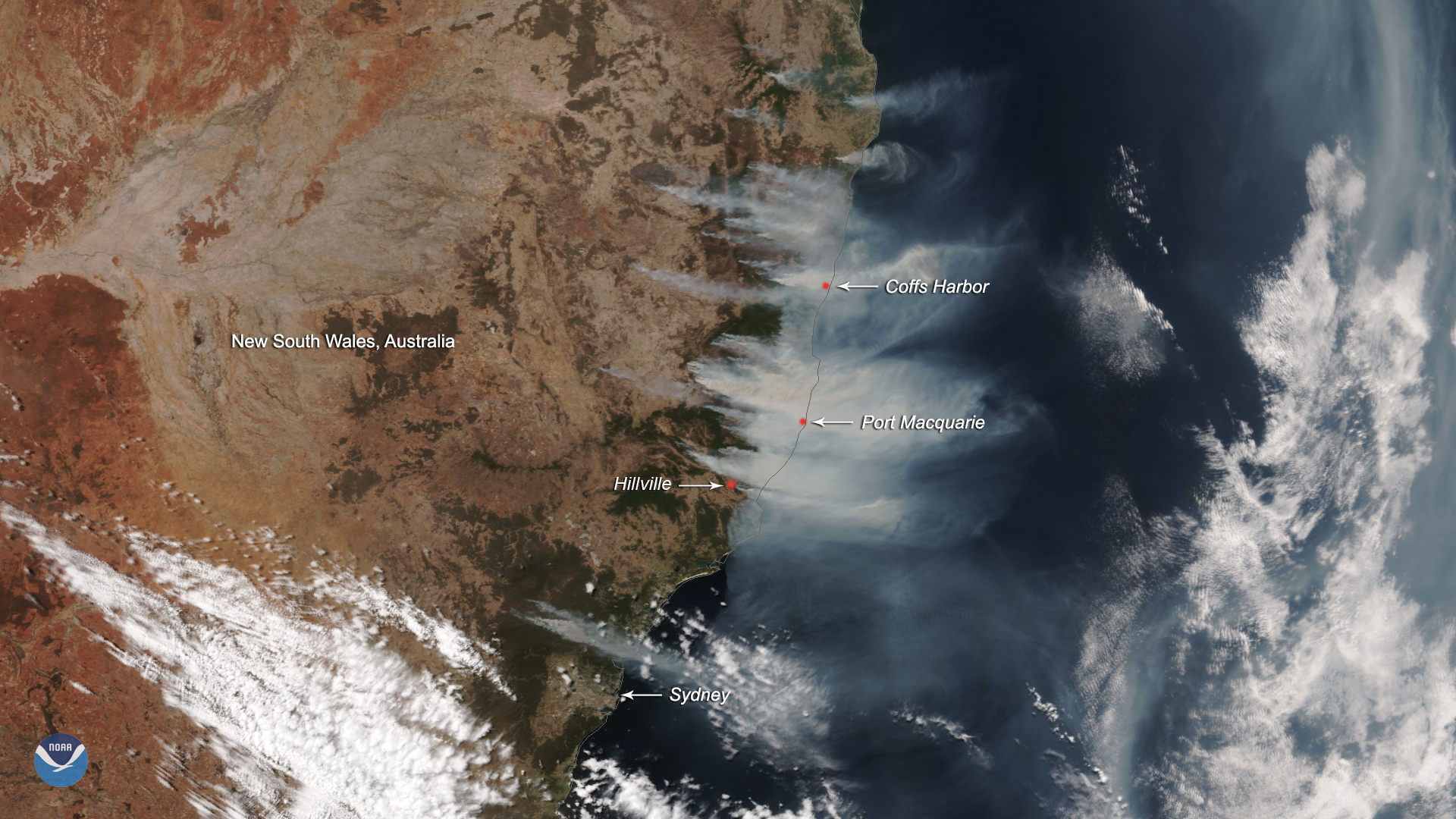
The Suomi-NPP satellite captured this True Color image of the eastern coast of Australia on Nov. 12, 2019, showing the intense bushfires around New South Wales that have lasted for the past five days. The Bureau of Meteorology in Australia recorded a downturn in the weekend’s fire intensity due to a cold front that is moving between New South Wales (NSW) and the Australian Capital Territory (ACT). Made from strong western winds and cooling gusts from the south, the cold front dropped temperatures at Sydney Airport from 90 degrees Fahrenheit to 68 degrees in just 11 minutes on Tuesday evening. As a result, the Bureau stated at 10 p.m. local time that “the immediate threat of severe weather [in NSW and the ACT] has passed, but the situation will continue to be monitored and further warnings will be issued if necessary.”
According to the Bureau’s webpage on Australia’s fire weather patterns, the bushfire season usually lasts from Australia’s spring to mid-summer (Oct. to March). Bushfires function as an integral part of Australia’s environment ; many species of plants native to Australia have evolved to be combustible and dependent on the fires to regenerate. However, the recent intensity of the yearly bushfires has outstripped expectations and usual management techniques. According to the NSW Rural Fire Service, the 17 emergency warning fires on Nov. 8 lead to a damage toll of over 100 homes and without “enough fire] trucks to cover every single possibility” with [assisting other threats to personal property. While the newly developed cold front has helped Sydney and some parts of NSW avoid the worst damage, the NSW Rural Fire Service has issued an advisory that states that the wind change has augmented the severity of fires in the north, specifically around the areas of Hillville and Port Macquarie.
This image was captured by the Suomi-NPP satellite's VIIRS instrument , which scans the entire globe twice daily at a 750-meter resolution. The VIIRS sensor provides high-resolution visible and infrared imagery of Earth's atmosphere, land, and oceans, and helps atmospheric scientists monitor severe weather events such as hurricanes and tropical storms.
Where this page came from
This page was imported from NOAA Satellites (NESDIS). Published by NOAA's National Environmental Satellite, Data, and Information Service and, as a work of the United States government, in the public domain; pictures credited elsewhere are left out.
Nobody has written it yet — it is the source material at a new address, which is why search engines are asked to skip it and why no one earns from it. It is up for grabs: take it on, and it is yours to rewrite and to earn from.
이용 허락: CC0 1.0 (퍼블릭 도메인) · 출처 www.nesdis.noaa.gov
1
0
0
0

코멘트