Download Image Download Image of Hurricane Dorian
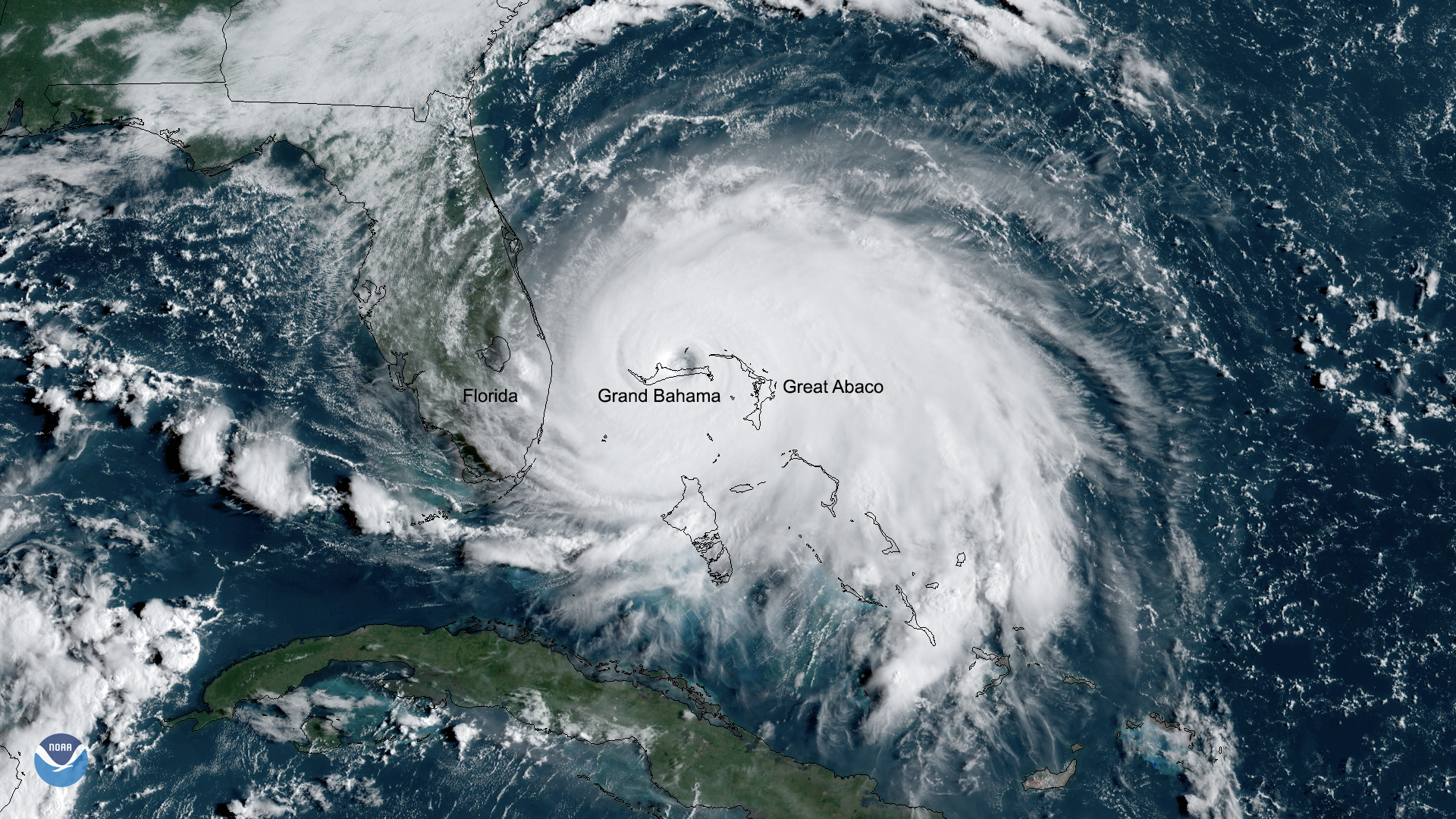
Catastrophic Hurricane Dorian slowed to a crawl over Grand Bahama Island overnight and into Labor Day. On Monday, Sept. 2, 2019, GOES East captured a view of the Category 5 storm over Grand Bahama. Destructive hurricane-force winds, along with 200 mph gusts, continue to lash the island, according to a 10 a.m. EDT tweet from the National Hurricane Center (NHC).
The NHC warns that destructive winds, as well as storm surge 18-23 feet above normal tide levels, are expected to pummel Grand Bahama for the majority of the day. Bahamas Press tweeted Monday morning saying, “Grand Bahama International Airport is now under 5 feet of water.”
Although gradual weakening is forecast, Dorian is expected to make a slow west-northwestern turn during the next day or so. While the current forecast track doesn’t show Dorian making landfall along the East Coast, the powerful storm is expected to track dangerously close to the east coast of Florida, Georgia, South Carolina, and North Carolina later this week. Residents in those areas should continue monitoring the storm’s progress, as a slight shift in the track could put the core of Dorian near or over the east coast of Florida.
Dorian is tied for the strongest Atlantic hurricane landfall on record with the 1935 Labor Day hurricane, according to the NHC.
This GeoColor-enhanced imagery was created by NOAA's partners at the Cooperative Institute for Research in the Atmosphere. The GOES East geostationary satellite, also known as GOES-16, provides coverage of the Western Hemisphere, including the United States, the Atlantic Ocean and the eastern Pacific. The satellite's high-resolution imagery provides optimal viewing of severe weather events, including thunderstorms, tropical storms, and hurricanes.
Where this page came from
This page was imported from NOAA Satellites (NESDIS). Published by NOAA's National Environmental Satellite, Data, and Information Service and, as a work of the United States government, in the public domain; pictures credited elsewhere are left out.
Nobody has written it yet — it is the source material at a new address, which is why search engines are asked to skip it and why no one earns from it. It is up for grabs: take it on, and it is yours to rewrite and to earn from.
이용 허락: CC0 1.0 (퍼블릭 도메인) · 출처 www.nesdis.noaa.gov
1
0
0
0

코멘트