
Colonisation needs soldiers and treaties. It also needs paperwork. In the Ohio Valley, the quiet instrument that finished the job was the Federal Land Office — the place where settlers, mostly White and mostly male, signed the legal documents that made land theirs.
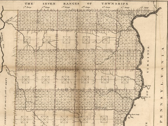
Thomas Hutchins, "Plat of the seven ranges of townships being part of the territory of the United States, N.W. of the River Ohio" (Philadelphia: M. Carey, 1796). The government commissioned the survey to divide the land and hand it out. Library of Congress.
Surveyors first
Congress built Fort Steuben, at what became Steubenville, mainly to protect the surveyors it had sent to map the Northwest Territory. The threat it had in mind was Indigenous people — who objected because they had seen what came next. Surveyors were the first step: settlers would follow, take the land, force treaties, and push Indigenous communities west, away from their homes.
By the time Lewis came through
When Meriwether Lewis and his crew passed, the region was in a later phase of the American colonial project — the process of claiming Indigenous land, forcing its people off, and then encouraging White settlers to move in and farm it. The United States had already asserted control of the Ohio Valley and had forced Shawnee and Delaware leaders to sign treaties and move west and north.
Lewis saw American families on the move, headed to claim land where Shawnee and Delaware families had so recently lived.
And further west
Lewis's own destination was country still controlled by Indigenous communities. The purpose of the journey, as President Thomas Jefferson set it out, was to establish U.S. claims to the lands bought from France in the Louisiana Purchase. There, too, wars, treaties and surveys would follow — and then those acres, someone else's homelands, would be handed out by signature at a federal land office, just like the one in Steubenville.
Sources
Based on "Federal Land Offices," from the series "Pivotal Places: Stories from the Lewis and Clark National Historic Trail," National Park Service; a work of the United States government in the public domain.
이 페이지가 속한 컬렉션Lewis & Clark National Historic Trail
이용 허락: CC0 1.0 (퍼블릭 도메인) · 출처 www.nps.gov
1
0
0
0

코멘트


