Download Image Download Image of Indonesia
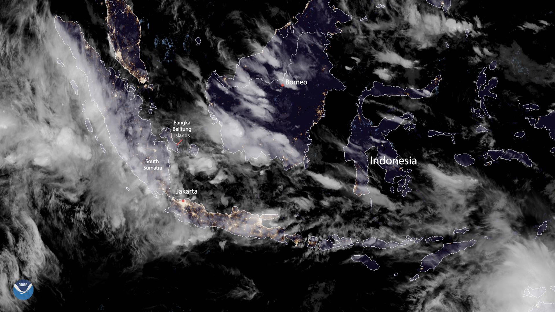
On Jan. 9, 2020 at 12:00 UTC, the Himawari-8 satellite captured an image of Indonesia, which is currently experiencing heavy rainfall in and around its capital, Jakarta. Since Jan. 1, Indonesia has experienced the residual effects of monsoon rain, which has caused flooding and landslides that have displaced more than 18,000 residents in a single province alone on the largest island and killed 47 people in the entire nation.
Indonesia’s Meteorology, Climatology and Geophysics Agency (BMKG) also warns that “t]here is still the potential for rain with moderate to heavy intensity that can be accompanied by lightning and strong winds...until Jan, 10, 2020” around the South Sumatra region. The Bangka Belitung islands are also under advisory, with the agency warning residents to “be aware of the potential for heavy rains accompanied by lightning and strong winds in the afternoon, evening and early morning” until Jan. 11. Government efforts are underway to repair damage to vital thoroughfares in the nation. The president of Indonesia, Joko Widodo, [stated on Twitter that he would like to clear “roads that have been buried by landslides and handling residents affected by disasters.”
Additionally, the nation has experienced a series of smaller earthquakes up to magnitude 4.8 since Jan. 1 in its outer lying islands. While the earthquakes continue as of Jan. 8, no tsunami activity is anticipated at this time. Due to ongoing issues with sea-level rise and infrastructure sinking the ground, Indonesia plans to move its capital city from Jakarta to a more stable area in Eastern Borneo in the near future.
This True Color image was captured by the Advanced Himawari Imager (AHI) on Japan’s Himawari-8 satellite. This satellite, the first unit of the Japan Meteorological Agency's (JMA) third-generation of geostationary satellites, provides visible light and infrared images of the Asia-Pacific region. Himawari-8's data are vital for global geostationary coverage, which is why NOAA and JMA have agreed to mutual back-up arrangements for their geostationary systems.
Where this page came from
This page was imported from NOAA Satellites (NESDIS). Published by NOAA's National Environmental Satellite, Data, and Information Service and, as a work of the United States government, in the public domain; pictures credited elsewhere are left out.
Nobody has written it yet — it is the source material at a new address, which is why search engines are asked to skip it and why no one earns from it. It is up for grabs: take it on, and it is yours to rewrite and to earn from.
이용 허락: CC0 1.0 (퍼블릭 도메인) · 출처 www.nesdis.noaa.gov
1
0
0
0

코멘트