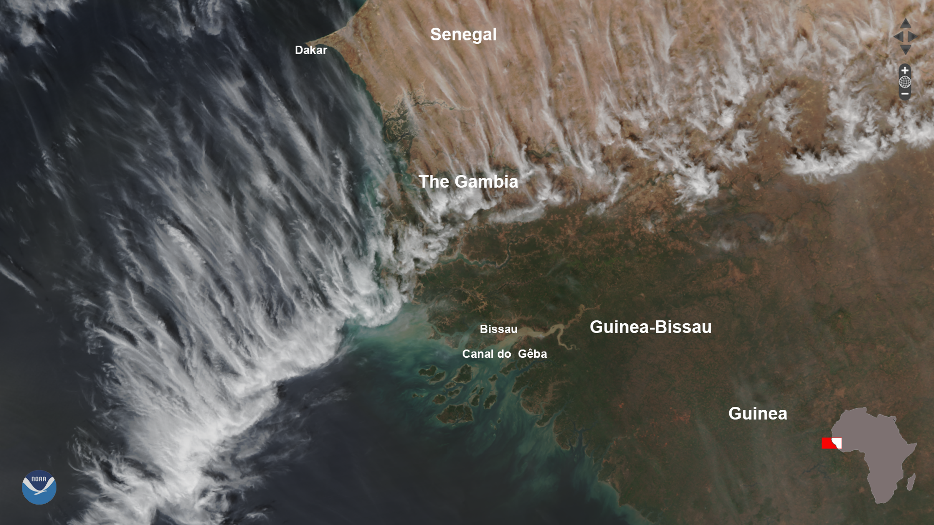
Download Image Download Image of the West African Coast
On Jan. 7, 2020, the NOAA-20 satellite snapped this dynamic shot of the West African coast.
The beautiful feathery clouds are a combination of various cirrus types, which include cirrocumulus (which have a more rippled or granulated appearance) and cirrostratus (made of ice crystals and appear thinner and more veil-like.)
South of the clouds, wispy grayish smoke plumes can be seen from numerous fires that are burning in the country of Guinea. Most of these fires are likely set to clear land for agriculture, but since December through May is also the country’s dry season , some may also be accidental.
Finally, it is easy to see the large amount of sediments along the shore running off from the mainland, which appear as a light greenish color through the water. It is especially visible in the Canal do Gêba estuary, which is connected to the brownish Rio Gêba river in the country of Guinea-Bissau.
This image was captured by the NOAA-20 satellite's VIIRS instrument , which scans the entire Earth twice per day at a 750-meter resolution. Multiple visible and infrared channels allow it to detect atmospheric aerosols, such as dust, smoke and haze associated with industrial pollution and fires. The polar-orbiting satellite circles the globe 14 times daily and captures a complete daytime view of our planet once every 24 hours.
Where this page came from
This page was imported from NOAA Satellites (NESDIS). Published by NOAA's National Environmental Satellite, Data, and Information Service and, as a work of the United States government, in the public domain; pictures credited elsewhere are left out.
Nobody has written it yet — it is the source material at a new address, which is why search engines are asked to skip it and why no one earns from it. It is up for grabs: take it on, and it is yours to rewrite and to earn from.
이용 허락: CC0 1.0 (퍼블릭 도메인) · 출처 www.nesdis.noaa.gov
1
0
0
0

코멘트