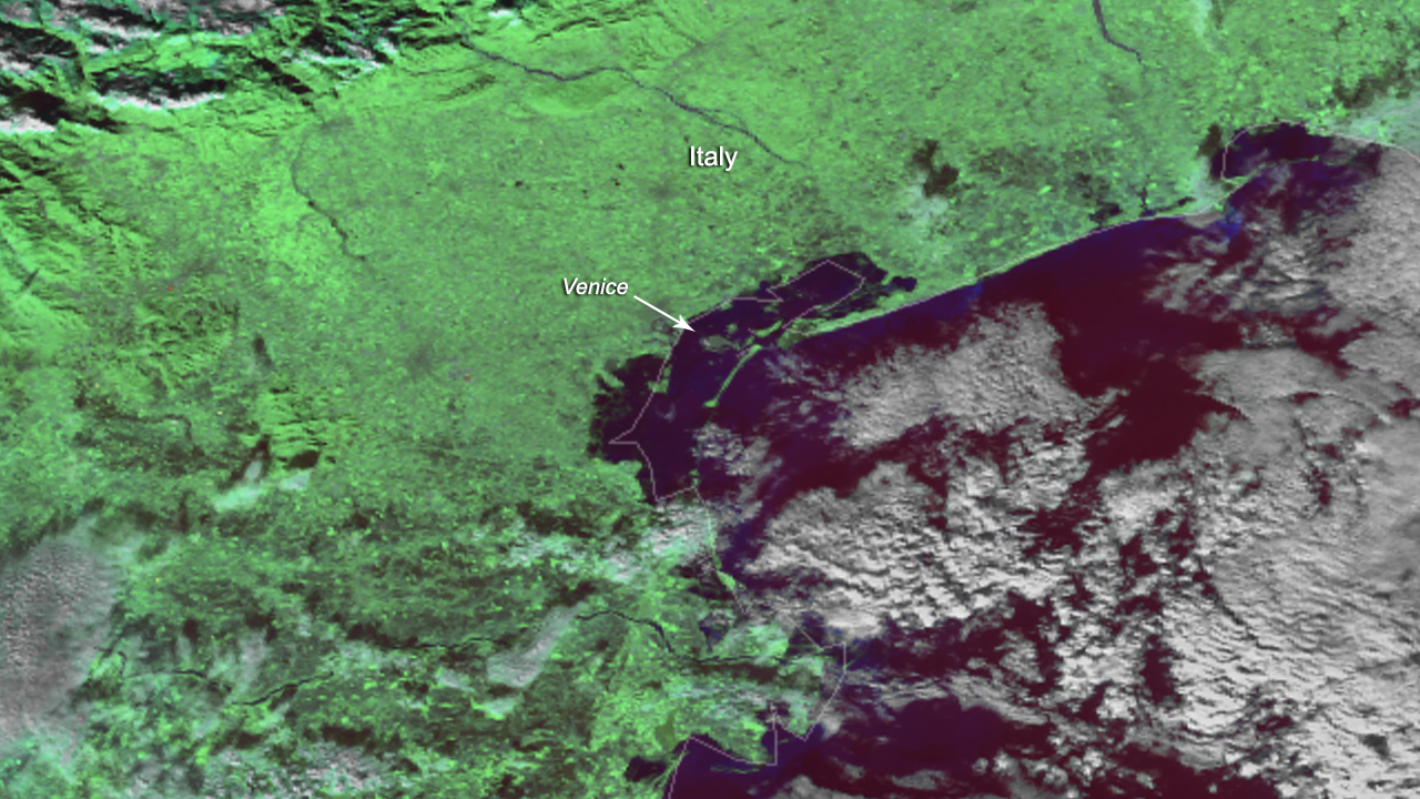
Download Image Download Image this image of Venice, Italy,
The NOAA-20 satellite captured this image of Venice, Italy, on Nov. 14, 2019, after devastating floods disrupted essential services and seasonal tourism within the city. A local ordinance declared a state of emergency for the city and suspension of municipal services after Venice experienced a tide of 70 inches on the evening of Nov. 12. On Nov. 14, the Tidal Forecast and Reporting Center of Venice tweeted that it was experiencing a 47-inch tide at 10:36 a.m. local time and that they expect a tide of nearly five feet for Friday at 11:20 a.m. due to sirocco winds (hot, humid winds from Northern Africa) coming across the Adriatic Sea. The Tide Bulletin in Venice added that “abundant rainfall in the central-northern areas on Friday will give way to possible cyclonic precipitation on Saturday; the evolution of exact weather patterns remains uncertain.”
Venice, a city that is composed of more than 100 small islands within a lagoon, is especially susceptible to flooding and severe weather. However, the mayor of Venice, Luigi Brugnaro, asserted that this year’s flooding outstrips previous records: “These floods],” he stated [on Twitter, “are the effects of climate change.” Additionally, NOAA records indicate a steady long-term linear trend towards increasing sea levels in Venice. In 1900, when measurements were first recorded, the sea level averaged at 271 inches; in 2020, it is projected to exceed 23 ft.
This image was captured by the NOAA-20 satellite's VIIRS instrument, which scans the entire Earth twice per day at a 750-meter resolution. Multiple visible and infrared channels allow it to detect atmospheric aerosols, such as dust, smoke and haze associated with industrial pollution and fires.
Where this page came from
This page was imported from NOAA Satellites (NESDIS). Published by NOAA's National Environmental Satellite, Data, and Information Service and, as a work of the United States government, in the public domain; pictures credited elsewhere are left out.
Nobody has written it yet — it is the source material at a new address, which is why search engines are asked to skip it and why no one earns from it. It is up for grabs: take it on, and it is yours to rewrite and to earn from.
이용 허락: CC0 1.0 (퍼블릭 도메인) · 출처 www.nesdis.noaa.gov
1
0
0
0

코멘트