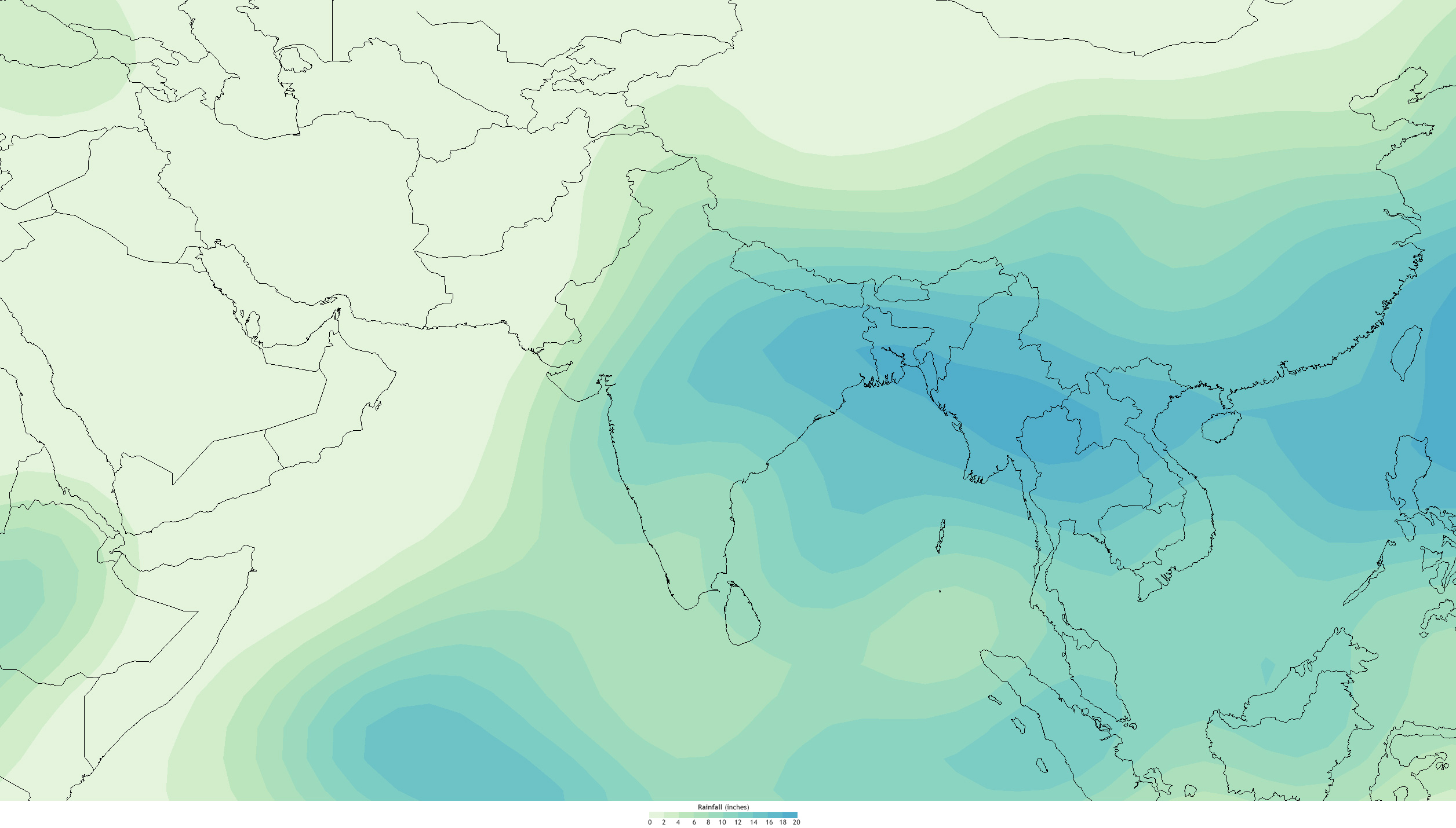
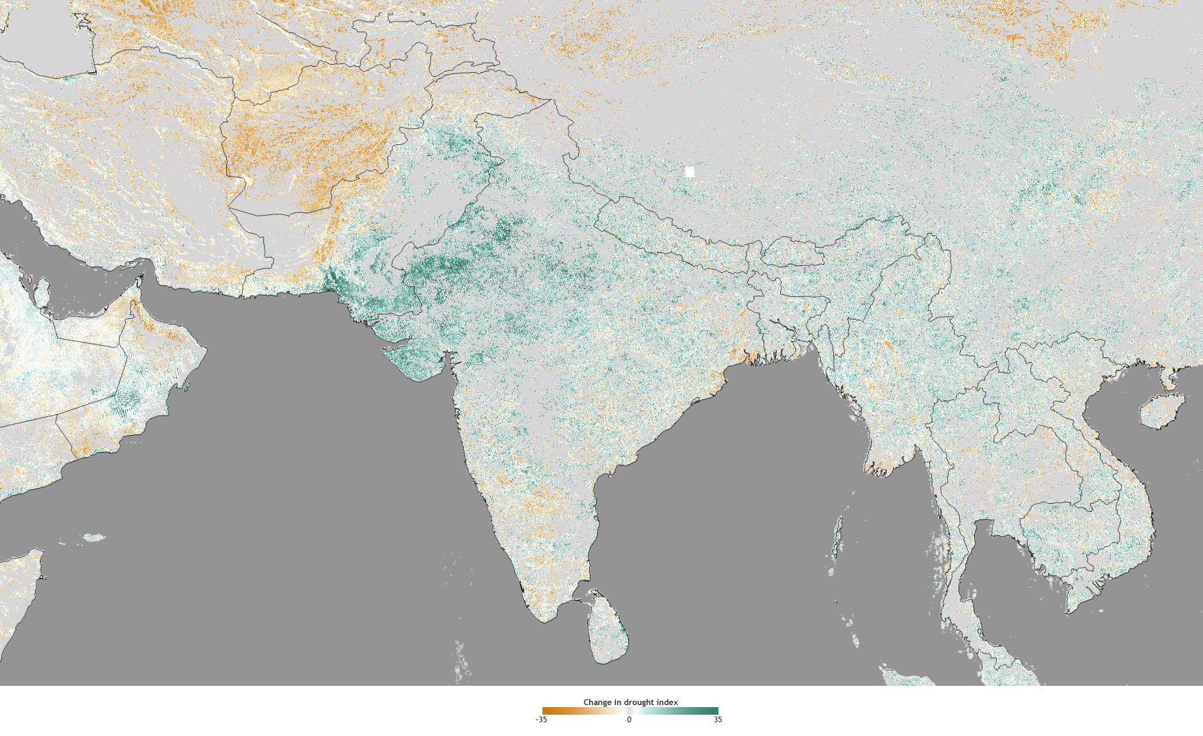
India's monsoon rains finally arrived in August—two months late—and vegetation conditions showed some improvement (maps above). Rainfall in August (left) was heavier in the eastern part of the country and across Bangladesh (blue colors), with amounts tapering off in the west and north.

(Left) Total rainfall in August 2012, based onNCEP reanalysis data provided by NOAA Earth System Research Laboratory. **(Right) **Change in drought status over a 4-week period ending on August 28, 2012, based on drought data from Felix Kogan at the NOAA Center for Satellite Applications and Research. Greens indicate improvement. Browns indicate worsening. large maps: precipitation | drought change
Despite the heavier rainfall amounts in the east, it was the western part of the country—where drought conditions were more severe in preceding months—that witnessed the most improvement (green colors on right-hand map) according to the satellite observations.
As with drought across the United States, however, timing can be everything, and the August rains will in many cases be too late to prevent some crop and cattle losses. Despite the increased rainfall since late August, large precipitation deficits for the season continue in western India.
For example, as of mid-September, Gujarat and Punjab had seasonal rainfall deficits of around 10 and 8 inches, respectively. The monsoon typically withdraws from western India during the latter half of September, and rainfall begins to decline.
Where this page came from
This page was imported from NOAA Climate.gov. Published by NOAA Climate.gov, which lets anything credited to it be re-used with attribution; material credited to others is left out.
Nobody has written it yet — it is the source material at a new address, which is why search engines are asked to skip it and why no one earns from it. It is up for grabs: take it on, and it is yours to rewrite and to earn from.
Licence: CC0 1.0 (public domain) · Adapted from www.climate.gov
1
0
0
0

Comments