Download Image Download Image of Kansas
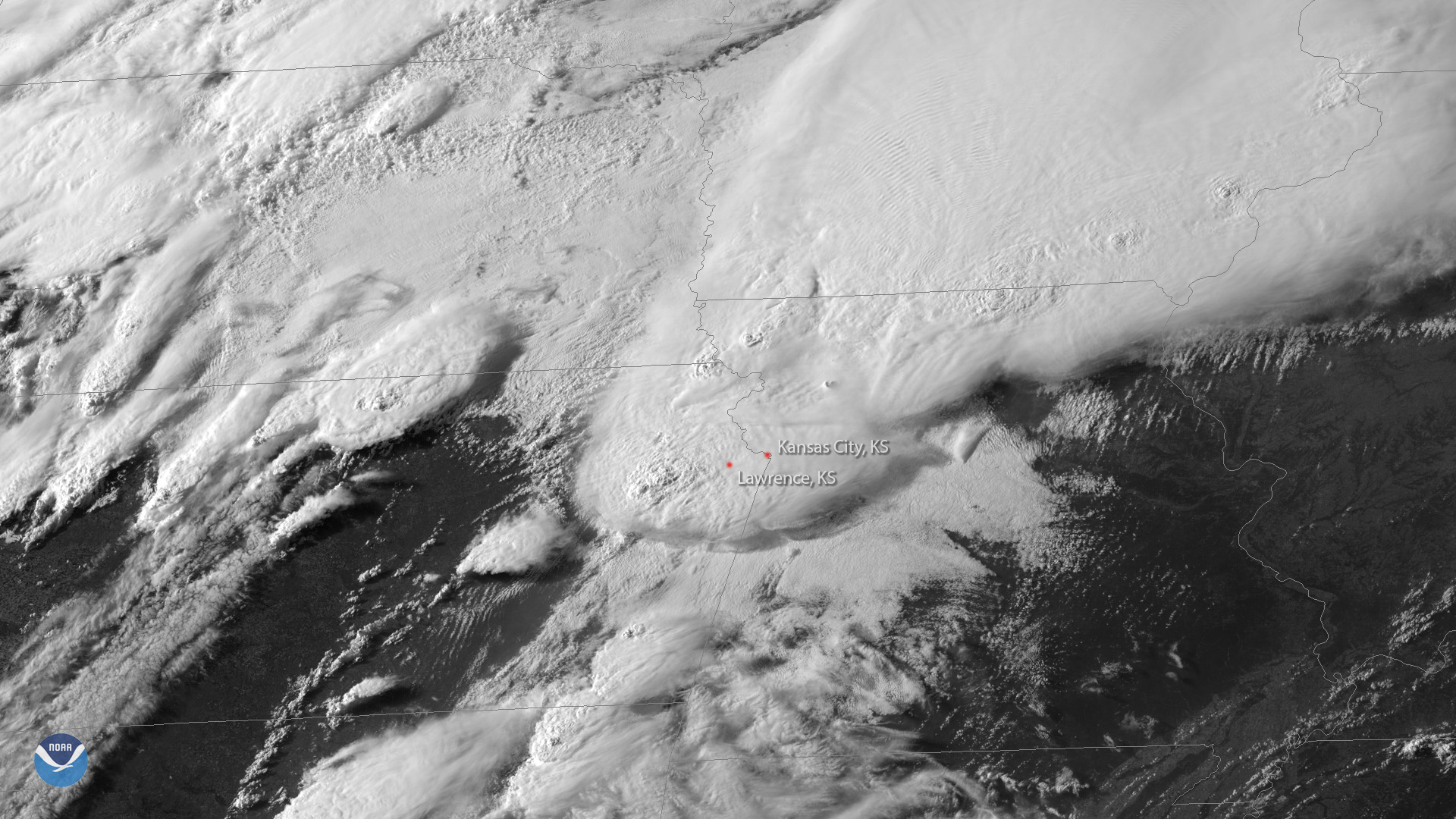
Survey crews from the National Weather Service in Kansas City are assessing the damage after severe storms tore through the state Tuesday evening. In this GOES East view from 6 p.m. CDT on May 28, 2019, you can see the thunderstorms already starting to bubble up over northeastern Kansas.
The destructive storms prompted a tornado emergency in Lawrence, Kan., and sent at least a dozen people to the hospital with storm-related injuries, according to LMH Health. Significant roof and tree damage, overturned vehicles and downed power lines were reported, according to the National Weather Service’s Storm Prediction Center. In addition, the Kansas City International Airport was forced to close its airfield due to storm debris.
“We apologize for the inconvenience,” airport personnel tweeted when the runway reopened shortly after midnight. “A tornado destroyed homes and businesses miles away & debris rained down onto the airport. Our crews had to clean it up in order to be safe.”
This imagery was captured by the satellite's visible band 2, which is useful for monitoring clouds and moisture imagery as well as a cloud's optical depth (or height) during severe weather events such as thunderstorms.
Where this page came from
This page was imported from NOAA Satellites (NESDIS). Published by NOAA's National Environmental Satellite, Data, and Information Service and, as a work of the United States government, in the public domain; pictures credited elsewhere are left out.
Nobody has written it yet — it is the source material at a new address, which is why search engines are asked to skip it and why no one earns from it. It is up for grabs: take it on, and it is yours to rewrite and to earn from.
Licence: CC0 1.0 (public domain) · Adapted from www.nesdis.noaa.gov
1
0
0
0

Comments