Download Image Download Image of Australia’s Southeastern States
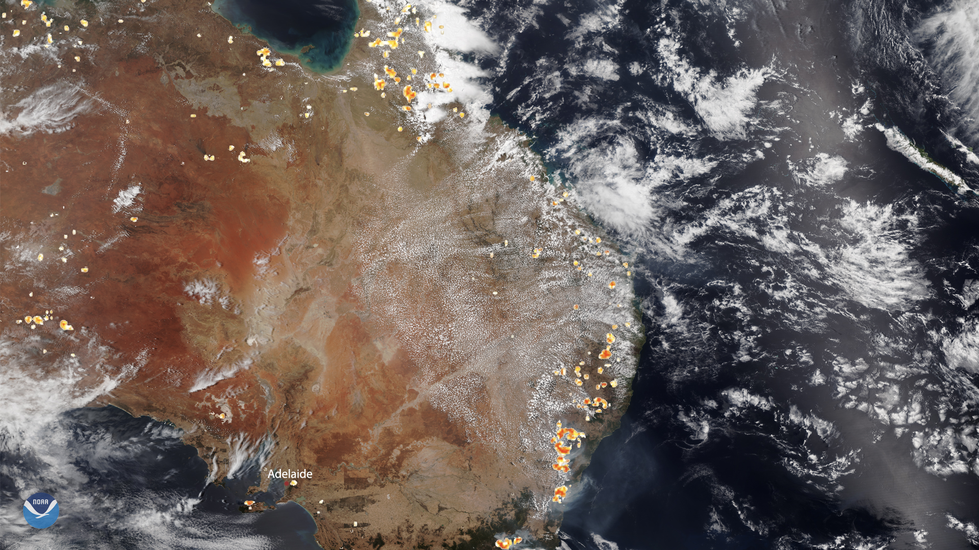
NOAA-20 captured this image of Australia on Dec. 26, where historic bushfires still rage in the southeastern states and territories and are especially intense around the South Australian city of Adelaide. Meanwhile, fires around Sydney have mostly been brought under control, but the New South Wales Rural Fire Service (NSWRFS) advised affected residents that “weather conditions are forecast to deteriorate over the coming days... [and to]...monitor the changing conditions.”
In the hills of Adelaide, areas such as Cudlee Cree, Bunbury, and Duncan are under advisories for ongoing scrub and grass fires. Authorities have also issued a total 24-hour ban on Dec. 27 at 4:25 p.m. local time for the Yorke Peninsula, the Mount Lofty Ranges, and the Mid-North, where “very hazardous fire weather conditions are predicted…and residents should implement their] Bushfire Survival Plan.” This plan, which the South Australian Country Fire Service (CFS) has [on its website , instructs people who fill it out to have: names and phone numbers of important emergency contacts, a predetermined meeting place, a collection of vital information and medication, a contingency plan for animals in your care, and action steps for preparing the home and one’s own well-being.
This image was captured by the NOAA-20 satellite's VIIRS instrument , which scans the entire Earth twice per day at a 750-meter resolution. Multiple visible and infrared channels allow it to detect atmospheric aerosols, such as dust, smoke and haze associated with industrial pollution and fires. The polar-orbiting satellite circles the globe 14 times daily and captures a complete daytime view of our planet once every 24 hours. Images taken by the VIIRS sensor during each orbit are then merged together to create image mosaics of larger regions, like the one used here.
Where this page came from
This page was imported from NOAA Satellites (NESDIS). Published by NOAA's National Environmental Satellite, Data, and Information Service and, as a work of the United States government, in the public domain; pictures credited elsewhere are left out.
Nobody has written it yet — it is the source material at a new address, which is why search engines are asked to skip it and why no one earns from it. It is up for grabs: take it on, and it is yours to rewrite and to earn from.
Licence: CC0 1.0 (public domain) · Adapted from www.nesdis.noaa.gov
1
0
0
0

Comments