Download Image Download Image of West Africa
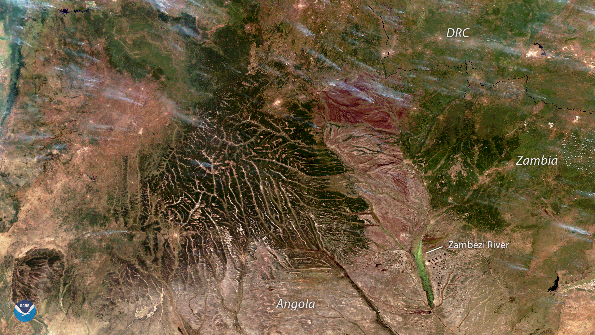
The NOAA-20 satellite captured this image of wildfires burning across Angola, Zambia and the Democratic Republic of the Congo on June 6, 2018. Widespread agricultural burning is a common practice in sub-Saharan Africa used by farmers to clear land for grazing and return nutrients to the soil. These fires are often visible from satellites during the dry season, which in Angola and Zambia, runs from May to October.
In addition to the smoke blowing across the landscape, this image also reveals the hilly terrain and intricate network of river valleys of eastern Angola, western Zambia and the Democratic Republic of the Congo. The upper Zambezi River, Africa's fourth-largest river, can be seen in the lower right.
The NOAA-20 satellite's VIIRS sensor provides global coverage twice a day with 750 m resolution across its entire scan. Its daily multi-band imaging capabilities support the acquisition of high-resolution atmospheric imagery, including visible and infrared imaging of hurricanes, atmospheric aerosols and, as shown here, detection of fires and smoke.
Where this page came from
This page was imported from NOAA Satellites (NESDIS). Published by NOAA's National Environmental Satellite, Data, and Information Service and, as a work of the United States government, in the public domain; pictures credited elsewhere are left out.
Nobody has written it yet — it is the source material at a new address, which is why search engines are asked to skip it and why no one earns from it. It is up for grabs: take it on, and it is yours to rewrite and to earn from.
Licence: CC0 1.0 (public domain) · Adapted from www.nesdis.noaa.gov
1
0
0
0

Comments