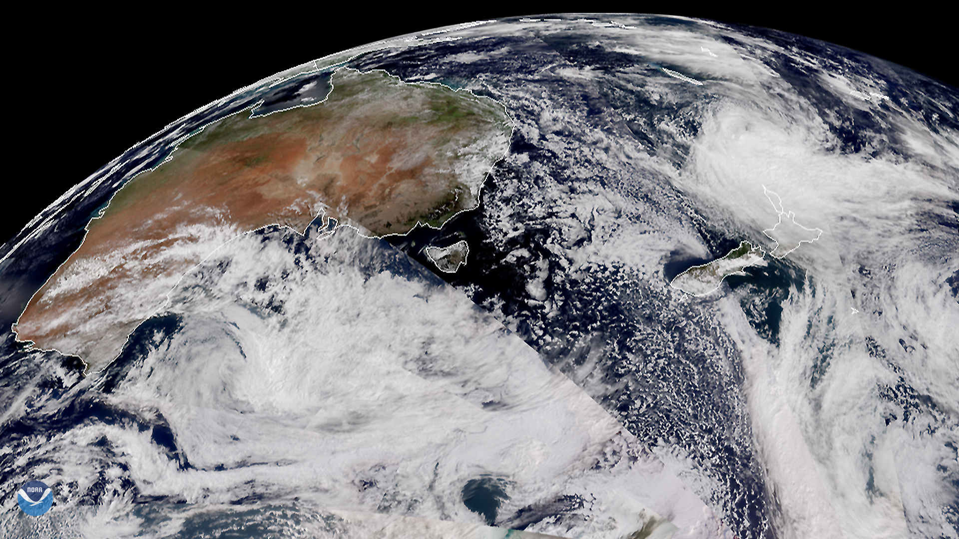
On March 18, 2020, the Suomi-NPP (or SNPP) and NOAA-20 satellites displayed a segment of the Southern Hemisphere, showing the ever-moving wind patterns of the Tasman Sea and Southern Indian Ocean. Here, the 40th parallel (or 40 degrees S latitude) rests atop Tasmania, with the lower boundary of the image lying right on the edge of the 60th parallel S. Thanks to 17th-century Dutch explorers who ventured out to the Australian and Antarctic seas for trade in the East Indies, mariners developed an ability to chart shipping routes and landmarks for later exploration and settling of the Australian continent. While this part of the world is not known for its hospitable conditions, one major city--Wellington, New Zealand-- rests below the 40th parallel.
Also known as the “Roaring Forties,” “Furious Fifties” and “Screaming Sixties,” the part of the Southern Hemisphere at these latitudes is known for its exceptionally strong gale-force winds. According to the National Ocean Service (NOS), the winds generate when warm air near the equator rises and moves towards either the North or the South Pole. The process, in turn, generates global circulation cells, which are mostly responsible for global wind patterns. As the temperature gradient decreases, the NOS adds , “air is deflected toward the poles by the Earth’s rotation, causing strong westerly and prevailing winds at approximately 40 degrees.” Since there’s little land blocking the winds in the Southern Hemisphere, they occasionally rage full force around the coasts of Australia, New Zealand, and Antarctica, making those waters among the most dangerous in the world to navigate.
This True-Color image was captured by the NOAA/NASA Suomi-NPP and NOAA-20 satellites’ VIIRS instrument , which scans the entire globe twice daily at a 750-meter resolution. The VIIRS sensor provides high-resolution visible and infrared imagery of Earth's atmosphere, land, and oceans, and helps atmospheric scientists monitor severe weather events such as hurricanes and tropical storms.
Where this page came from
This page was imported from NOAA Satellites (NESDIS). Published by NOAA's National Environmental Satellite, Data, and Information Service and, as a work of the United States government, in the public domain; pictures credited elsewhere are left out.
Nobody has written it yet — it is the source material at a new address, which is why search engines are asked to skip it and why no one earns from it. It is up for grabs: take it on, and it is yours to rewrite and to earn from.
Licence: CC0 1.0 (public domain) · Adapted from www.nesdis.noaa.gov
1
0
0
0

Comments