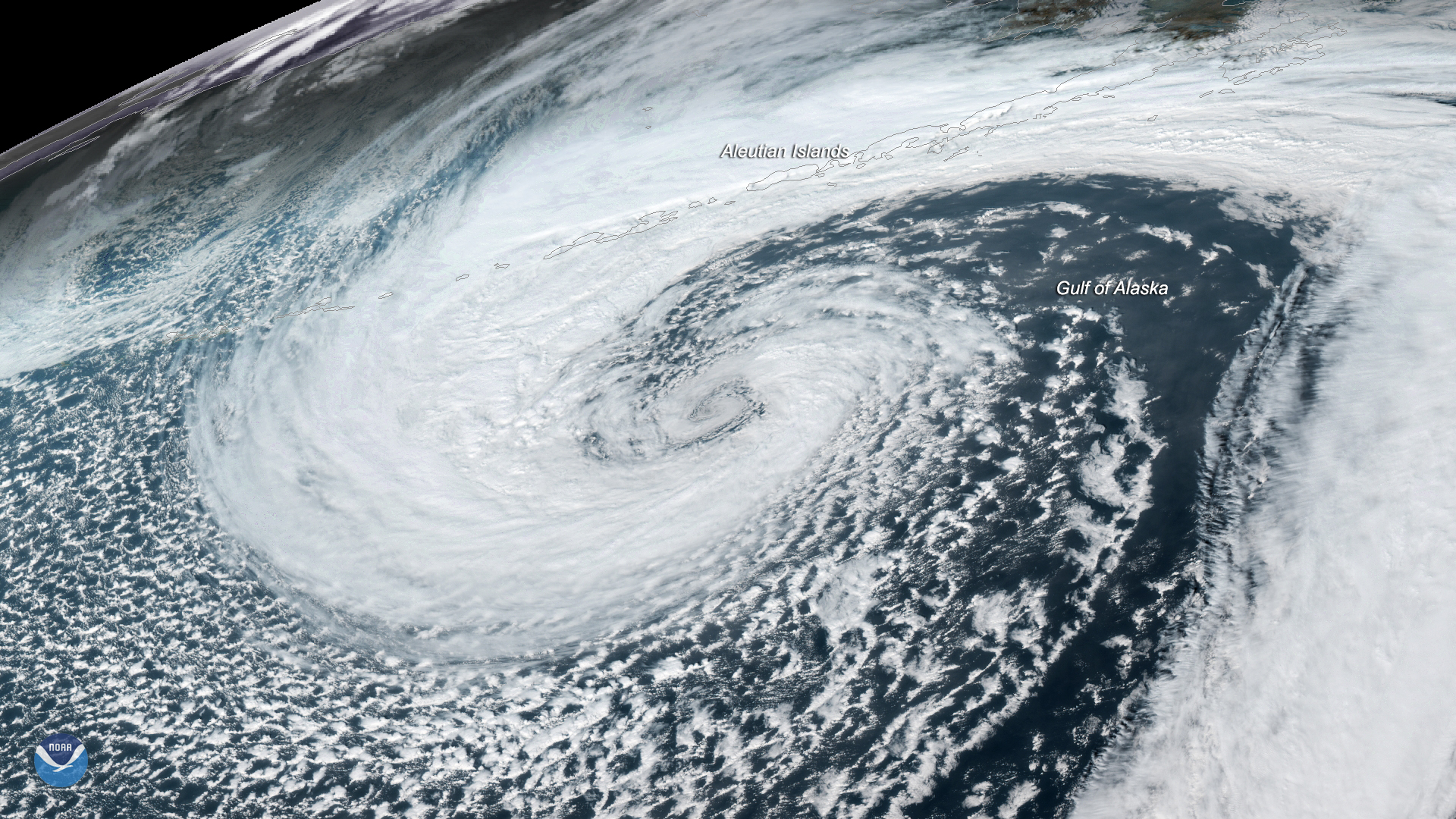
Download Image Download Image of the Cyclone in Gulf of Alaska
A mid-latitude cyclone was seen swirling in the Gulf of Alaska by the GOES West satellite on Nov. 12, 2019 at 1:00 p.m. Alaska Standard Time. These tend to form within the Aleutian Low, which is a semi-permanent breeding ground for some of the strongest storms on Earth. Located near the Aleutian Islands of Alaska, the Aleutian Low helps encourage storm development due to a combination of considerable temperature differences, a strong Coriolis force, and a high latitude location.
According to the National Weather Service , this storm system is steadily creeping northward, bringing rain to the southwestern region of Alaska, across the Gulf Coast, as well as into the southeast. At the same time, a separate mass of cold dry air will be moving in from the north, cutting beneath the moisture-laden clouds. This will likely cause a mix of freezing rain and snow to form along the Kuskokwim Delta Coast. Winter weather advisories are also in effect for heavy snow in the Lower Kuskokwim Valley and Bristol Bay, north of King Salmon.
Additionally, meteorologists expect the system to bring high winds this weekend across the Alaska Peninsula, the Eastern Aleutians, the Kuskokwim Delta Coast, and the Pribilof Islands. Storm and gale warnings , as well as small craft advisories, are currently in effect.
This GeoColor enhanced imagery was created by NOAA's partners at the Cooperative Institute for Research in the Atmosphere. The GOES West satellite, also known as GOES-17, provides geostationary satellite coverage of the Western Hemisphere, including the United States, the Pacific Ocean, Alaska and Hawaii. First launched in March 2018, the satellite became fully operational in February 2019.
Where this page came from
This page was imported from NOAA Satellites (NESDIS). Published by NOAA's National Environmental Satellite, Data, and Information Service and, as a work of the United States government, in the public domain; pictures credited elsewhere are left out.
Nobody has written it yet — it is the source material at a new address, which is why search engines are asked to skip it and why no one earns from it. It is up for grabs: take it on, and it is yours to rewrite and to earn from.
Licence: CC0 1.0 (public domain) · Adapted from www.nesdis.noaa.gov
1
0
0
0

Comments