Download Image Download Tropical Storm Barry Image
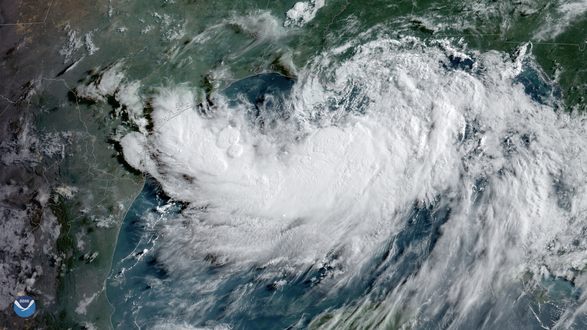
Tropical Storm Barry, seen here by GOES East on July 12, 2019, at 9 a.m. ET is strengthening over the warm waters of the northern Gulf of Mexico. Barry is expected to begin tracking toward the northwest later today and turn north on Saturday before making landfall.
“Barry is expected to be a hurricane when the center reaches the Louisiana coast,” the National Hurricane Center (NHC) warned in its 11 a.m. update.
While Barry could still reach hurricane strength before landfall, heavy rainfall and storm surge remain the biggest threats. Parts of south-central and southeast Louisiana, as well as parts of southwest Mississippi, could see total rainfall of accumulations of 10-20 inches, according to the NHC. This could lead to dangerous, life-threatening flooding in these areas. Hurricane and storm surge watches and warnings are already in effect for much of the region.
While Barry doesn’t have the typical presentation of a tropical cyclone on satellite loops at this time, a National Hurricane Center spokesman noted that the latest imagery “suggests the convection is beginning to wrap more around the center.”
Explore more with our live hurricane tracker and archived imagery.
Where this page came from
This page was imported from NOAA Satellites (NESDIS). Published by NOAA's National Environmental Satellite, Data, and Information Service and, as a work of the United States government, in the public domain; pictures credited elsewhere are left out.
Nobody has written it yet — it is the source material at a new address, which is why search engines are asked to skip it and why no one earns from it. It is up for grabs: take it on, and it is yours to rewrite and to earn from.
Licence: CC0 1.0 (public domain) · Adapted from www.nesdis.noaa.gov
1
0
0
0

Comments