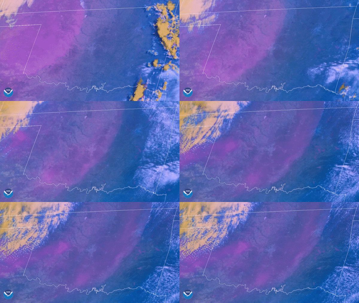
Download Image Download visible and infrared image of Oklahoma
On June 9, 2020, NOAA’s GOES-East satellite viewed as a large dust cloud blew over the landscape of Oklahoma (pink shading). According to the Tulsa NWS office, the dust was the result of strong winds from a dry line pushing across the state. The strength and size of the dryline were unusual for this time of year; as dust storms typically occur across Oklahoma from February through April.
The dust was detected via the Dust RGB multispectral product on GOES-East. For better visibility, this colorful product clarifies the dust from the surrounding clouds by infrared frequencies and on-the-ground contrasting software. Together, they display the difference and speed between water and dust particles.
The GOES-East geostationary satellite, also known as GOES-16, keeps watch over most of North America, including the continental United States and Mexico, as well as Central and South America, the Caribbean, and the Atlantic Ocean to the west coast of Africa. The satellite's high-resolution imagery provides optimal viewing of severe weather events, including thunderstorms, tropical storms, and hurricanes.
Where this page came from
This page was imported from NOAA Satellites (NESDIS). Published by NOAA's National Environmental Satellite, Data, and Information Service and, as a work of the United States government, in the public domain; pictures credited elsewhere are left out.
Nobody has written it yet — it is the source material at a new address, which is why search engines are asked to skip it and why no one earns from it. It is up for grabs: take it on, and it is yours to rewrite and to earn from.
Licence: CC0 1.0 (public domain) · Adapted from www.nesdis.noaa.gov
1
0
0
0

Comments