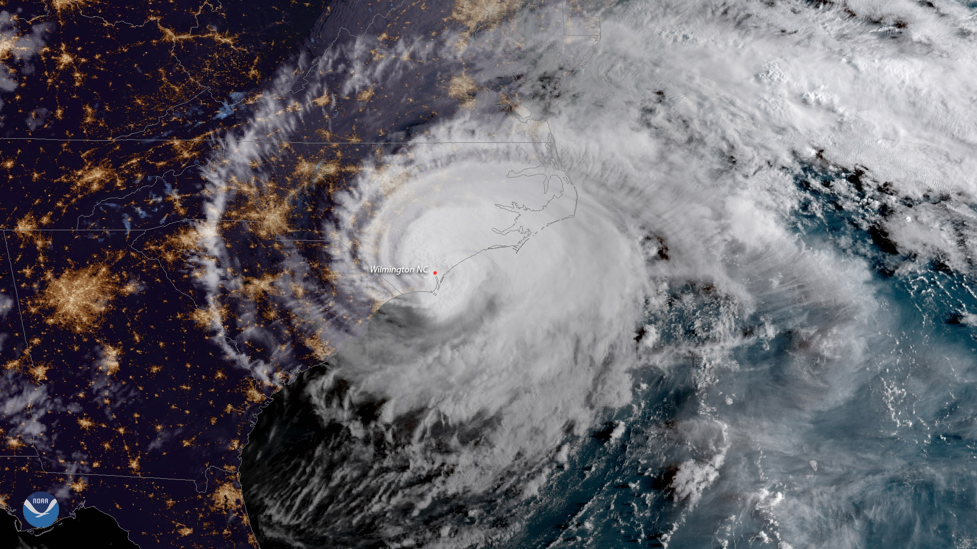
Download Image Download Image of Hurricane Florence
Hurricane Florence made landfall near Wrightsville Beach, North Carolina at 7:15 a.m. ET September 14, 2018 as a Category 1 storm. The GOES East satellite captured this geocolor image of the massive storm at 7:45 a.m. ET, shortly after it moved ashore.
The National Hurricane Center reported Florence had sustained winds of 90 mph at landfall and was moving slowly westward at 6 mph. The storm was expected to slowly begin weakening during the day of September 14, but would continue to have significant impacts across the Carolinas.
Life-threatening storm surges and hurricane-force winds were expected to continue even as Florence moved inland, while very heavy rainfall, upwards of 20 inches in some locations, would cause catastrophic flooding across portions of North and South Carolina into the weekend.
Where this page came from
This page was imported from NOAA Satellites (NESDIS). Published by NOAA's National Environmental Satellite, Data, and Information Service and, as a work of the United States government, in the public domain; pictures credited elsewhere are left out.
Nobody has written it yet — it is the source material at a new address, which is why search engines are asked to skip it and why no one earns from it. It is up for grabs: take it on, and it is yours to rewrite and to earn from.
Licence: CC0 1.0 (public domain) · Adapted from www.nesdis.noaa.gov
1
0
0
0

Comments