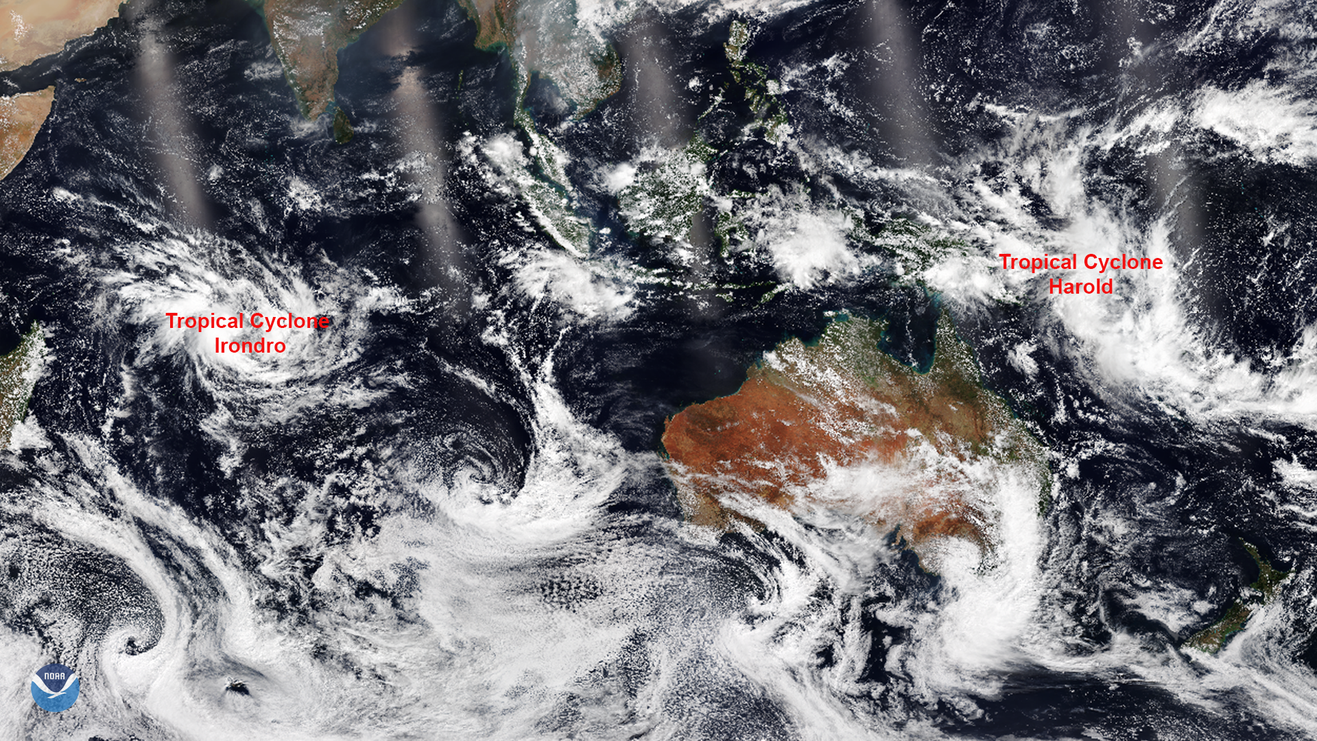
Download Image Download Image of the Two Cyclones
On April 2, 2020, the NOAA-20 satellite captured this imagery of two tropical cyclones that developed in the Southern Hemisphere. The first, Tropical Cyclone Irondro, formed in the Indian Ocean around 6 a.m. GMT (2 a.m. EDT) east of the islands of Victoria and Mauritius. The other, Tropical Cyclone Harold, formed between the Solomon Islands and the eastern coast of Papua New Guinea around 6 p.m. GMT (2 p.m. EDT).
As of 2 a.m. EDT, April 3, Tropical Cyclone Irondro was located approximately 720 miles south of the island Diego Garcia, and was tracking south-southeastward at around 18 mph. The storm’s maximum sustained wind speed was 65 mph with gusts up to 80 mph, which is the equivalent of a strong tropical storm in the Atlantic Ocean. The storm is expected to intensify to the equivalent of a Category 1 hurricane, with winds of 85 mph, before turning east-southeastward by tomorrow.
Meanwhile, another tropical cyclone, Harold, was located approximately 577 miles northwest of Port Vila, Vanuatu, and was tracking east-southeastward at 17 mph. The storm’s maximum sustained wind speed was about 45 mph with gusts up to 60 mph and it was moving away from the Solomon Islands. Harold is expected to intensify quickly, with sustained winds peaking at about 90 mph Saturday as it continues on its path.
The Solomon Islands Government’s Meteorological Services Division warned residents in storm-prone regions near rivers and coasts to evacuate to higher ground. Additionally, falling trees, branches, and debris resulting from the storm have caused widespread damage and power outages. Australia has donated more than $US 60,000 in emergency funds to the Solomon Islands to assist with its response to the damage.
This image was captured by the NOAA-20 satellite's VIIRS instrument , which scans the entire Earth twice per day at a 750-meter resolution. Multiple visible and infrared channels allow it to detect atmospheric aerosols, such as dust, smoke and haze associated with industrial pollution and fires. The polar-orbiting satellite circles the globe 14 times daily and captures a complete daytime view of our planet once every 24 hours.
Where this page came from
This page was imported from NOAA Satellites (NESDIS). Published by NOAA's National Environmental Satellite, Data, and Information Service and, as a work of the United States government, in the public domain; pictures credited elsewhere are left out.
Nobody has written it yet — it is the source material at a new address, which is why search engines are asked to skip it and why no one earns from it. It is up for grabs: take it on, and it is yours to rewrite and to earn from.
Licence: CC0 1.0 (public domain) · Adapted from www.nesdis.noaa.gov
1
0
0
0

Comments