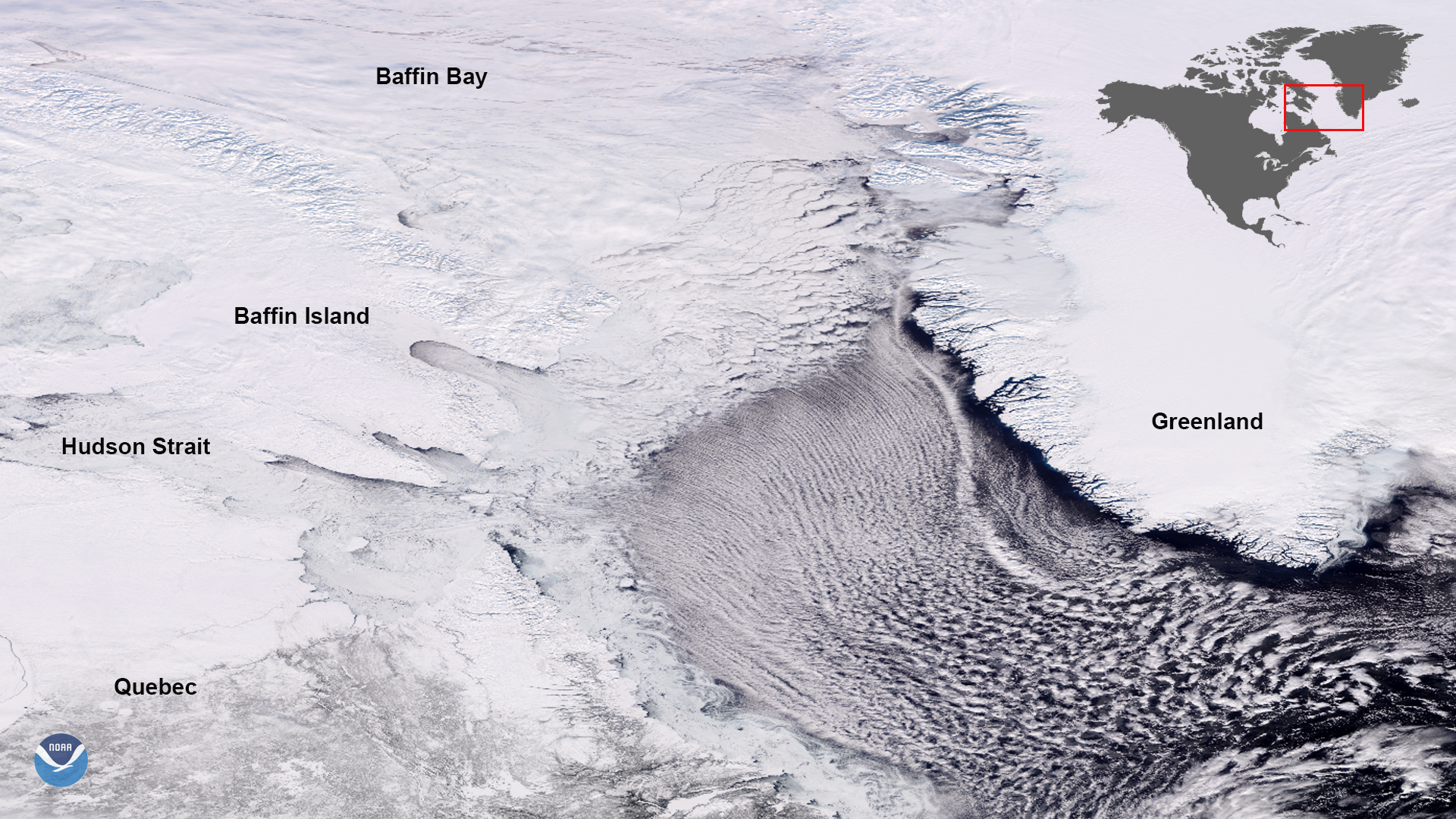
Download Image Download Image of the Cloud Streets Over the Labrador Sea
On Feb. 27, 2020, the NOAA-20 satellite snapped this dynamic image of ribbon-shaped cloud streets streaming over the Labrador Sea from the sea ice edge in the Davis Strait. As frigid air moves over relatively warmer water, the warmer air rises, bringing moisture with it. As it cools, it gradually condenses and sinks in rows of horizontal counterclockwise-rotating air cylinders that line up with the prevailing direction of the wind. As that wind sweeps around the southern tip of Greenland, the clouds are blown in a new direction, losing their ââ¬Åstreamerââ¬Â shape.
Baffin Bay, which is north of the strait, is completely covered in ice. This bay is not generally navigable most of the year due to this ice cover; however, an area roughly 31,000 square miles north of the bay near Smith Sound [not shown] opens up during the summer. These types of open water areas surrounded by sea ice are called polynyas. This one in particular is known as the North Water Polynya.
Also covered in ice is the Hudson Strait to the west, which leads to Hudson Bay. These bodies of water also tend to freeze over completely during the winter, thawing for periods during the summer. Most of this ice is gone by August, but they will begin to freeze over again by October or November.
This image was captured by the NOAA-20 satellite's VIIRS instrument , which scans the entire Earth twice per day at a 750-meter resolution. Multiple visible and infrared channels allow it to detect atmospheric aerosols, such as dust, smoke and haze associated with industrial pollution and fires. The polar-orbiting satellite circles the globe 14 times daily and captures a complete daytime view of our planet once every 24 hours.
Where this page came from
This page was imported from NOAA Satellites (NESDIS). Published by NOAA's National Environmental Satellite, Data, and Information Service and, as a work of the United States government, in the public domain; pictures credited elsewhere are left out.
Nobody has written it yet — it is the source material at a new address, which is why search engines are asked to skip it and why no one earns from it. It is up for grabs: take it on, and it is yours to rewrite and to earn from.
Licence: CC0 1.0 (public domain) · Adapted from www.nesdis.noaa.gov
1
0
0
0

Comments