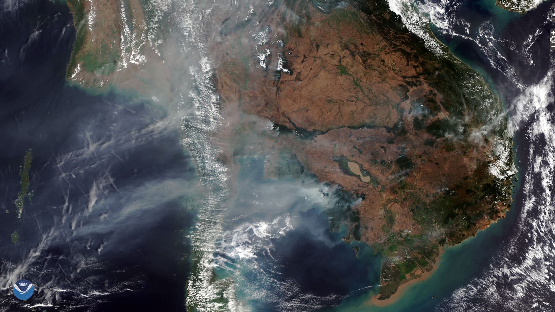
Download Image Download Image of Smoke from Fires in Cambodia, Laos, and Myanmar
On Feb. 24, 2020, the NOAA-20 satellite observed smoke plumes from fires burning in Cambodia, Laos, and Myanmar. Most of these blazes are likely agricultural fires that farmers intentionally set to clear land, though some are ignited by weather events such as lightning, burning surface debris, dry brush, and grasses. Others may also be accidentally lit by discarded cigarettes, sparks, or faulty electrical systems.
The region’s fire season runs from January through March, but can extend as late as May. In an article from the Phnom Penh Post from March 6, 2018, Simon Mahood, a senior technical advisor for the Wildlife Conservation Society–Cambodia, agreed that a portion of the annual wildfire season is a natural part of the ecology of the area, which is mainly deciduous forests. However, he continued to say that “the vast majority of fires are set by people.”
In the same article, Chea Sam Ang, head of the Environment Ministry’s General Directorate for Administration of Nature Conservation and Protection, explained that “many fires are from slash-and-burn agriculture, hunting, foraging, and resin collection, but land clearing on concessions is the key factor.” Another article from NASA stated how loggers also use fire to clear roads and land after harvesting desirable species.

Zoomed-in image from the NOAA-20 satellite of smoke from fires in Cambodia, Laos, and Myanmar
These images were captured by the NOAA-20 satellite's VIIRS instrument , which scans the entire Earth twice per day at a 750-meter resolution. Multiple visible and infrared channels allow it to detect atmospheric aerosols, such as dust, smoke, and haze associated with industrial pollution and fires. The polar-orbiting satellite circles the globe 14 times daily and captures a complete daytime view of our planet once every 24 hours.
Where this page came from
This page was imported from NOAA Satellites (NESDIS). Published by NOAA's National Environmental Satellite, Data, and Information Service and, as a work of the United States government, in the public domain; pictures credited elsewhere are left out.
Nobody has written it yet — it is the source material at a new address, which is why search engines are asked to skip it and why no one earns from it. It is up for grabs: take it on, and it is yours to rewrite and to earn from.
Licence: CC0 1.0 (public domain) · Adapted from www.nesdis.noaa.gov
1
0
0
0

Comments