Download Image Download true-color imagery
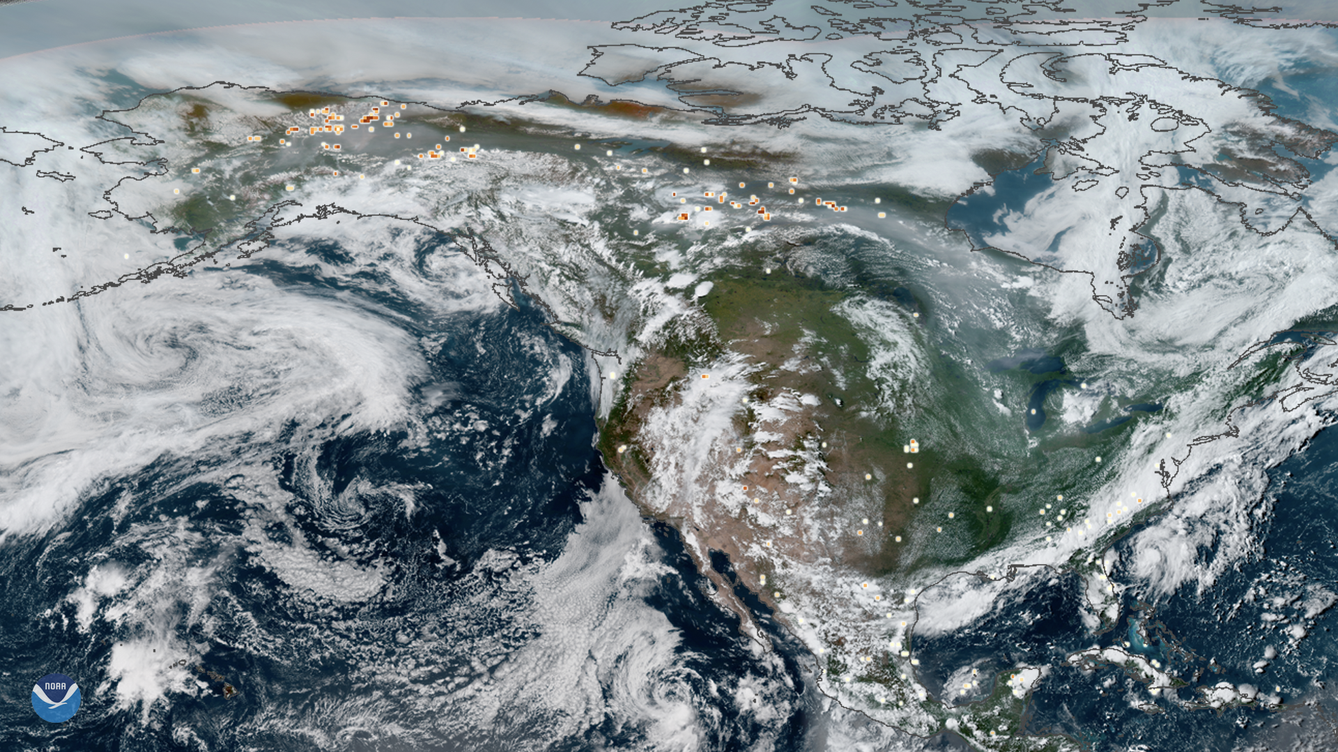
This true-color composite image of smoke from Arctic wildfires spreading across Alaska and Canada was captured by both GOES East and GOES West on July 23, 2019. Since June 2019, which was the hottest June on record , there have been more than 100 intense wildfires in the region. With July currently on track to become the hottest July on record, with heatwaves occurring across Europe and the United States, scientists are bracing for more while describing the conflagrations as “ unprecedented.”
The fires themselves, overlaid onto the image as yellow-red dots, were gathered using the VIIRS sensor onboard NOAA-20, which provides daily, high-resolution visible and infrared images of Earth's atmosphere from across the globe.
The wildfires are estimated to have released roughly 100 megatons of carbon dioxide (CO2) into the atmosphere between June 1 and July 21, according to the Copernicus Atmosphere Monitoring Service. This is about as much as Belgium’s total carbon output for 2017.
This GeoColor enhanced imagery was created by NOAA's partners at the Cooperative Institute for Research in the Atmosphere. The GOES East geostationary satellite, also known as GOES-16, provides coverage of the Western Hemisphere, including the United States, the Atlantic Ocean and the eastern Pacific. The satellite's high-resolution imagery provides optimal viewing of severe weather events, including thunderstorms, tropical storms, and hurricanes. The GOES West satellite, also known as GOES-17, provides geostationary satellite coverage of the Western Hemisphere, including the United States, the Pacific Ocean, Alaska and Hawaii. First launched in March 2018, the satellite became fully operational in February 2019.
Where this page came from
This page was imported from NOAA Satellites (NESDIS). Published by NOAA's National Environmental Satellite, Data, and Information Service and, as a work of the United States government, in the public domain; pictures credited elsewhere are left out.
Nobody has written it yet — it is the source material at a new address, which is why search engines are asked to skip it and why no one earns from it. It is up for grabs: take it on, and it is yours to rewrite and to earn from.
Licence: CC0 1.0 (public domain) · Adapted from www.nesdis.noaa.gov
1
0
0
0

Comments