
Want to improve the page's content? Try to propose a change.
On This Page Navigation
Geodiversity refers to the full variety of natural geologic (rocks, minerals, sediments, fossils, landforms, and physical processes) and soil resources and processes that occur in the park. A product of the Geologic Resources Inventory, the NPS Geodiversity Atlas delivers information in support of education, Geoconservation, and integrated management of living (biotic) and non-living (abiotic) components of the ecosystem.

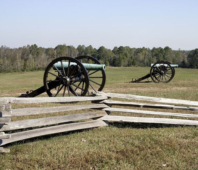
Garrity's Alabama Battery overlooking Moccasin Bend, the Tennessee River, and Chattanooga from Lookout Mountain.
Introduction
Chickamauga and Chattanooga National Military Park encompasses 18 separate units along the Georgia–Tennessee border in Catoosa, Dade, and Walker Counties, Georgia, as well as Georgia and Hamilton Counties, Tennessee. Established as the first national military park on August 19, 1890, Chickamauga and Chattanooga encompasses about 3,673 hectares (9,078 acres) and preserves nationally significant resources associated with the Civil War campaign for Chattanooga, including the battles of Chickamauga and Chattanooga and the 12,000 years of human habitation of the Moccasin Bend Peninsula. The Chattanooga campaign was one of the deciding campaigns of the Civil War, where Union victories assured access through the “Gateway to the Deep South,” ultimately hastening the end of fighting and the reunification of the United States. Resources preserved in Chickamauga and Chattanooga offer exceptional opportunities for study of some of the most remarkable maneuvers and brilliant fight strategies of the Civil War. Moccasin Bend National Archeological District provides an outstanding opportunity for education and research of American Indian habitation, including those of transitional Paleo-Indian/Archaic, Archaic, Woodland, Mississippian, and historic periods.
Geologic Setting
Situated in the southern Appalachian Mountains in the Valley and Ridge physiographic province, the bedrock geology of Chickamauga and Chattanooga predominantly consists of Paleozoic sedimentary rocks. Formations within Chickamauga and Chattanooga occur as elongate northeast–southwest trending belts that mimic the orientation of the Valley and Ridge province. Mapped units that underlie Chickamauga Battlefield are predominantly Ordovician-age carbonates and include rocks of the Knox Group (Chepultepec Dolomite, Longview Dolomite, Kingsport Formation, and Mascot Dolomite) and Chickamauga Group (Pond Spring Formation, Murfreesboro Limestone, Ridley Limestone, Lebanon Limestone, Carters Limestone, and Hermitage Formation). The Lookout Mountain Battlefield region is underlain by a rich assemblage of strata spanning the Ordovician through the Pennsylvanian. At Lookout Mountain, these units form a broad syncline and include the Ordovician Sequatchie Formation; Silurian Rockwood Formation; Mississippian Fort Payne Chert, Warsaw Limestone, St. Louis Limestone, Monteagle Limestone, Hartselle Formation, Bangor Limestone, and Pennington Formation; and formations of the Pennsylvanian Gizzard Group (Raccoon Mountain Formation, Warren Point Sandstone, Signal Point Shale) and Crooked Fork Group (Sewanee Conglomerate, Whitwell Shale). The Lookout Valley fault is a major structural feature that cuts across most of Lookout Mountain Battlefield and Moccasin Bend National Archeological District.
Regional Geology
Chickamauga & Chattanooga National Military Park is part of both the Valley and Ridge and Appalachian Plateaus Physiographic Provinces shares its geologic history and some characteristic geologic formations with a region that extends well beyond park boundaries.
Geologic Resources Inventory
The Geologic Resources Inventory produces digital geologic maps and reports for more than 270 natural resource parks. The products listed below are currently available for this park, check back often for updates as many maps, reports, and posters are still in progress.
Scoping summaries are records of scoping meetings where NPS staff and local geologists determined the park’s geologic mapping plan and what content should be included in the report.
- Digital geologic maps include files for viewing in GIS software, a guide to using the data, and a document with ancillary map information. Newer products also include data viewable in Google Earth and online map services.
- Reports use the maps to discuss the park’s setting and significance, notable geologic features and processes, geologic resource management issues, and geologic history.
- Posters are a static view of the GIS data in PDF format. Newer posters include aerial imagery or shaded relief and other park information. They are also included with the reports.
- Projects list basic information about the program and all products available for a park.
Source: NPS DataStore Saved Search 2787. To search for additional information, visit the NPS DataStore.
Soil Resources inventory
A NPS Soil Resources Inventory project has been completed for Chickamauga & Chattanooga National Military Park and can be found on the NPS Data Store.
Source: NPS DataStore Saved Search 2847. To search for additional information, visit the NPS DataStore.
Related Links
Chickamauga & Chattanooga—Park Home
Related Articles
Chickamauga & Chattanooga National Military Park
Narrow By Location
Narrow By Office
Show
10
40
Sort by
Relevance
Recently Updated
Date Released
Title
Loading results...
Tags:
geodiversity
,
geologic
,
[geologic forces](/media/article-search.htm?q=geologic forces)
,
[geologic resources](/media/article-search.htm?q=geologic resources)
,
[geologic feature](/media/article-search.htm?q=geologic feature)
,
[geologic time](/media/article-search.htm?q=geologic time)
,
[geologic layers](/media/article-search.htm?q=geologic layers)
,
[geologic history](/media/article-search.htm?q=geologic history)
,
[geologic formations](/media/article-search.htm?q=geologic formations)
,
geology
,
geological
,
[geological maps](/media/article-search.htm?q=geological maps)
,
geologist
,
[geology talk](/media/article-search.htm?q=geology talk)
,
[geology hike](/media/article-search.htm?q=geology hike)
,
[geology science and learning](/media/article-search.htm?q=geology science and learning)
,
geologists
,
[geology close up](/media/article-search.htm?q=geology close up)
,
[geologic resources inventory](/media/article-search.htm?q=geologic resources inventory)
,
geoheritage
,
geohazards
,
geomorphology
,
[geoscientists in parks](/media/article-search.htm?q=Geoscientists in Parks)
,
geoscientists-in-the-parks
,
[geological survey](/media/article-search.htm?q=Geological Survey)
,
geothermal
,
[geothermal activity](/media/article-search.htm?q=geothermal activity)
,
geotour
,
geotourism
,
[geothermal processes & features](/media/article-search.htm?q=geothermal processes & features)
,
fossils
,
paleontology
,
caves
,
karst
,
glaciers
,
[geoheritage sites](/media/article-search.htm?q=geoheritage sites)
,
earthquakes
,
landslides
,
mining
National Park Service Geodiversity Atlas
The servicewide Geodiversity Atlas provides information on geoheritage and geodiversity resources and values within the National Park System. This information supports science-based geoconservation and interpretation in the NPS, as well as STEM education in schools, museums, and field camps. The NPS Geologic Resources Division and many parks work with National and International geoconservation communities to ensure that NPS abiotic resources are managed using the highest standards and best practices available.
Where this belongs
- Chickamauga & Chattanooga National Military Park
Where this page came from
This page was imported from National Park Service. Produced by the U.S. National Park Service and, as a work of the United States government, in the public domain.
Nobody has written it yet — it is the source material at a new address, which is why search engines are asked to skip it and why no one earns from it. It is up for grabs: take it on, and it is yours to rewrite and to earn from.
In these collectionsChickamauga & Chattanooga National Military Park
Licence: CC0 1.0 (public domain) · Adapted from www.nps.gov
1
0
0
0

Comments
Read next


